
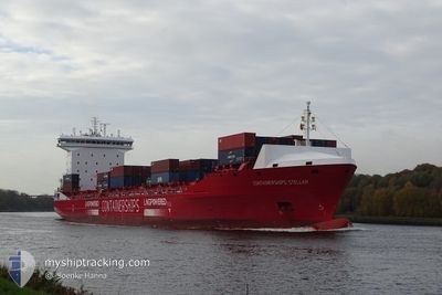
CONTSHIPS STELLAR
Cargo A
Current Trip
| Trip Time | 1 day |
|---|---|
| Trip Distance | 373.57 nm |
| AVG Speed | 14.6 Knots |
| MAX Speed | 17.2 Knots |
| Draught | 9.2 m |
| AVG Wind | 9.7 knots |
| MAX Wind | 16 knots |
| MIN Temp | 9.7°C / 49.46°F |
| MAX Temp | 18.5°C / 65.3°F |
| Position Received | 8 h, 40 m ago |
Current Position
| Longitude | -0.85055° |
|---|---|
| Latitude | 54.63778° |
| Status | Under way using engine |
| Speed | 12.4 Knots |
| Course | 290.5° |
| Area | North Sea |
| Station | T-AIS |
| Position Received | 8 h, 40 m ago |
Info
Information
The current position of CONTSHIPS STELLAR is in North Sea with coordinates 54.63778° / -0.85055° as reported on 2024-05-12 11:34 by AIS to our vessel tracker app. The vessel's current speed is 12.4 Knots and is currently inside the port of TEES.
The vessel CONTSHIPS STELLAR (IMO: 9866251, MMSI: 210195000) is a Cargo A It's sailing under the flag of [CY] Cyprus.
In this page you can find informations about the vessels current position, last detected port calls, and current voyage information. If the vessels is not in coverage by AIS you will find the latest position.
The current position of CONTSHIPS STELLAR is detected by our AIS receivers and we are not responsible for the reliability of the data. The last position was recorded while the vessel was in Coverage by the Ais receivers of our vessel tracking app.
The current draught of CONTSHIPS STELLAR as reported by AIS is 9.2 meters
Weather
| Temperature | 13.1°C / 55.58°F |
|---|---|
| Wind Speed | 6 knots |
| Direction | 128° SE |
| Pressure | 1009.7 hPa |
| Humidity | 84.1 % |
| Cloud Coverage | 90 % |
Featured Company
Last Port Calls
| Port | Arrival | Departure | Time In Port |
|---|---|---|---|
| 2024-05-12 13:30 | |||
| 2024-05-11 12:12 | 2024-05-11 13:56 | 1 h | |
| 2024-05-07 09:01 | 2024-05-08 04:47 | 19 h | |
| 2024-05-06 09:02 | 2024-05-07 05:03 | 20 h | |
| 2024-05-02 03:55 | 2024-05-03 10:19 | 1 d | |
| 2024-05-01 07:38 | 2024-05-01 19:11 | 11 h | |
| 2024-04-29 03:18 | 2024-04-30 08:10 | 1 d | |
| 2024-04-27 23:29 | 2024-04-28 01:36 | 2 h | |
| 2024-04-27 12:53 | 2024-04-27 13:39 | 46 m | |
| 2024-04-24 08:53 | 2024-04-24 15:21 | 6 h |
Last Trips
| Origin | Departure | Destination | Arrival | Distance | |
|---|---|---|---|---|---|
| 2024-05-11 13:56 | 2024-05-12 13:30 | 373.57 nm | |||
| 2024-05-08 04:47 | 2024-05-11 12:12 | 910.18 nm | |||
| 2024-05-07 05:03 | 2024-05-07 09:01 | 46.41 nm | |||
| 2024-05-03 10:19 | 2024-05-06 09:02 | 976.95 nm | |||
| 2024-05-01 19:11 | 2024-05-02 03:55 | 110.90 nm | |||
| 2024-04-30 08:10 | 2024-05-01 07:38 | 280.05 nm | |||
| 2024-04-28 01:36 | 2024-04-29 03:18 | 378.05 nm | |||
| 2024-04-27 13:39 | 2024-04-27 23:29 | 49.13 nm | |||
| 2024-04-24 15:21 | 2024-04-27 12:53 | 850.89 nm | |||
| 2024-04-24 05:32 | 2024-04-24 08:53 | 46.14 nm |
Events
| Time | Event | Details | Position / Dest | Info |
|---|---|---|---|---|
| 2024-05-12 13:10 | STOP Moving |
54.60236 / -1.15349
[GB] TEES
|
Speed: 0.2 kn Course: 135° |
|
| 2024-05-12 12:30 | PORT ARRIVAL |
|
54.64476 / -1.14588
[GB] TEES
|
Speed: 10.8 kn Course: 213° |
| 2024-05-12 11:40 | Status Changed | Default Under way using engine |
54.64487 / -.88334
GBTEE
|
Speed: 12.4 kn Course: 290.5° |
| 2024-05-12 11:34 | OUT of Coverage |
54.63778 / -.85055
North Sea
[GB] TEES
|
Speed: 12.4 kn Course: 290.5° |
|
| 2024-05-12 11:04 | Status Changed | Under way using engine Default |
54.62830 / -.68917
GBTEE
|
Speed: 11 kn Course: 246° |
| 2024-05-12 11:00 | Status Changed | Default Under way using engine |
54.63334 / -.66667
GBTEE
|
Speed: 11.7 kn Course: 284.9° |
| 2024-05-12 10:14 | Status Changed | Under way using engine Default |
54.61724 / -.39881
GBTEE
|
Speed: 17 kn Course: 280° |
| 2024-05-12 09:58 | IN Coverage |
54.61724 / -.39881
North Sea
GBTEE
|
Speed: 16.3 kn Course: 281.2° |
|
| 2024-05-12 07:56 | Status Changed | Default Under way using engine |
54.49157 / .66901
GBTEE
|
Speed: 16.2 kn Course: 281.8° |
| 2024-05-12 07:49 | OUT of Coverage |
54.48474 / .72551
North Sea
GBTEE
|
Speed: 16.2 kn Course: 281.8° |