
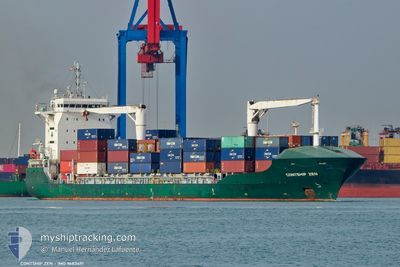
CONTSHIP ZEN
Cargo C
Current Trip
| Trip Time | 1 day |
|---|---|
| Trip Distance | 35.32 nm |
| AVG Speed | 10.3 Knots |
| MAX Speed | 12.4 Knots |
| Draught | 7.1 m |
| AVG Wind | 12.3 knots |
| MAX Wind | 25.2 knots |
| MIN Temp | 6.3°C / 43.34°F |
| MAX Temp | 11.9°C / 53.42°F |
| Position Received | 2 d ago |
Current Position
| Longitude | --- |
|---|---|
| Latitude | --- |
| Status | Under way using engine |
| Speed | 6.4 Knots |
| Course | 19.6° |
| Area | Mediterranean Sea - Western Basin |
| Station | T-AIS |
| Position Received | 2 d ago |
Info
Information
The current position of CONTSHIP ZEN is in Mediterranean Sea - Western Basin with coordinates 43.34215° / 4.97760° as reported on 2025-12-05 15:10 by AIS to our vessel tracker app. The vessel's current speed is 6.4 Knots and is currently inside the port of FOS.
The vessel CONTSHIP ZEN (IMO: 9683491, MMSI: 636018704) is a Cargo C It's sailing under the flag of [LR] Liberia.
In this page you can find informations about the vessels current position, last detected port calls, and current voyage information. If the vessels is not in coverage by AIS you will find the latest position.
The current position of CONTSHIP ZEN is detected by our AIS receivers and we are not responsible for the reliability of the data. The last position was recorded while the vessel was in Coverage by the Ais receivers of our vessel tracking app.
The current draught of CONTSHIP ZEN as reported by AIS is 7.1 meters
Weather
| Temperature | 10.5°C / 50.9°F |
|---|---|
| Wind Speed | 5 knots |
| Direction | 359° N |
| Pressure | 1019.9 hPa |
| Humidity | 82.6 % |
| Cloud Coverage | 3 % |
Featured Company
Last Port Calls
| Port | Arrival | Departure | Time In Port |
|---|---|---|---|
| 2025-12-07 10:29 | |||
| 2025-12-04 12:17 | 2025-12-05 13:37 | 1 d | |
| 2025-12-03 02:20 | 2025-12-03 15:40 | 13 h | |
| 2025-11-27 12:34 | 2025-11-30 00:43 | 2 d | |
| 2025-11-23 11:33 | 2025-11-26 13:20 | 3 d | |
| 2025-11-19 18:02 | 2025-11-20 15:07 | 21 h | |
| 2025-11-15 11:24 | 2025-11-15 20:45 | 9 h | |
| 2025-11-14 03:35 | 2025-11-14 15:07 | 11 h | |
| 2025-11-09 07:03 | 2025-11-12 00:27 | 2 d | |
| 2025-11-05 12:27 | 2025-11-08 00:21 | 2 d |
Last Trips
| Origin | Departure | Destination | Arrival | Distance | |
|---|---|---|---|---|---|
| 2025-12-05 13:37 | 2025-12-07 10:29 | 35.32 nm | |||
| 2025-12-03 15:40 | 2025-12-04 12:17 | 194.69 nm | |||
| 2025-11-30 00:43 | 2025-12-03 02:20 | 442.03 nm | |||
| 2025-11-26 13:20 | 2025-11-27 12:34 | 51.68 nm | |||
| 2025-11-20 15:07 | 2025-11-23 11:33 | 261.22 nm | |||
| 2025-11-15 20:45 | 2025-11-19 18:02 | 360.09 nm | |||
| 2025-11-14 15:07 | 2025-11-15 11:24 | 220.76 nm | |||
| 2025-11-12 00:27 | 2025-11-14 03:35 | 381.52 nm | |||
| 2025-11-08 00:21 | 2025-11-09 07:03 | 54.38 nm | |||
| 2025-11-03 21:17 | 2025-11-05 12:27 | 252.62 nm |
Events
| Time | Event | Details | Position / Dest | Info |
|---|---|---|---|---|
| 2025-12-07 10:12 | STOP Moving |
43.41821 / 4.83458
[FR] FOS
|
Speed: Course: 312° |
|
| 2025-12-07 09:29 | PORT ARRIVAL |
|
43.40263 / 4.91949
[FR] FOS
|
Speed: 7.6 kn Course: 256° |
| 2025-12-07 09:25 | START Moving | 1.72 nm, East of FOS |
43.40654 / 4.93355
FRFOS
|
Speed: 7.6 kn Course: 256° |
| 2025-12-05 15:57 | STOP Moving | 1.83 nm, East of FOS |
43.40608 / 4.93637
FRFOS
|
Speed: 0.3 kn Course: 11° |
| 2025-12-05 15:17 | Status Changed | Default Under way using engine |
43.35312 / 4.97812
FRFOS
|
Speed: 6.4 kn Course: 19.6° |
| 2025-12-05 15:10 | OUT of Coverage |
43.34215 / 4.97760
Mediterranean Sea - Western Basin
FRFOS
|
Speed: 6.4 kn Course: 19.6° |
|
| 2025-12-05 15:02 | Status Changed | Under way using engine Default |
43.32171 / 4.98602
FRFOS
|
Speed: 10.8 kn Course: 342° |
| 2025-12-05 15:01 | Status Changed | Default Under way using engine |
43.31830 / 4.98746
FRFOS
|
Speed: 10.8 kn Course: 336.7° |
| 2025-12-05 14:36 | Status Changed | Under way using engine Default |
43.24684 / 5.02113
FRFOS
|
Speed: 10.5 kn Course: 342° |
| 2025-12-05 14:21 | Status Changed | Default Under way using engine |
43.20564 / 5.04199
FRFOS
|
Speed: 10.3 kn Course: 312° |