
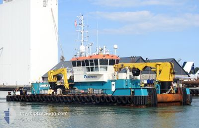
COASTAL CHARIOT
Work Vessel
Current Trip
DWF
| Time Travelled | 15 days |
|---|---|
| Remaining Time | --- |
| Distance Travelled | 130.79 nm |
| Remaining Distance | --- |
| AVG Speed | 5.4 Knots |
| MAX Speed | 8.8 Knots |
| AVG Wind | 9.8 knots |
| MAX Wind | 20 knots |
| MIN Temp | 21.8°C / 71.24°F |
| MAX Temp | 33.6°C / 92.48°F |
| Draught | 2.3 m |
| Position Received | Now |
Current Position
| Longitude | 54.90361° |
|---|---|
| Latitude | 24.95521° |
| Status | Moored |
| Speed | |
| Course | 249° |
| Area | Persian Gulf |
| Station | T-AIS |
| Position Received | Now |
Info
Information
The current position of COASTAL CHARIOT is in Persian Gulf with coordinates 24.95521° / 54.90361° as reported on 2024-05-10 21:29 by AIS to our vessel tracker app. The vessel's current speed is 0 Knots
The vessel COASTAL CHARIOT (IMO: 9704946, MMSI: 244770069) is a Work Vessel that was built in 2014 ( 10 years old ). It's sailing under the flag of [NL] Netherlands.
In this page you can find informations about the vessels current position, last detected port calls, and current voyage information. If the vessels is not in coverage by AIS you will find the latest position.
The current position of COASTAL CHARIOT is detected by our AIS receivers and we are not responsible for the reliability of the data. The last position was recorded while the vessel was in Coverage by the Ais receivers of our vessel tracking app.
The current draught of COASTAL CHARIOT as reported by AIS is 2.3 meters
Weather
| Temperature | 26.7°C / 80.06°F |
|---|---|
| Wind Speed | 5 knots |
| Direction | 293° WNW |
| Pressure | 1008 hPa |
| Humidity | 62.9 % |
| Cloud Coverage | 2 % |
Featured Company
Last Port Calls
| Port | Arrival | Departure | Time In Port |
|---|---|---|---|
| 2024-03-12 06:34 | 2024-04-25 12:26 | ||
| 2024-03-02 15:31 | 2024-03-02 15:33 | 1 m | |
| 2024-03-02 07:21 | 2024-03-02 07:51 | 30 m |
Most Visited Ports (Last year)
| Port | Arrivals | |
|---|---|---|
| 44 | ||
| 19 | ||
| 2 | ||
| 1 | ||
| 1 |
Last Trips
| Origin | Departure | Destination | Arrival | Distance | |
|---|---|---|---|---|---|
| 2024-03-02 19:33 | 2024-03-12 10:34 | 355.14 nm | |||
| 2024-03-02 11:51 | 2024-03-02 19:31 | 15.93 nm | |||
| 2024-02-24 06:14 | 2024-03-02 11:21 | 517.33 nm |
Events
| Time | Event | Details | Position / Dest | Info |
|---|---|---|---|---|
| 2024-05-10 20:56 | Status Changed | Moored Default |
24.95521 / 54.90362
DWF
|
Speed: Course: 249° |
| 2024-05-10 20:50 | Status Changed | Default Moored |
24.95521 / 54.90362
DWF
|
Speed: Course: 249° |
| 2024-05-10 09:09 | STOP Moving | 4.64 nm, North East of GHANTOOT |
24.95527 / 54.90357
DWF
|
Speed: 0.3 kn Course: 237° |
| 2024-05-10 08:55 | START Moving | 4.55 nm, North East of GHANTOOT |
24.94288 / 54.91501
DWF
|
Speed: 5.5 kn Course: 45° |
| 2024-05-10 08:53 | Status Changed | Moored Default |
24.94271 / 54.91409
DWF
|
Speed: 0.1 kn Course: 252° |
| 2024-05-10 08:47 | Status Changed | Default Moored |
24.94294 / 54.91297
DWF
|
Speed: Course: 253° |
| 2024-05-10 08:35 | STOP Moving | 4.46 nm, North East of GHANTOOT |
24.94295 / 54.91297
DWF
|
Speed: 0.2 kn Course: 250° |
| 2024-05-10 08:26 | START Moving | 4.68 nm, North East of GHANTOOT |
24.94518 / 54.91602
DWF
|
Speed: 4.4 kn Course: 177° |
| 2024-05-10 06:17 | STOP Moving | 4.73 nm, North East of GHANTOOT |
24.94694 / 54.91552
DWF
|
Speed: 0.3 kn Course: 207° |
| 2024-05-10 06:15 | START Moving | 4.72 nm, North East of GHANTOOT |
24.94565 / 54.91670
DWF
|
Speed: 5.8 kn Course: 337° |