
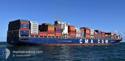
CMA CGM SAMSON
Container Ship
Current Trip
| Time Travelled | 16 days |
|---|---|
| Remaining Time | 15 days |
| Distance Travelled | 6121.00 nm |
| Remaining Distance | 5749.47 nm |
| AVG Speed | 15 Knots |
| MAX Speed | 16.3 Knots |
| AVG Wind | 14.7 knots |
| MAX Wind | 25.9 knots |
| MIN Temp | 18°C / 64.4°F |
| MAX Temp | 29°C / 84.2°F |
| Draught | 12.1 m |
| Position Received | Now |
Current Position
| Longitude | 15.95177° |
|---|---|
| Latitude | -34.00647° |
| Status | Under way using engine |
| Speed | 15.5 Knots |
| Course | 112° |
| Area | South Atlantic Ocean |
| Station | T-AIS |
| Position Received | Now |
Info
Information
The current position of CMA CGM SAMSON is in South Atlantic Ocean with coordinates -34.00647° / 15.95177° as reported on 2024-05-14 06:22 by AIS to our vessel tracker app. The vessel's current speed is 15.5 Knots and is heading at the port of SINGAPORE. The estimated time of arrival as calculated by MyShipTracking vessel tracking app is 2024-05-29 13:15 LT
The vessel CMA CGM SAMSON (IMO: 9436379, MMSI: 256687000) is a Container Ship that was built in 2011 ( 13 years old ). It's sailing under the flag of [MT] Malta.
In this page you can find informations about the vessels current position, last detected port calls, and current voyage information. If the vessels is not in coverage by AIS you will find the latest position.
The current position of CMA CGM SAMSON is detected by our AIS receivers and we are not responsible for the reliability of the data. The last position was recorded while the vessel was in Coverage by the Ais receivers of our vessel tracking app.
The current draught of CMA CGM SAMSON as reported by AIS is 12.1 meters
Weather
| Temperature | 18°C / 64.4°F |
|---|---|
| Wind Speed | 8 knots |
| Direction | 112° ESE |
| Pressure | 1014 hPa |
| Humidity | 88.1 % |
| Cloud Coverage | 34 % |
Featured Company
Last Port Calls
| Port | Arrival | Departure | Time In Port |
|---|---|---|---|
| 2024-04-26 23:56 | 2024-04-27 11:57 | 12 h | |
| 2024-04-24 14:12 | 2024-04-25 08:27 | 18 h | |
| 2024-04-19 04:37 | 2024-04-20 07:58 | 1 d | |
| 2024-04-16 20:41 | 2024-04-18 06:07 | 1 d | |
| 2024-04-11 13:09 | 2024-04-14 12:24 | 2 d | |
| 2024-03-12 15:39 | 2024-03-12 16:16 | 37 m | |
| 2024-03-12 15:03 | 2024-03-12 15:15 | 12 m | |
| 2024-03-12 14:09 | 2024-03-12 15:00 | 50 m | |
| 2024-03-12 13:30 | 2024-03-12 13:33 | 2 m | |
| 2024-03-12 12:29 | 2024-03-12 13:18 | 48 m |
Last Trips
| Origin | Departure | Destination | Arrival | Distance | |
|---|---|---|---|---|---|
| 2024-04-25 03:27 | 2024-04-26 18:56 | 5.77 nm | |||
| 2024-04-20 02:58 | 2024-04-24 09:12 | 1502.61 nm | |||
| 2024-04-18 01:07 | 2024-04-18 23:37 | 227.32 nm | |||
| 2024-04-14 07:24 | 2024-04-16 15:41 | 539.76 nm | |||
| 2024-03-13 00:16 | 2024-04-11 08:09 | 10812.60 nm | |||
| 2024-03-12 23:15 | 2024-03-12 23:39 | 0.10 nm | |||
| 2024-03-12 23:00 | 2024-03-12 23:03 | 0.10 nm | |||
| 2024-03-12 21:33 | 2024-03-12 22:09 | 0.11 nm | |||
| 2024-03-12 21:18 | 2024-03-12 21:30 | 0.27 nm | |||
| 2024-03-12 19:03 | 2024-03-12 20:29 | 0.37 nm |
Events
| Time | Event | Details | Position / Dest | Info |
|---|---|---|---|---|
| 2024-05-14 05:43 | Status Changed | Under way using engine Default |
-33.94232 / 15.76102
SGSIN
|
Speed: 15.7 kn Course: 110° |
| 2024-05-14 05:38 | Status Changed | Default Under way using engine |
-33.93427 / 15.73538
SGSIN
|
Speed: 15.9 kn Course: 109° |
| 2024-05-14 05:16 | Status Changed | Under way using engine Default |
-33.90085 / 15.62738
SGSIN
|
Speed: 15.9 kn Course: 110° |
| 2024-05-14 04:54 | Status Changed | Default Under way using engine |
-33.86867 / 15.52178
SGSIN
|
Speed: 15.9 kn Course: 109° |
| 2024-05-14 04:50 | Status Changed | Under way using engine Default |
-33.86142 / 15.49785
SGSIN
|
Speed: 15.9 kn Course: 109° |
| 2024-05-14 04:47 | Status Changed | Default Under way using engine |
-33.85737 / 15.48428
SGSIN
|
Speed: 15.9 kn Course: 110° |
| 2024-05-14 04:23 | Status Changed | Under way using engine Default |
-33.82003 / 15.36550
SGSIN
|
Speed: 15.9 kn Course: 110° |
| 2024-05-14 03:28 | Status Changed | Default Under way using engine |
-33.72666 / 15.09500
SGSIN
|
Speed: 15.8 kn Course: 112° |
| 2024-05-14 03:22 | Change Sea Area | South African part of the South Atlantic Ocean High seas of the South Atlantic Ocean |
-33.71680 / 15.06347
South Atlantic Ocean
SGSIN
|
Speed: 15.8 kn Course: 112° |
| 2024-05-14 03:22 | Status Changed | Under way using engine Default |
-33.71680 / 15.06347
SGSIN
|
Speed: 15.8 kn Course: 112° |