
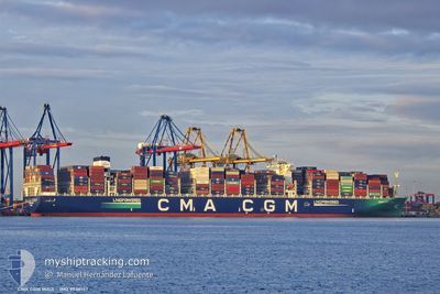
CMA CGM MAUI
Cargo A
Current Trip
| Time Travelled | 19 days |
|---|---|
| Remaining Time | --- |
| Distance Travelled | 8419.58 nm |
| Remaining Distance | --- |
| AVG Speed | 19.8 Knots |
| MAX Speed | 23 Knots |
| AVG Wind | 13.5 knots |
| MAX Wind | 31 knots |
| MIN Temp | 10.1°C / 50.18°F |
| MAX Temp | 28.6°C / 83.48°F |
| Draught | 10.8 m |
| Position Received | 9 d ago |
Current Position
| Longitude | --- |
|---|---|
| Latitude | --- |
| Status | Under way using engine |
| Speed | 19.5 Knots |
| Course | 297.3° |
| Area | North Pacific Ocean |
| Station | T-AIS |
| Position Received | 9 d ago |
Info
Information
The current position of CMA CGM MAUI is in North Pacific Ocean with coordinates 36.53089° / -135.33557° as reported on 2025-12-11 13:57 by AIS to our vessel tracker app. The vessel's current speed is 19.5 Knots and is heading at the port of SHEKOU. The estimated time of arrival as calculated by MyShipTracking vessel tracking app is 2025-12-24 20:00 LT
The vessel CMA CGM MAUI (IMO: 9938157, MMSI: 228459800) is a Cargo A It's sailing under the flag of [FR] France.
In this page you can find informations about the vessels current position, last detected port calls, and current voyage information. If the vessels is not in coverage by AIS you will find the latest position.
The current position of CMA CGM MAUI is detected by our AIS receivers and we are not responsible for the reliability of the data. The last position was recorded while the vessel was in Coverage by the Ais receivers of our vessel tracking app.
The current draught of CMA CGM MAUI as reported by AIS is 10.8 meters
Weather
| Temperature | 20.8°C / 69.44°F |
|---|---|
| Wind Speed | 19 knots |
| Direction | 334° NNW |
| Pressure | 1017.5 hPa |
| Humidity | 73.7 % |
| Cloud Coverage | 86 % |
Featured Company
Last Port Calls
| Port | Arrival | Departure | Time In Port |
|---|---|---|---|
| 2025-12-01 12:50 | 2025-12-01 13:03 | 12 m | |
| 2025-11-21 08:15 | 2025-11-25 07:32 | 3 d | |
| 2025-11-14 05:58 | 2025-11-15 09:54 | 1 d | |
| 2025-11-05 15:10 | 2025-11-07 14:18 | 1 d | |
| 2025-11-02 06:22 | 2025-11-05 01:40 | 2 d | |
| 2025-10-16 08:00 | 2025-10-17 03:52 | 19 h | |
| 2025-10-14 06:32 | 2025-10-14 20:04 | 13 h | |
| 2025-10-11 22:12 | 2025-10-12 19:32 | 21 h | |
| 2025-10-08 12:12 | 2025-10-09 00:36 | 12 h |
Most Visited Ports (Last year)
| Port | Arrivals | |
|---|---|---|
| 4 | ||
| 3 | ||
| 3 | ||
| 3 | ||
| 3 | ||
| 2 |
Last Trips
| Origin | Departure | Destination | Arrival | Distance | |
|---|---|---|---|---|---|
| 2025-11-25 07:32 | 2025-12-01 12:50 | 2432.35 nm | |||
| 2025-11-15 09:54 | 2025-11-21 08:15 | 2645.06 nm | |||
| 2025-11-07 14:18 | 2025-11-14 05:58 | 1908.41 nm | |||
| 2025-11-05 01:40 | 2025-11-05 15:10 | 166.12 nm | |||
| 2025-10-17 03:52 | 2025-11-02 06:22 | 6490.67 nm | |||
| 2025-10-14 20:04 | 2025-10-16 08:00 | 524.87 nm | |||
| 2025-10-12 19:32 | 2025-10-14 06:32 | 116.24 nm | |||
| 2025-10-09 00:36 | 2025-10-11 22:12 | 513.85 nm | |||
| 2025-09-30 23:55 | 2025-10-08 12:12 | 1417.04 nm |
Events
| Time | Event | Details | Position / Dest | Info |
|---|---|---|---|---|
| 2025-12-11 14:02 | Status Changed | Default Under way using engine |
36.54325 / -135.36600
CNSHK
|
Speed: 19.5 kn Course: 297.3° |
| 2025-12-11 13:57 | Status Changed | Under way using engine Default |
36.53089 / -135.33557
CNSHK
|
Speed: 19.9 kn Course: 297° |
| 2025-12-11 13:57 | OUT of Coverage |
36.53089 / -135.33557
North Pacific Ocean
CNSHK
|
Speed: 19.5 kn Course: 297.3° |
|
| 2025-12-11 13:54 | Status Changed | Default Under way using engine |
36.52432 / -135.31921
CNSHK
|
Speed: 19.8 kn Course: 297.1° |
| 2025-12-11 13:53 | Status Changed | Under way using engine Default |
36.52164 / -135.31255
CNSHK
|
Speed: 19.9 kn Course: 296° |
| 2025-12-11 13:53 | IN Coverage |
36.52164 / -135.31255
North Pacific Ocean
CNSHK
|
Speed: 19.8 kn Course: 297.1° |
|
| 2025-12-11 11:50 | Status Changed | Default Under way using engine |
36.21881 / -134.57086
CNSHK
|
Speed: 20 kn Course: 296.7° |
| 2025-12-11 11:43 | OUT of Coverage |
36.20003 / -134.52563
North Pacific Ocean
CNSHK
|
Speed: 20 kn Course: 296.7° |
|
| 2025-12-11 11:40 | Status Changed | Under way using engine Default |
36.19423 / -134.51121
CNSHK
|
Speed: 19.8 kn Course: 298° |
| 2025-12-11 11:40 | IN Coverage |
36.19423 / -134.51121
North Pacific Ocean
CNSHK
|
Speed: 19.3 kn Course: 297.4° |