
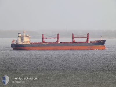
CL BILIU HE
Cargo
Current Trip
| Time Travelled | 14 days |
|---|---|
| Remaining Time | --- |
| Distance Travelled | 3926.47 nm |
| Remaining Distance | 190.63 nm |
| AVG Speed | 11.3 Knots |
| MAX Speed | 13.9 Knots |
| AVG Wind | 10.1 knots |
| MAX Wind | 30.9 knots |
| MIN Temp | 11.9°C / 53.42°F |
| MAX Temp | 30.7°C / 87.26°F |
| Draught | 13.2 m |
| Position Received | 4 d ago |
Current Position
| Longitude | 103.45150° |
|---|---|
| Latitude | 1.22860° |
| Status | Under way using engine |
| Speed | 13.5 Knots |
| Course | 285.5° |
| Area | Malacca Strait |
| Station | T-AIS |
| Position Received | 4 d ago |
Info
Information
The current position of CL BILIU HE is in Malacca Strait with coordinates 1.22860° / 103.45150° as reported on 2024-05-22 08:18 by AIS to our vessel tracker app. The vessel's current speed is 13.5 Knots and is heading at the port of CHITTAGONG. The estimated time of arrival as calculated by MyShipTracking vessel tracking app is 2024-05-27 09:00 LT
The vessel CL BILIU HE (IMO: 9890604, MMSI: 477632300) is a Cargo It's sailing under the flag of [HK] Hong Kong.
In this page you can find informations about the vessels current position, last detected port calls, and current voyage information. If the vessels is not in coverage by AIS you will find the latest position.
The current position of CL BILIU HE is detected by our AIS receivers and we are not responsible for the reliability of the data. The last position was recorded while the vessel was in Coverage by the Ais receivers of our vessel tracking app.
The current draught of CL BILIU HE as reported by AIS is 13.2 meters
Weather
| Temperature | 30.1°C / 86.18°F |
|---|---|
| Wind Speed | 25 knots |
| Direction | 197° SSW |
| Pressure | 1001.7 hPa |
| Humidity | 84.1 % |
| Cloud Coverage | 100 % |
Featured Company
Last Port Calls
| Port | Arrival | Departure | Time In Port |
|---|---|---|---|
| 2024-05-09 13:16 | 2024-05-12 15:20 | 3 d | |
| 2024-05-06 00:04 | 2024-05-08 02:24 | 2 d | |
| 2024-03-18 19:23 |
Most Visited Ports (Last year)
| Port | Arrivals | |
|---|---|---|
| 2 | ||
| 1 | ||
| 1 | ||
| 1 | ||
| 1 | ||
| 1 |
Last Trips
| Origin | Departure | Destination | Arrival | Distance | |
|---|---|---|---|---|---|
| 2024-05-08 10:24 | 2024-05-09 22:16 | 404.90 nm | |||
| 2024-03-19 03:23 | 2024-05-06 08:04 | 7313.21 nm |
Events
| Time | Event | Details | Position / Dest | Info |
|---|---|---|---|---|
| 2024-05-22 08:25 | Status Changed | Default Under way using engine |
1.23629 / 103.42535
BD CGP
|
Speed: 13.5 kn Course: 285.5° |
| 2024-05-22 08:18 | OUT of Coverage |
1.22860 / 103.45150
Malacca Strait
BD CGP
|
Speed: 13.5 kn Course: 285.5° |
|
| 2024-05-22 08:15 | Detected in Sea | Malaysian part of the Malacca Strait |
1.22552 / 103.46226
Malacca Strait
BD CGP
|
Speed: 13.5 kn Course: 285.6° |
| 2024-05-22 07:41 | Change Sea Area | Malaysian part of the Singapore Strait Indonesian part of the Singapore Strait |
1.19719 / 103.58169
Singapore Strait
BD CGP
|
Speed: 12.8 kn Course: 279.6° |
| 2024-05-22 07:05 | Change Sea Area | Indonesian part of the Singapore Strait Singaporean part of the Singapore Strait |
1.15743 / 103.70094
Singapore Strait
BD CGP
|
Speed: 12.1 kn Course: 300.4° |
| 2024-05-22 05:01 | START Moving | 1.18 nm, South West of TANAH MERAH |
1.29419 / 104.00985
BD CGP
|
Speed: 3.3 kn Course: 124° |
| 2024-05-22 04:51 | Status Changed | Under way using engine At anchor |
1.29232 / 104.00595
BD CGP
|
Speed: 0.2 kn Course: 30° |
| 2024-05-22 03:54 | Status Changed | At anchor Default |
1.29323 / 104.00518
BD CGP
|
Speed: Course: 75° |
| 2024-05-22 03:51 | Status Changed | Default At anchor |
1.29327 / 104.00521
BD CGP
|
Speed: Course: 74° |
| 2024-05-22 03:33 | Status Changed | At anchor Default |
1.29309 / 104.00529
BD CGP
|
Speed: Course: 65° |