
CIVITAS
Cargo
Current Trip
ILE NAPOLEON
| Time Travelled | 11 days |
|---|---|
| Remaining Time | --- |
| Distance Travelled | 124.23 nm |
| Remaining Distance | --- |
| AVG Speed | 6.9 Knots |
| MAX Speed | 8.4 Knots |
| AVG Wind | 9.3 knots |
| MAX Wind | 10 knots |
| MIN Temp | 4.3°C / 39.74°F |
| MAX Temp | 12.2°C / 53.96°F |
| Draught | 2.1 m |
| Position Received | 9 d ago |
Current Position
| Longitude | --- |
|---|---|
| Latitude | --- |
| Status | Under way using engine |
| Speed | 5.5 Knots |
| Course | 265° |
| Area | North Sea |
| Station | T-AIS |
| Position Received | 9 d ago |
Info
Information
The current position of CIVITAS is in North Sea with coordinates 52.38740° / 9.31182° as reported on 2025-12-12 10:03 by AIS to our vessel tracker app. The vessel's current speed is 5.5 Knots
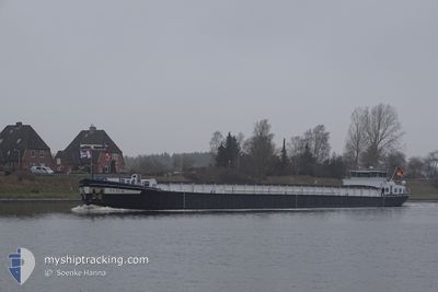
The vessel CIVITAS (MMSI: 211517780) is a Cargo It's sailing under the flag of [DE] Germany.
In this page you can find informations about the vessels current position, last detected port calls, and current voyage information. If the vessels is not in coverage by AIS you will find the latest position.
The current position of CIVITAS is detected by our AIS receivers and we are not responsible for the reliability of the data. The last position was recorded while the vessel was in Coverage by the Ais receivers of our vessel tracking app.
The current draught of CIVITAS as reported by AIS is 2.1 meters
Weather
| Temperature | 5.1°C / 41.18°F |
|---|---|
| Wind Speed | 6 knots |
| Direction | 175° S |
| Pressure | 1014.5 hPa |
| Humidity | 70.5 % |
| Cloud Coverage | 25 % |
Featured Company
Last Port Calls
| Port | Arrival | Departure | Time In Port |
|---|---|---|---|
| 2025-12-09 13:04 | 2025-12-10 10:31 | 21 h | |
| 2025-12-07 09:49 | 2025-12-09 06:09 | 1 d | |
| 2025-12-06 13:56 | 2025-12-07 05:18 | 15 h | |
| 2025-12-06 11:21 | 2025-12-06 12:21 | 1 h | |
| 2025-12-03 12:50 | 2025-12-05 13:23 | 2 d | |
| 2025-11-27 22:16 | 2025-11-28 07:26 | 9 h | |
| 2025-11-20 11:09 | 2025-11-27 11:12 | 7 d | |
| 2025-11-19 15:20 | 2025-11-20 06:21 | 15 h | |
| 2025-11-17 21:36 | 2025-11-19 13:18 | 1 d | |
| 2025-11-17 18:04 | 2025-11-17 18:43 | 39 m |
Last Trips
| Origin | Departure | Destination | Arrival | Distance | |
|---|---|---|---|---|---|
| 2025-12-09 06:09 | 2025-12-09 13:04 | 55.81 nm | |||
| 2025-12-07 05:18 | 2025-12-07 09:49 | 49.03 nm | |||
| 2025-12-06 12:21 | 2025-12-06 13:56 | 14.74 nm | |||
| 2025-12-05 13:23 | 2025-12-06 11:21 | 36.02 nm | |||
| 2025-11-28 07:26 | 2025-12-03 12:50 | 224.84 nm | |||
| 2025-11-27 11:12 | 2025-11-27 22:16 | 48.88 nm | |||
| 2025-11-20 06:21 | 2025-11-20 11:09 | 16.60 nm | |||
| 2025-11-19 13:18 | 2025-11-19 15:20 | 17.99 nm | |||
| 2025-11-17 18:43 | 2025-11-17 21:36 | 18.19 nm | |||
| 2025-11-17 07:21 | 2025-11-17 18:04 | 23.31 nm |
Events
| Time | Event | Details | Position / Dest | Info |
|---|---|---|---|---|
| 2025-12-12 15:02 | STOP Moving | 7.48 nm, North East of MINDEN |
52.41000 / 9.02167
ILE NAPOLEON
|
Speed: Course: -1° |
| 2025-12-12 10:27 | Status Changed | Default Under way using engine |
52.38167 / 9.25296
ILE NAPOLEON
|
Speed: 5.5 kn Course: 265° |
| 2025-12-12 10:03 | OUT of Coverage |
52.38740 / 9.31182
North Sea
|
Speed: 5.5 kn Course: 265° |
|
| 2025-12-12 09:46 | Status Changed | Under way using engine Default |
52.38935 / 9.35194
ILE NAPOLEON
|
Speed: 5.3 kn Course: 265° |
| 2025-12-12 09:40 | Status Changed | Default Under way using engine |
52.39002 / 9.36635
ILE NAPOLEON
|
Speed: 5.5 kn Course: 266° |
| 2025-12-12 09:04 | Status Changed | Under way using engine Default |
52.39864 / 9.45600
ILE NAPOLEON
|
Speed: 5 kn Course: 254° |
| 2025-12-12 09:04 | IN Coverage |
52.39864 / 9.45600
North Sea
|
Speed: 5.6 kn Course: 247° |
|
| 2025-12-12 07:12 | OUT of Coverage |
52.41495 / 9.71850
North Sea
|
Speed: 5.5 kn Course: 299° |
|
| 2025-12-12 07:04 | IN Coverage |
52.40893 / 9.73586
North Sea
|
Speed: 5.6 kn Course: 298° |