
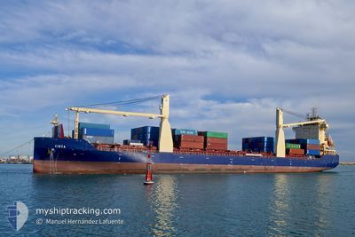
CIRTA
Cargo
Current Trip
| Time Travelled | 2 days |
|---|---|
| Remaining Time | --- |
| Distance Travelled | 166.61 nm |
| Remaining Distance | --- |
| AVG Speed | 9.4 Knots |
| MAX Speed | 10.4 Knots |
| AVG Wind | 6.4 knots |
| MAX Wind | 12 knots |
| MIN Temp | 13.6°C / 56.48°F |
| MAX Temp | 17.5°C / 63.5°F |
| Draught | 8.5 m |
| Position Received | 3 m ago |
Current Position
| Longitude | --- |
|---|---|
| Latitude | --- |
| Status | At anchor |
| Speed | |
| Course | 60° |
| Area | Balearic Sea |
| Station | T-AIS |
| Position Received | 3 m ago |
Info
Information
The current position of CIRTA is in Balearic Sea with coordinates 39.39424° / -0.28219° as reported on 2025-12-11 11:56 by AIS to our vessel tracker app. The vessel's current speed is 0 Knots
The vessel CIRTA (IMO: 984505100, MMSI: 605086060) is a Cargo It's sailing under the flag of [DZ] Algeria.
In this page you can find informations about the vessels current position, last detected port calls, and current voyage information. If the vessels is not in coverage by AIS you will find the latest position.
The current position of CIRTA is detected by our AIS receivers and we are not responsible for the reliability of the data. The last position was recorded while the vessel was in Coverage by the Ais receivers of our vessel tracking app.
The current draught of CIRTA as reported by AIS is 8.5 meters
Weather
| Temperature | 15.2°C / 59.36°F |
|---|---|
| Wind Speed | 4 knots |
| Direction | 51° NE |
| Pressure | 1024.1 hPa |
| Humidity | 64.7 % |
| Cloud Coverage | 82 % |
Featured Company
Last Port Calls
| Port | Arrival | Departure | Time In Port |
|---|---|---|---|
| 2025-12-08 10:10 | 2025-12-09 02:23 | 16 h | |
| 2025-12-03 06:19 | 2025-12-06 16:29 | 3 d | |
| 2025-11-27 11:33 | 2025-11-28 03:36 | 16 h | |
| 2025-11-25 05:03 | 2025-11-26 15:54 | 1 d | |
| 2025-11-20 08:04 | 2025-11-22 15:31 | 2 d | |
| 2025-11-07 12:19 | 2025-11-15 16:28 | 8 d | |
| 2025-11-04 06:34 | 2025-11-04 20:03 | 13 h | |
| 2025-10-31 05:29 | 2025-10-31 15:04 | 9 h | |
| 2025-10-25 09:03 | 2025-10-26 09:24 | 1 d | |
| 2025-10-22 13:56 | 2025-10-23 07:20 | 17 h |
Last Trips
| Origin | Departure | Destination | Arrival | Distance | |
|---|---|---|---|---|---|
| 2025-12-06 16:29 | 2025-12-08 10:10 | 404.42 nm | |||
| 2025-11-28 03:36 | 2025-12-03 06:19 | 29.45 nm | |||
| 2025-11-26 15:54 | 2025-11-27 11:33 | 61.95 nm | |||
| 2025-11-22 15:31 | 2025-11-25 05:03 | 599.75 nm | |||
| 2025-11-15 16:28 | 2025-11-20 08:04 | 24.67 nm | |||
| 2025-11-04 20:03 | 2025-11-07 12:19 | 247.79 nm | |||
| 2025-10-31 15:04 | 2025-11-04 06:34 | 170.30 nm | |||
| 2025-10-26 09:24 | 2025-10-31 05:29 | 455.64 nm | |||
| 2025-10-23 07:20 | 2025-10-25 09:03 | 29.81 nm | |||
| 2025-10-21 14:39 | 2025-10-22 13:56 | 63.01 nm |
Events
| Time | Event | Details | Position / Dest | Info |
|---|---|---|---|---|
| 2025-12-10 10:08 | Status Changed | At anchor Default |
39.39636 / -.27870
ESVLC
|
Speed: Course: 238° |
| 2025-12-10 10:05 | Status Changed | Default At anchor |
39.39634 / -.27871
ESVLC
|
Speed: Course: 237° |
| 2025-12-10 03:08 | Status Changed | At anchor Default |
39.39658 / -.27891
ESVLC
|
Speed: Course: 224° |
| 2025-12-10 03:05 | Status Changed | Default At anchor |
39.39659 / -.27894
ESVLC
|
Speed: Course: 222° |
| 2025-12-10 00:20 | Status Changed | At anchor Default |
39.39654 / -.27890
ESVLC
|
Speed: Course: 225° |
| 2025-12-10 00:17 | Status Changed | Default At anchor |
39.39656 / -.27891
ESVLC
|
Speed: Course: 224° |
| 2025-12-09 18:38 | Status Changed | At anchor Under way using engine |
39.39487 / -.28203
ESVLC
|
Speed: 0.4 kn Course: 66° |
| 2025-12-09 18:28 | STOP Moving | 2.97 nm, South East of VALENCIA |
39.39314 / -.28095
ESVLC
|
Speed: 0.3 kn Course: 5° |
| 2025-12-09 13:28 | ETA Changed | 2025/12/09 18:00 |
39.97565 / .35270
ESVLC
|
Speed: 9.6 kn Course: 215.5° |
| 2025-12-09 13:03 | Status Changed | Under way using engine Default |
40.02657 / .40100
ESVLC
|
Speed: 9.6 kn Course: 217° |