
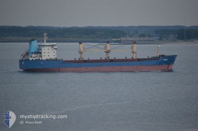
GAZIBEY
General Cargo
Current Trip
| Time Travelled | 10 days |
|---|---|
| Remaining Time | 1 day |
| Distance Travelled | 1188.80 nm |
| Remaining Distance | 266.60 nm |
| AVG Speed | 11.3 Knots |
| MAX Speed | 15.2 Knots |
| AVG Wind | 11.4 knots |
| MAX Wind | 29.3 knots |
| MIN Temp | 9.8°C / 49.64°F |
| MAX Temp | 22.3°C / 72.14°F |
| Draught | 5.7 m |
| Position Received | 1 m ago |
Current Position
| Longitude | 28.96683° |
|---|---|
| Latitude | 40.91745° |
| Status | Under way using engine |
| Speed | 10.1 Knots |
| Course | 32.2° |
| Area | Sea of Marmara |
| Station | T-AIS |
| Position Received | 1 m ago |
Info
Information
The current position of GAZIBEY is in Sea of Marmara with coordinates 40.91745° / 28.96683° as reported on 2024-04-26 13:26 by AIS to our vessel tracker app. The vessel's current speed is 10.1 Knots and is heading at the port of SULINA. The estimated time of arrival as calculated by MyShipTracking vessel tracking app is 2024-04-27 14:04 LT
The vessel GAZIBEY (IMO: 9121912, MMSI: 370261000) is a General Cargo that was built in 1998 ( 26 years old ). It's sailing under the flag of [PA] Panama.
In this page you can find informations about the vessels current position, last detected port calls, and current voyage information. If the vessels is not in coverage by AIS you will find the latest position.
The current position of GAZIBEY is detected by our AIS receivers and we are not responsible for the reliability of the data. The last position was recorded while the vessel was in Coverage by the Ais receivers of our vessel tracking app.
The current draught of GAZIBEY as reported by AIS is 5.7 meters
Weather
| Temperature | 18.8°C / 65.84°F |
|---|---|
| Wind Speed | 3 knots |
| Direction | 313° NW |
| Pressure | 1013.3 hPa |
| Humidity | 56 % |
| Cloud Coverage | --- |
Featured Company
Last Port Calls
| Port | Arrival | Departure | Time In Port |
|---|---|---|---|
| 2024-04-15 10:24 | 2024-04-16 10:33 | 1 d | |
| 2024-02-27 23:28 | 2024-03-26 00:44 | 27 d | |
| 2024-02-18 08:13 | 2024-02-21 23:51 | 3 d | |
| 2024-02-06 04:34 | 2024-02-09 10:38 | 3 d |
Last Trips
| Origin | Departure | Destination | Arrival | Distance | |
|---|---|---|---|---|---|
| 2024-03-26 01:44 | 2024-04-15 12:24 | 3166.51 nm | |||
| 2024-02-22 00:51 | 2024-02-28 00:28 | 991.37 nm | |||
| 2024-02-09 13:38 | 2024-02-18 09:13 | 2164.08 nm | |||
| 2024-01-23 22:34 | 2024-02-06 07:34 | 561.52 nm |
Events
| Time | Event | Details | Position / Dest | Info |
|---|---|---|---|---|
| 2024-04-26 12:12 | Destination Changed | SULINA ROMANIA ROCND |
40.76841 / 28.75588
SULINA ROMANIA
|
Speed: 10.6 kn Course: 45.7° |
| 2024-04-26 12:12 | ETA Changed | 2024/04/27 18:00 2024/04/22 00:00 |
40.76841 / 28.75588
SULINA ROMANIA
|
Speed: 10.6 kn Course: 45.7° |
| 2024-04-26 12:08 | Status Changed | Under way using engine At anchor |
40.76048 / 28.74518
ROCND
|
Speed: 11 kn Course: 45.1° |
| 2024-04-26 11:43 | START Moving | 14.97 nm, South of AMBARLI |
40.71007 / 28.68263
ROCND
|
Speed: 3.5 kn Course: 272° |
| 2024-04-26 11:35 | Status Changed | At anchor Default |
40.71127 / 28.68509
ROCND
|
Speed: 0.2 kn Course: 238° |
| 2024-04-26 11:31 | Status Changed | Default At anchor |
40.71146 / 28.68534
ROCND
|
Speed: 0.1 kn Course: 233° |
| 2024-04-26 10:52 | Status Changed | At anchor Default |
40.71286 / 28.68568
ROCND
|
Speed: 0.1 kn Course: 241° |
| 2024-04-26 10:41 | Status Changed | Default At anchor |
40.71295 / 28.68576
ROCND
|
Speed: 0.1 kn Course: 241° |
| 2024-04-26 09:35 | Status Changed | At anchor Default |
40.71326 / 28.68341
ROCND
|
Speed: 0.2 kn Course: 218° |
| 2024-04-26 09:26 | Status Changed | Default At anchor |
40.71333 / 28.68271
ROCND
|
Speed: 0.2 kn Course: 218° |