
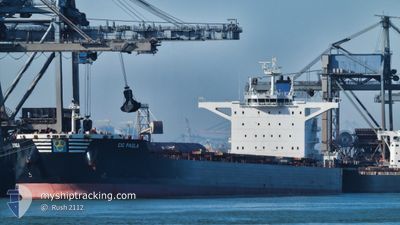
CIC PAOLA
Cargo
Current Trip
CO DRU
| Time Travelled | 22 days |
|---|---|
| Remaining Time | --- |
| Distance Travelled | 4172.77 nm |
| Remaining Distance | --- |
| AVG Speed | 8.4 Knots |
| MAX Speed | 13 Knots |
| AVG Wind | 14.4 knots |
| MAX Wind | 35.9 knots |
| MIN Temp | 6.8°C / 44.24°F |
| MAX Temp | 28.7°C / 83.66°F |
| Draught | 8.8 m |
| Position Received | 1 d ago |
Current Position
| Longitude | -67.21809° |
|---|---|
| Latitude | 19.50938° |
| Status | Under way using engine |
| Speed | 9.4 Knots |
| Course | 223.8° |
| Area | North Atlantic Ocean |
| Station | T-AIS |
| Position Received | 1 d ago |
Info
Information
The current position of CIC PAOLA is in North Atlantic Ocean with coordinates 19.50938° / -67.21809° as reported on 2024-05-19 16:06 by AIS to our vessel tracker app. The vessel's current speed is 9.4 Knots
The vessel CIC PAOLA (IMO: 9692820, MMSI: 356820000) is a Cargo It's sailing under the flag of [PA] Panama.
In this page you can find informations about the vessels current position, last detected port calls, and current voyage information. If the vessels is not in coverage by AIS you will find the latest position.
The current position of CIC PAOLA is detected by our AIS receivers and we are not responsible for the reliability of the data. The last position was recorded while the vessel was in Coverage by the Ais receivers of our vessel tracking app.
The current draught of CIC PAOLA as reported by AIS is 8.8 meters
Weather
| Temperature | 28.3°C / 82.94°F |
|---|---|
| Wind Speed | 17 knots |
| Direction | 94° E |
| Pressure | 1011.3 hPa |
| Humidity | 85.6 % |
| Cloud Coverage | 30 % |
Featured Company
Last Port Calls
| Port | Arrival | Departure | Time In Port |
|---|---|---|---|
| 2024-04-27 22:44 | 2024-04-27 23:21 | 36 m | |
| 2024-04-20 05:32 | 2024-04-27 21:31 | 7 d | |
| 2024-04-15 05:14 | 2024-04-20 04:41 | 4 d | |
| 2024-04-05 22:25 | 2024-04-09 08:03 | 3 d | |
| 2024-03-11 22:29 | |||
| 2024-03-10 09:25 | 2024-03-11 22:21 | 1 d |
Last Trips
| Origin | Departure | Destination | Arrival | Distance | |
|---|---|---|---|---|---|
| 2024-04-27 21:31 | 2024-04-27 22:44 | 5.26 nm | |||
| 2024-04-20 04:41 | 2024-04-20 05:32 | 4.35 nm | |||
| 2024-04-09 08:03 | 2024-04-15 05:14 | 1196.02 nm | |||
| 2024-03-11 22:21 | 2024-03-11 22:29 | 0.83 nm | |||
| 2024-01-11 23:21 | 2024-03-10 09:25 | 4296.86 nm |
Events
| Time | Event | Details | Position / Dest | Info |
|---|---|---|---|---|
| 2024-05-19 16:13 | Status Changed | Default Under way using engine |
19.49663 / -67.23107
CO DRU
|
Speed: 9.4 kn Course: 223.8° |
| 2024-05-19 16:06 | Status Changed | Under way using engine Default |
19.50938 / -67.21809
CO DRU
|
Speed: 9 kn Course: 224° |
| 2024-05-19 16:06 | OUT of Coverage |
19.50938 / -67.21809
North Atlantic Ocean
CO DRU
|
Speed: 9.4 kn Course: 223.8° |
|
| 2024-05-19 15:23 | Status Changed | Default Under way using engine |
19.59166 / -67.13500
CO DRU
|
Speed: 9.5 kn Course: 222.5° |
| 2024-05-19 15:19 | Change Sea Area | Puerto Rican part of the North Atlantic Ocean High seas of the North Atlantic Ocean |
19.59881 / -67.12912
North Atlantic Ocean
CO DRU
|
Speed: 9.5 kn Course: 222.5° |
| 2024-05-19 15:19 | Status Changed | Under way using engine Default |
19.59881 / -67.12912
CO DRU
|
Speed: 9 kn Course: 223° |
| 2024-05-19 15:02 | IN Coverage |
19.59881 / -67.12912
North Atlantic Ocean
CO DRU
|
Speed: 9.5 kn Course: 222.5° |
|
| 2024-05-18 01:36 | Status Changed | Default Under way using engine |
23.63778 / -62.59845
CO DRU
|
Speed: 9.2 kn Course: 231.2° |
| 2024-05-18 01:33 | Status Changed | Under way using engine Default |
23.64311 / -62.59063
CO DRU
|
Speed: 9 kn Course: 232° |
| 2024-05-18 01:33 | OUT of Coverage |
23.64311 / -62.59063
North Atlantic Ocean
CO DRU
|
Speed: 9.2 kn Course: 231.2° |