
CHIQUITA PROGRESS
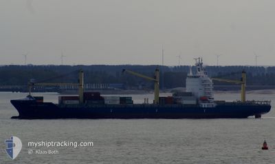
Container Ship
Current Trip
| Time Travelled | 4 days |
|---|---|
| Remaining Time | 3 h, 2 mins |
| Distance Travelled | 2053.90 nm |
| Remaining Distance | 65.98 nm |
| AVG Speed | 17.5 Knots |
| MAX Speed | 19.8 Knots |
| AVG Wind | 6.8 knots |
| MAX Wind | 19 knots |
| MIN Temp | 15.8°C / 60.44°F |
| MAX Temp | 28.2°C / 82.76°F |
| Draught | 9.5 m |
| Position Received | 23 m ago |
Current Position
| Longitude | --- |
|---|---|
| Latitude | --- |
| Status | Under way using engine |
| Speed | 15.3 Knots |
| Course | 322.5° |
| Area | North Pacific Ocean |
| Station | T-AIS |
| Position Received | 23 m ago |
Info
Information
The current position of CHIQUITA PROGRESS is in North Pacific Ocean with coordinates 33.39590° / -118.67544° as reported on 2025-12-23 11:26 by AIS to our vessel tracker app. The vessel's current speed is 15.3 Knots and is heading at the port of HUENEME. The estimated time of arrival as calculated by MyShipTracking vessel tracking app is 2025-12-23 06:51 LT
The vessel CHIQUITA PROGRESS (IMO: 9357119, MMSI: 636017731) is a Container Ship that was built in 2007 ( 18 years old ). It's sailing under the flag of [LR] Liberia.
In this page you can find informations about the vessels current position, last detected port calls, and current voyage information. If the vessels is not in coverage by AIS you will find the latest position.
The current position of CHIQUITA PROGRESS is detected by our AIS receivers and we are not responsible for the reliability of the data. The last position was recorded while the vessel was in Coverage by the Ais receivers of our vessel tracking app.
The current draught of CHIQUITA PROGRESS as reported by AIS is 9.5 meters
Weather
| Temperature | 15.7°C / 60.26°F |
|---|---|
| Wind Speed | 6 knots |
| Direction | 229° SW |
| Pressure | 1013.4 hPa |
| Humidity | 84.4 % |
| Cloud Coverage | 100 % |
Featured Company
Last Port Calls
| Port | Arrival | Departure | Time In Port |
|---|---|---|---|
| 2025-12-17 12:41 | 2025-12-18 10:33 | 21 h | |
| 2025-12-13 23:20 | 2025-12-14 10:40 | 11 h | |
| 2025-12-09 07:11 | 2025-12-10 17:47 | 1 d | |
| 2025-12-03 05:29 | 2025-12-04 02:47 | 21 h | |
| 2025-11-29 21:42 | 2025-11-30 12:44 | 15 h | |
| 2025-11-25 09:37 | 2025-11-26 17:46 | 1 d | |
| 2025-11-19 12:05 | 2025-11-20 07:41 | 19 h | |
| 2025-11-18 05:31 | 2025-11-18 15:08 | 9 h | |
| 2025-11-15 17:20 | 2025-11-16 06:05 | 12 h | |
| 2025-11-11 08:58 | 2025-11-12 18:14 | 1 d |
Most Visited Ports (Last year)
| Port | Arrivals | |
|---|---|---|
| 26 | ||
| 26 | ||
| 20 | ||
| 11 |
Last Trips
| Origin | Departure | Destination | Arrival | Distance | |
|---|---|---|---|---|---|
| 2025-12-14 10:40 | 2025-12-17 12:41 | 875.90 nm | |||
| 2025-12-10 17:47 | 2025-12-13 23:20 | 1277.43 nm | |||
| 2025-12-04 02:47 | 2025-12-09 07:11 | 2115.31 nm | |||
| 2025-11-30 12:44 | 2025-12-03 05:29 | 876.58 nm | |||
| 2025-11-26 17:46 | 2025-11-29 21:42 | 1259.62 nm | |||
| 2025-11-20 07:41 | 2025-11-25 09:37 | 2118.79 nm | |||
| 2025-11-18 15:08 | 2025-11-19 12:05 | 141.68 nm | |||
| 2025-11-16 06:05 | 2025-11-18 05:31 | 751.21 nm | |||
| 2025-11-12 18:14 | 2025-11-15 17:20 | 1262.99 nm | |||
| 2025-11-06 02:09 | 2025-11-11 08:58 | 2125.52 nm |
Events
| Time | Event | Details | Position / Dest | Info |
|---|---|---|---|---|
| 2025-12-23 11:32 | Status Changed | Default Under way using engine |
33.41542 / -118.69263
GTPRQ>USNTD
|
Speed: 15.3 kn Course: 322.5° |
| 2025-12-23 11:26 | Status Changed | Under way using engine Default |
33.39590 / -118.67544
GTPRQ>USNTD
|
Speed: 15.4 kn Course: 324° |
| 2025-12-23 11:23 | Status Changed | Default Under way using engine |
33.38500 / -118.66566
GTPRQ>USNTD
|
Speed: 15.3 kn Course: 323.8° |
| 2025-12-23 11:18 | Status Changed | Under way using engine Default |
33.36793 / -118.65054
GTPRQ>USNTD
|
Speed: 15.3 kn Course: 324° |
| 2025-12-23 11:16 | Status Changed | Default Under way using engine |
33.36033 / -118.64396
GTPRQ>USNTD
|
Speed: 15.4 kn Course: 322.5° |
| 2025-12-23 11:03 | Status Changed | Under way using engine Default |
33.31714 / -118.60594
GTPRQ>USNTD
|
Speed: 15.5 kn Course: 323° |
| 2025-12-23 11:00 | Status Changed | Default Under way using engine |
33.30616 / -118.59612
GTPRQ>USNTD
|
Speed: 15.5 kn Course: 315.5° |
| 2025-12-23 10:24 | Status Changed | Under way using engine Default |
33.19419 / -118.47190
GTPRQ>USNTD
|
Speed: 15.3 kn Course: 317° |
| 2025-12-23 10:04 | Status Changed | Default Under way using engine |
33.13092 / -118.39990
GTPRQ>USNTD
|
Speed: 15.9 kn Course: 315.2° |
| 2025-12-23 10:01 | Status Changed | Under way using engine Default |
33.12038 / -118.38803
GTPRQ>USNTD
|
Speed: 15.9 kn Course: 316° |