
CHIOS I
Tanker
Current Trip
| Time Travelled | --- |
|---|---|
| Remaining Time | --- |
| Distance Travelled | 6013.07 nm |
| Remaining Distance | 11.05 nm |
| AVG Speed | 9.8 Knots |
| MAX Speed | 15.8 Knots |
| AVG Wind | 7.1 knots |
| MAX Wind | 20 knots |
| MIN Temp | 20.2°C / 68.36°F |
| MAX Temp | 28.7°C / 83.66°F |
| Draught | 15.9 m |
| Position Received | 5 d ago |
Current Position
| Longitude | --- |
|---|---|
| Latitude | --- |
| Status | Under way using engine |
| Speed | 12.1 Knots |
| Course | 150.7° |
| Area | Gulf of Oman |
| Station | T-AIS |
| Position Received | 5 d ago |
Info
Information
The current position of CHIOS I is in Gulf of Oman with coordinates 25.77221° / 57.06697° as reported on 2025-12-08 05:21 by AIS to our vessel tracker app. The vessel's current speed is 12.1 Knots and is heading at the port of KOCHI. The estimated time of arrival as calculated by MyShipTracking vessel tracking app is 2025-12-13 06:00 LT
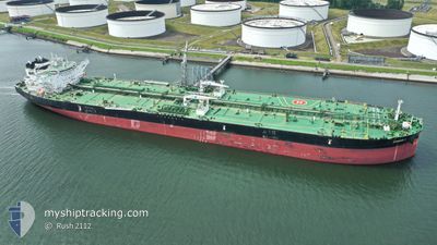
The vessel CHIOS I (IMO: 9792187, MMSI: 248109000) is a Tanker It's sailing under the flag of [MT] Malta.
In this page you can find informations about the vessels current position, last detected port calls, and current voyage information. If the vessels is not in coverage by AIS you will find the latest position.
The current position of CHIOS I is detected by our AIS receivers and we are not responsible for the reliability of the data. The last position was recorded while the vessel was in Coverage by the Ais receivers of our vessel tracking app.
The current draught of CHIOS I as reported by AIS is 15.9 meters
Weather
| Temperature | 25.2°C / 77.36°F |
|---|---|
| Wind Speed | 7 knots |
| Direction | 70° ENE |
| Pressure | 1011.7 hPa |
| Humidity | 81.7 % |
| Cloud Coverage | --- |
Featured Company
Last Port Calls
Most Visited Ports (Last year)
| Port | Arrivals | |
|---|---|---|
| 10 | ||
| 3 | ||
| 2 | ||
| 2 | ||
| 1 | ||
| 1 |
Last Trips
| Origin | Departure | Destination | Arrival | Distance |
|---|
Events
| Time | Event | Details | Position / Dest | Info |
|---|---|---|---|---|
| 2025-12-13 08:28 | STOP Moving | 16.31 nm, West of KOCHI |
9.91333 / 75.96500
INCOK
|
Speed: Course: -1° |
| 2025-12-08 05:25 | Status Changed | Default Under way using engine |
25.76084 / 57.07381
INCOK
|
Speed: 12.1 kn Course: 150.7° |
| 2025-12-08 05:21 | OUT of Coverage |
25.77221 / 57.06697
Gulf of Oman
INCOK
|
Speed: 12.1 kn Course: 150.7° |
|
| 2025-12-08 05:01 | Change Sea Area | Iranian part of the Gulf of Oman Omani part of the Persian Gulf |
25.82861 / 57.02732
Gulf of Oman
INCOK
|
Speed: 12.1 kn Course: 146.9° |
| 2025-12-08 05:01 | Status Changed | Under way using engine Default |
25.83000 / 57.02632
INCOK
|
Speed: 12.1 kn Course: 143° |
| 2025-12-08 04:55 | IN Coverage |
25.82861 / 57.02732
Gulf of Oman
INCOK
|
Speed: 12.1 kn Course: 146.9° |
|
| 2025-12-07 21:21 | Status Changed | Default Under way using engine |
26.24685 / 55.94719
INCOK
|
Speed: 11.8 kn Course: 57° |
| 2025-12-07 21:12 | OUT of Coverage |
26.23025 / 55.91907
Persian Gulf
INCOK
|
Speed: 11.8 kn Course: 57° |
|
| 2025-12-07 21:08 | Status Changed | Under way using engine Default |
26.22476 / 55.90712
INCOK
|
Speed: 11.8 kn Course: 67° |
| 2025-12-07 21:05 | Status Changed | Default Under way using engine |
26.22064 / 55.89760
INCOK
|
Speed: 12.1 kn Course: 65° |