
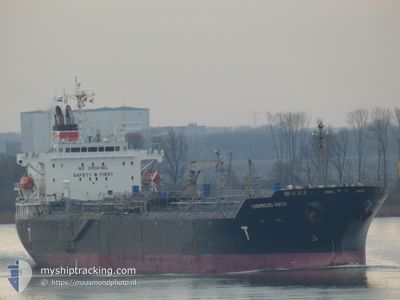
CHEMROAD HAYA
Oil/Chemical Tanker
Current Trip
| Time Travelled | 15 h, 42 mins |
|---|---|
| Remaining Time | 4 days |
| Distance Travelled | 194.31 nm |
| Remaining Distance | 1280.92 nm |
| AVG Speed | 12.5 Knots |
| MAX Speed | 17.3 Knots |
| AVG Wind | 7.9 knots |
| MAX Wind | 13 knots |
| MIN Temp | 12.3°C / 54.14°F |
| MAX Temp | 14.5°C / 58.1°F |
| Draught | 7.3 m |
| Position Received | 1 m ago |
Current Position
| Longitude | 0.80315° |
|---|---|
| Latitude | 50.70242° |
| Status | Under way using engine |
| Speed | 12.6 Knots |
| Course | 225.4° |
| Area | English Channel |
| Station | T-AIS |
| Position Received | 1 m ago |
Info
Information
The current position of CHEMROAD HAYA is in English Channel with coordinates 50.70242° / 0.80315° as reported on 2024-05-10 23:05 by AIS to our vessel tracker app. The vessel's current speed is 12.6 Knots and is heading at the port of JORF LASFAR. The estimated time of arrival as calculated by MyShipTracking vessel tracking app is 2024-05-14 23:11 LT
The vessel CHEMROAD HAYA (IMO: 9303649, MMSI: 354801000) is a Oil/Chemical Tanker that was built in 2004 ( 20 years old ). It's sailing under the flag of [PA] Panama.
In this page you can find informations about the vessels current position, last detected port calls, and current voyage information. If the vessels is not in coverage by AIS you will find the latest position.
The current position of CHEMROAD HAYA is detected by our AIS receivers and we are not responsible for the reliability of the data. The last position was recorded while the vessel was in Coverage by the Ais receivers of our vessel tracking app.
The current draught of CHEMROAD HAYA as reported by AIS is 7.3 meters
Weather
| Temperature | 12.3°C / 54.14°F |
|---|---|
| Wind Speed | 13 knots |
| Direction | 55° NE |
| Pressure | 1021.9 hPa |
| Humidity | 88.1 % |
| Cloud Coverage | 99 % |
Featured Company
Last Port Calls
| Port | Arrival | Departure | Time In Port |
|---|---|---|---|
| 2024-05-09 03:29 | 2024-05-10 07:24 | 1 d | |
| 2024-05-07 20:40 | 2024-05-08 18:40 | 22 h | |
| 2024-05-06 04:54 | 2024-05-07 20:25 | 1 d | |
| 2024-04-26 20:57 | 2024-05-05 02:49 | 8 d | |
| 2024-04-19 05:04 | 2024-04-20 06:19 | 1 d | |
| 2024-03-08 22:30 | 2024-03-09 13:34 | 15 h | |
| 2024-03-08 20:19 | |||
| 2024-03-08 20:17 | |||
| 2024-03-01 13:16 | 2024-03-03 08:52 | 1 d |
Last Trips
| Origin | Departure | Destination | Arrival | Distance | |
|---|---|---|---|---|---|
| 2024-05-08 20:40 | 2024-05-09 05:29 | 76.77 nm | |||
| 2024-05-07 22:25 | 2024-05-07 22:40 | 0.99 nm | |||
| 2024-05-05 04:49 | 2024-05-06 06:54 | 130.52 nm | |||
| 2024-04-20 08:19 | 2024-04-26 22:57 | 1932.42 nm | |||
| 2024-03-09 16:34 | 2024-04-19 07:04 | 10951.97 nm | |||
| 2024-03-08 23:17 | 2024-03-09 01:30 | 9.18 nm | |||
| 2024-03-03 11:52 | 2024-03-08 23:19 | 311.92 nm | |||
| 2024-02-29 17:41 | 2024-03-01 16:16 | 280.10 nm |
Events
| Time | Event | Details | Position / Dest | Info |
|---|---|---|---|---|
| 2024-05-10 20:44 | Change Sea Area | United Kingdom part of the English Channel United Kingdom part of the North Sea |
51.06737 / 1.48432
English Channel
MA JFL
|
Speed: 16.8 kn Course: 239.1° |
| 2024-05-10 17:47 | Change Sea Area | United Kingdom part of the North Sea Belgian part of the North Sea |
51.61045 / 2.24958
North Sea
MA JFL
|
Speed: 12.7 kn Course: 226.5° |
| 2024-05-10 16:17 | Change Sea Area | Belgian part of the North Sea Dutch part of the North Sea |
51.84708 / 2.57445
North Sea
MA JFL
|
Speed: 12 kn Course: 219.6° |
| 2024-05-10 10:13 | Destination Changed | MA JFL NL AMS |
52.50494 / 4.29107
MA JFL
|
Speed: 13.5 kn Course: 284.3° |
| 2024-05-10 10:13 | ETA Changed | 2024/05/14 23:00 2024/05/09 00:01 |
52.50494 / 4.29107
MA JFL
|
Speed: 13.5 kn Course: 284.3° |
| 2024-05-10 09:02 | START Moving | 0.63 nm, East of IJMUIDEN |
52.46766 / 4.60469
NL AMS
|
Speed: 3.1 kn Course: 277° |
| 2024-05-10 08:34 | STOP Moving | 0.81 nm, East of IJMUIDEN |
52.46732 / 4.60944
NL AMS
|
Speed: 0.3 kn Course: 277° |
| 2024-05-10 07:24 | PORT DEPARTURE |
|
52.42911 / 4.75819
NL AMS
|
Speed: 6.9 kn Course: 284° |
| 2024-05-10 06:51 | START Moving |
52.40609 / 4.82074
[NL] AMSTERDAM
|
Speed: 3.1 kn Course: 309° |
|
| 2024-05-10 06:40 | Status Changed | Under way using engine Moored |
52.40546 / 4.82410
[NL] AMSTERDAM
|
Speed: 0.1 kn Course: 270° |