
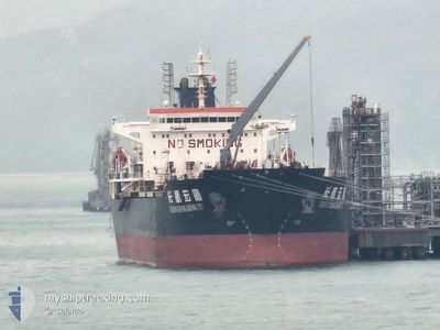
CHANG HANG HONG TU
Oil Products Tanker
Current Trip
| Trip Time | 14 days |
|---|---|
| Trip Distance | 4031.36 nm |
| AVG Speed | 11.6 Knots |
| MAX Speed | 14.7 Knots |
| Draught | 8 m |
| AVG Wind | 12.8 knots |
| MAX Wind | 27.8 knots |
| MIN Temp | 12.3°C / 54.14°F |
| MAX Temp | 30°C / 86°F |
| Position Received | 3 m ago |
Current Position
| Longitude | --- |
|---|---|
| Latitude | --- |
| Status | Under way using engine |
| Speed | 5.9 Knots |
| Course | 258° |
| Area | Singapore Strait |
| Station | T-AIS |
| Position Received | 3 m ago |
Info
Information
The current position of CHANG HANG HONG TU is in Singapore Strait with coordinates 1.29436° / 103.68931° as reported on 2025-12-24 06:14 by AIS to our vessel tracker app. The vessel's current speed is 5.9 Knots and is currently inside the port of JURONG ISLAND.
The vessel CHANG HANG HONG TU (IMO: 9379777, MMSI: 413372000) is a Oil Products Tanker that was built in 2008 ( 17 years old ). It's sailing under the flag of [CN] China.
In this page you can find informations about the vessels current position, last detected port calls, and current voyage information. If the vessels is not in coverage by AIS you will find the latest position.
The current position of CHANG HANG HONG TU is detected by our AIS receivers and we are not responsible for the reliability of the data. The last position was recorded while the vessel was in Coverage by the Ais receivers of our vessel tracking app.
The current draught of CHANG HANG HONG TU as reported by AIS is 8 meters
Weather
| Temperature | 28.8°C / 83.84°F |
|---|---|
| Wind Speed | 10 knots |
| Direction | 3° N |
| Pressure | 1007.1 hPa |
| Humidity | 74.4 % |
| Cloud Coverage | 97 % |
Featured Company
Last Port Calls
| Port | Arrival | Departure | Time In Port |
|---|---|---|---|
| 2025-12-22 14:57 | |||
| 2025-12-07 13:38 | 2025-12-08 12:32 | 22 h | |
| 2025-12-05 10:08 | 2025-12-06 08:17 | 22 h | |
| 2025-11-24 09:20 | 2025-12-01 11:06 | 7 d | |
| 2025-10-31 13:20 | 2025-11-02 12:36 | 1 d | |
| 2025-10-11 11:29 | 2025-10-12 11:49 | 1 d | |
| 2025-10-09 20:34 | 2025-10-11 11:19 | 1 d | |
| 2025-10-04 11:13 | 2025-10-06 13:16 | 2 d |
Last Trips
| Origin | Departure | Destination | Arrival | Distance | |
|---|---|---|---|---|---|
| 2025-12-08 12:32 | 2025-12-22 14:57 | 4031.36 nm | |||
| 2025-12-06 08:17 | 2025-12-07 13:38 | 323.14 nm | |||
| 2025-12-01 11:06 | 2025-12-05 10:08 | 503.80 nm | |||
| 2025-11-02 12:36 | 2025-11-24 09:20 | 5143.05 nm | |||
| 2025-10-12 11:49 | 2025-10-31 13:20 | 3351.59 nm | |||
| 2025-10-11 11:19 | 2025-10-11 11:29 | 0.41 nm | |||
| 2025-10-06 13:16 | 2025-10-09 20:34 | 852.01 nm | |||
| 2025-09-27 12:54 | 2025-10-04 11:13 | 1987.21 nm |
Events
| Time | Event | Details | Position / Dest | Info |
|---|---|---|---|---|
| 2025-12-24 05:58 | START Moving |
1.28724 / 103.69740
[SG] JURONG ISLAND
|
Speed: 3.1 kn Course: 35° |
|
| 2025-12-24 05:50 | Status Changed | Under way using engine Default |
1.28488 / 103.69585
[SG] JURONG ISLAND
|
Speed: Course: 223° |
| 2025-12-24 05:50 | IN Coverage |
1.28491 / 103.69578
Singapore Strait
[SG] JURONG ISLAND
|
Speed: 0.7 kn Course: 298.8° |
|
| 2025-12-22 07:45 | Status Changed | Default Under way using engine |
1.28444 / 103.69750
[SG] JURONG ISLAND
|
Speed: 3.2 kn Course: 215° |
| 2025-12-22 07:45 | STOP Moving |
1.28444 / 103.69750
[SG] JURONG ISLAND
|
Speed: Course: 222° |
|
| 2025-12-22 06:57 | PORT ARRIVAL |
|
1.28444 / 103.69750
[SG] JURONG ISLAND
|
Speed: 3.2 kn Course: 215° |
| 2025-12-22 06:52 | OUT of Coverage |
1.28878 / 103.69901
Singapore Strait
[SG] JURONG ISLAND
|
Speed: 3.2 kn Course: 214.8° |
|
| 2025-12-22 04:46 | Change Sea Area | Singaporean part of the Singapore Strait Indonesian part of the Singapore Strait |
1.15603 / 103.70599
Singapore Strait
SG SIN PWBGB
|
Speed: 7.8 kn Course: 309.5° |
| 2025-12-22 04:34 | Change Sea Area | Indonesian part of the Singapore Strait Singaporean part of the Singapore Strait |
1.13810 / 103.72468
Singapore Strait
SG SIN PWBGB
|
Speed: 7.4 kn Course: 307.4° |
| 2025-12-22 03:17 | Destination Changed | SG SIN PWBGB SG SIN |
1.22695 / 103.91430
SG SIN PWBGB
|
Speed: 7.7 kn Course: 247.8° |