
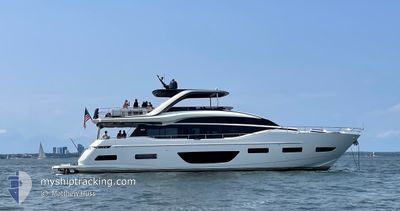
CENTENNIAL PRINCESS
Pleasure Craft
Current Trip
Unknown
| Time Travelled | 4 days |
|---|---|
| Remaining Time | --- |
| Distance Travelled | 72.86 nm |
| Remaining Distance | --- |
| AVG Speed | 9 Knots |
| MAX Speed | 21.8 Knots |
| AVG Wind | 6.5 knots |
| MAX Wind | 11 knots |
| MIN Temp | 23.7°C / 74.66°F |
| MAX Temp | 28.3°C / 82.94°F |
| Draught | --- |
| Position Received | 4 d ago |
Current Position
| Longitude | --- |
|---|---|
| Latitude | --- |
| Status | Default |
| Speed | 0.1 Knots |
| Course | --- |
| Area | North Atlantic Ocean |
| Station | T-AIS |
| Position Received | 4 d ago |
Info
Information
The current position of CENTENNIAL PRINCESS is in North Atlantic Ocean with coordinates 27.21035° / -80.25661° as reported on 2025-03-09 22:34 by AIS to our vessel tracker app. The vessel's current speed is 0.1 Knots
The vessel CENTENNIAL PRINCESS (MMSI: 368272540) is a Pleasure Craft It's sailing under the flag of [US] USA.
In this page you can find informations about the vessels current position, last detected port calls, and current voyage information. If the vessels is not in coverage by AIS you will find the latest position.
The current position of CENTENNIAL PRINCESS is detected by our AIS receivers and we are not responsible for the reliability of the data. The last position was recorded while the vessel was in Coverage by the Ais receivers of our vessel tracking app.
Weather
| Temperature | 27.8°C / 82.04°F |
|---|---|
| Wind Speed | 5 knots |
| Direction | 121° ESE |
| Pressure | 1013.2 hPa |
| Humidity | 51.4 % |
| Cloud Coverage | --- |
Featured Company
Last Port Calls
| Port | Arrival | Departure | Time In Port |
|---|---|---|---|
| 2025-03-08 19:15 | 2025-03-09 13:45 | 18 h |
Most Visited Ports (Last year)
| Port | Arrivals | |
|---|---|---|
| 3 | ||
| 1 |
Last Trips
| Origin | Departure | Destination | Arrival | Distance |
|---|
Events
| Time | Event | Details | Position / Dest | Info |
|---|---|---|---|---|
| 2025-03-09 22:34 | OUT of Coverage |
27.21035 / -80.25661
North Atlantic Ocean
|
Speed: 0.1 kn Course: 359.9° |
|
| 2025-03-09 21:38 | STOP Moving |
27.21032 / -80.25662
|
Speed: Course: 511° |
|
| 2025-03-09 20:46 | IN Coverage |
27.17304 / -80.19647
North Atlantic Ocean
|
Speed: 9.1 kn Course: 349.1° |
|
| 2025-03-09 18:53 | OUT of Coverage |
26.97999 / -80.08638
North Atlantic Ocean
|
Speed: 8.4 kn Course: 330.1° |
|
| 2025-03-09 18:18 | IN Coverage |
26.92897 / -80.08191
North Atlantic Ocean
|
Speed: 6.6 kn Course: 335.3° |
|
| 2025-03-09 14:32 | OUT of Coverage |
26.21987 / -80.05699
North Atlantic Ocean
|
Speed: 21.8 kn Course: 24.8° |
|
| 2025-03-09 13:56 | START Moving | 0.22 nm, North East of PORT EVERGLADES |
26.09336 / -80.11474
|
Speed: 7 kn Course: 86.3° |
| 2025-03-09 13:45 | PORT DEPARTURE |
|
26.09336 / -80.11474
|
Speed: Course: 511° |
| 2025-03-09 13:19 | IN Coverage |
26.11491 / -80.10813
North Atlantic Ocean
[US] FORT LAUDERDALE
|
Speed: Course: 511° |
|
| 2025-03-09 10:25 | OUT of Coverage |
26.11493 / -80.10815
North Atlantic Ocean
[US] FORT LAUDERDALE
|
Speed: Course: 511° |