
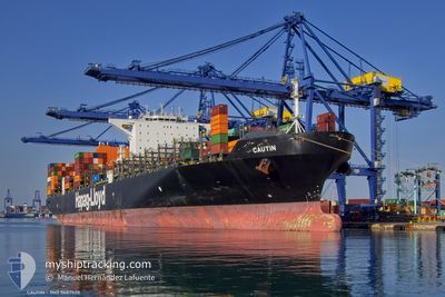
CAUTIN
Cargo D
Current Trip
CNYSN
| Time Travelled | 7 days |
|---|---|
| Remaining Time | --- |
| Distance Travelled | 2857.74 nm |
| Remaining Distance | --- |
| AVG Speed | 17.2 Knots |
| MAX Speed | 20.7 Knots |
| AVG Wind | 8.5 knots |
| MAX Wind | 19 knots |
| MIN Temp | 5.3°C / 41.54°F |
| MAX Temp | 28.9°C / 84.02°F |
| Draught | 11.5 m |
| Position Received | 2 d ago |
Current Position
| Longitude | --- |
|---|---|
| Latitude | --- |
| Status | Under way using engine |
| Speed | 9.5 Knots |
| Course | 141.4° |
| Area | North Pacific Ocean |
| Station | T-AIS |
| Position Received | 2 d ago |
Info
Information
The current position of CAUTIN is in North Pacific Ocean with coordinates 8.88156° / -79.51680° as reported on 2025-12-08 23:26 by AIS to our vessel tracker app. The vessel's current speed is 9.5 Knots
The vessel CAUTIN (IMO: 9687538, MMSI: 636092792) is a Cargo D It's sailing under the flag of [LR] Liberia.
In this page you can find informations about the vessels current position, last detected port calls, and current voyage information. If the vessels is not in coverage by AIS you will find the latest position.
The current position of CAUTIN is detected by our AIS receivers and we are not responsible for the reliability of the data. The last position was recorded while the vessel was in Coverage by the Ais receivers of our vessel tracking app.
The current draught of CAUTIN as reported by AIS is 11.5 meters
Weather
| Temperature | 26.8°C / 80.24°F |
|---|---|
| Wind Speed | 10 knots |
| Direction | 80° E |
| Pressure | 1010.7 hPa |
| Humidity | 80.6 % |
| Cloud Coverage | 10 % |
Featured Company
Last Port Calls
| Port | Arrival | Departure | Time In Port |
|---|---|---|---|
| 2025-12-02 14:46 | 2025-12-04 03:38 | 1 d | |
| 2025-11-29 08:48 | 2025-11-30 12:39 | 1 d | |
| 2025-11-24 00:50 | 2025-11-25 04:41 | 1 d | |
| 2025-11-20 06:15 | 2025-11-22 08:51 | 2 d | |
| 2025-10-25 01:10 | 2025-10-25 15:48 | 14 h | |
| 2025-10-19 06:44 | 2025-10-21 00:02 | 1 d | |
| 2025-10-15 04:36 | 2025-10-16 16:06 | 1 d | |
| 2025-10-09 12:44 | 2025-10-10 20:37 | 1 d | |
| 2025-10-06 11:16 | 2025-10-07 14:04 | 1 d | |
| 2025-10-02 10:52 | 2025-10-03 03:11 | 16 h |
Last Trips
| Origin | Departure | Destination | Arrival | Distance | |
|---|---|---|---|---|---|
| 2025-11-30 12:39 | 2025-12-02 14:46 | 131.71 nm | |||
| 2025-11-25 04:41 | 2025-11-29 08:48 | 454.40 nm | |||
| 2025-11-22 08:51 | 2025-11-24 00:50 | 311.85 nm | |||
| 2025-10-25 15:48 | 2025-11-20 06:15 | 11152.19 nm | |||
| 2025-10-21 00:02 | 2025-10-25 01:10 | 1623.91 nm | |||
| 2025-10-16 16:06 | 2025-10-19 06:44 | 636.59 nm | |||
| 2025-10-10 20:37 | 2025-10-15 04:36 | 1051.61 nm | |||
| 2025-10-07 14:04 | 2025-10-09 12:44 | 92.58 nm | |||
| 2025-10-03 03:11 | 2025-10-06 11:16 | 571.40 nm | |||
| 2025-08-31 10:16 | 2025-10-02 10:52 | 10762.01 nm |
Events
| Time | Event | Details | Position / Dest | Info |
|---|---|---|---|---|
| 2025-12-08 23:27 | Status Changed | Default Under way using engine |
8.88007 / -79.51564
CNYSN
|
Speed: 9.5 kn Course: 141.4° |
| 2025-12-08 23:26 | Status Changed | Under way using engine Default |
8.88156 / -79.51680
CNYSN
|
Speed: 7.6 kn Course: 142° |
| 2025-12-08 23:26 | OUT of Coverage |
8.88156 / -79.51680
North Pacific Ocean
CNYSN
|
Speed: 9.5 kn Course: 141.4° |
|
| 2025-12-08 23:26 | Change Sea Area | Panamanian part of the North Pacific Ocean United States part of the North Atlantic Ocean |
8.88156 / -79.51680
North Pacific Ocean
CNYSN
|
Speed: 9.5 kn Course: 141.4° |
| 2025-12-08 23:07 | Status Changed | Default Under way using engine |
8.91521 / -79.54277
CNYSN
|
Speed: 8.9 kn Course: 141.2° |
| 2025-12-08 22:57 | Status Changed | Under way using engine Default |
8.93392 / -79.55752
CNYSN
|
Speed: 7.6 kn Course: 142° |
| 2025-12-08 22:55 | Status Changed | Default Under way using engine |
8.93754 / -79.56033
CNYSN
|
Speed: 5.6 kn Course: 147.4° |
| 2025-12-08 22:32 | Status Changed | Under way using engine Default |
8.96694 / -79.57708
CNYSN
|
Speed: 2.9 kn Course: 142° |
| 2025-12-08 22:32 | START Moving | 0.71 nm, North of RODMAN |
8.96694 / -79.57708
CNYSN
|
Speed: 4.4 kn Course: 142° |
| 2025-12-08 22:32 | IN Coverage |
8.96438 / -79.57528
North Atlantic Ocean
CNYSN
|
Speed: 4.5 kn Course: 149.7° |