
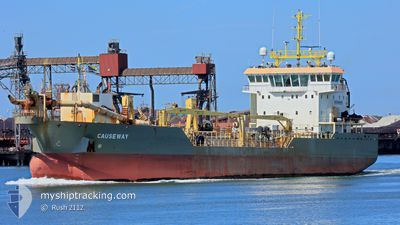
CAUSEWAY
Trailing Suction Hopper Dredger
Current Trip
| Time Travelled | 2 days |
|---|---|
| Remaining Time | --- |
| Distance Travelled | 274.98 nm |
| Remaining Distance | --- |
| AVG Speed | 7.6 Knots |
| MAX Speed | 13.4 Knots |
| AVG Wind | 3.6 knots |
| MAX Wind | 10 knots |
| MIN Temp | 3.9°C / 39.02°F |
| MAX Temp | 7.7°C / 45.86°F |
| Draught | 4 m |
| Position Received | 1 m ago |
Current Position
| Longitude | --- |
|---|---|
| Latitude | --- |
| Status | Restricted manoeuverability |
| Speed | 0.3 Knots |
| Course | 201° |
| Area | North Sea |
| Station | T-AIS |
| Position Received | 1 m ago |
Info
Information
The current position of CAUSEWAY is in North Sea with coordinates 51.57524° / 3.48227° as reported on 2025-03-05 05:50 by AIS to our vessel tracker app. The vessel's current speed is 0.3 Knots
The vessel CAUSEWAY (IMO: 9653197, MMSI: 210523000) is a Trailing Suction Hopper Dredger that was built in 2013 ( 12 years old ). It's sailing under the flag of [CY] Cyprus.
In this page you can find informations about the vessels current position, last detected port calls, and current voyage information. If the vessels is not in coverage by AIS you will find the latest position.
The current position of CAUSEWAY is detected by our AIS receivers and we are not responsible for the reliability of the data. The last position was recorded while the vessel was in Coverage by the Ais receivers of our vessel tracking app.
The current draught of CAUSEWAY as reported by AIS is 4 meters
Weather
| Temperature | 5.6°C / 42.08°F |
|---|---|
| Wind Speed | 9 knots |
| Direction | 195° SSW |
| Pressure | 1023.7 hPa |
| Humidity | 79.3 % |
| Cloud Coverage | --- |
Featured Company
Last Port Calls
| Port | Arrival | Departure | Time In Port |
|---|---|---|---|
| 2025-03-02 04:32 | 2025-03-02 20:24 | 15 h | |
| 2025-02-26 04:53 | 2025-02-26 17:18 | 12 h | |
| 2025-02-23 13:13 | 2025-02-24 17:20 | 1 d | |
| 2025-02-19 05:39 | 2025-02-19 16:07 | 10 h | |
| 2025-02-12 09:42 | 2025-02-12 13:54 | 4 h | |
| 2025-02-03 05:43 | 2025-02-08 07:36 | 5 d | |
| 2025-02-01 16:20 | 2025-02-01 16:54 | 33 m | |
| 2025-01-31 13:42 | 2025-01-31 13:46 | 4 m | |
| 2025-01-31 13:25 | 2025-01-31 13:36 | 10 m | |
| 2025-01-31 05:43 | 2025-01-31 05:49 | 5 m |
Most Visited Ports (Last year)
| Port | Arrivals | |
|---|---|---|
| 135 | ||
| 129 | ||
| 128 | ||
| 44 | ||
| 31 | ||
| 30 |
Last Trips
| Origin | Departure | Destination | Arrival | Distance | |
|---|---|---|---|---|---|
| 2025-02-26 18:18 | 2025-03-02 05:32 | 280.36 nm | |||
| 2025-02-24 18:20 | 2025-02-26 05:53 | 116.77 nm | |||
| 2025-02-19 17:07 | 2025-02-23 14:13 | 301.13 nm | |||
| 2025-02-12 14:54 | 2025-02-19 06:39 | 559.73 nm | |||
| 2025-02-08 08:36 | 2025-02-12 10:42 | 332.98 nm | |||
| 2025-02-01 17:54 | 2025-02-03 06:43 | 288.92 nm | |||
| 2025-01-31 14:46 | 2025-02-01 17:20 | 186.23 nm | |||
| 2025-01-31 14:36 | 2025-01-31 14:42 | 0.43 nm | |||
| 2025-01-31 06:49 | 2025-01-31 14:25 | 63.97 nm | |||
| 2025-01-30 20:00 | 2025-01-31 06:43 | 80.60 nm |
Events
| Time | Event | Details | Position / Dest | Info |
|---|---|---|---|---|
| 2025-03-05 05:07 | STOP Moving | 6.33 nm, West of OOSTWATERING |
51.57485 / 3.48283
VLISSINGEN
|
Speed: 0.3 kn Course: 227° |
| 2025-03-05 05:00 | START Moving | 6.2 nm, West of OOSTWATERING |
51.57807 / 3.48730
VLISSINGEN
|
Speed: 3.4 kn Course: 236° |
| 2025-03-05 04:50 | STOP Moving | 6.17 nm, West of OOSTWATERING |
51.57971 / 3.48854
VLISSINGEN
|
Speed: 0.3 kn Course: 218° |
| 2025-03-05 02:22 | START Moving | 6.55 nm, West of OOSTWATERING |
51.57438 / 3.47677
VLISSINGEN
|
Speed: 8.3 kn Course: 324.8° |
| 2025-03-05 01:41 | STOP Moving | 6.45 nm, West of OOSTWATERING |
51.57311 / 3.47917
VLISSINGEN
|
Speed: 0.3 kn Course: 62° |
| 2025-03-04 23:15 | START Moving | 6.56 nm, West of OOSTWATERING |
51.57418 / 3.47655
VLISSINGEN
|
Speed: 9 kn Course: 328.6° |
| 2025-03-04 22:32 | STOP Moving | 6.45 nm, West of OOSTWATERING |
51.57302 / 3.47932
VLISSINGEN
|
Speed: 0.3 kn Course: 50° |
| 2025-03-04 19:42 | START Moving | 6.51 nm, West of OOSTWATERING |
51.57329 / 3.47772
VLISSINGEN
|
Speed: 3.5 kn Course: 320° |
| 2025-03-04 18:23 | STOP Moving | 6.33 nm, West of OOSTWATERING |
51.57834 / 3.48385
VLISSINGEN
|
Speed: 0.3 kn Course: 197° |
| 2025-03-04 15:38 | START Moving | 6.41 nm, West of OOSTWATERING |
51.57611 / 3.48091
VLISSINGEN
|
Speed: 5.5 kn Course: 307.6° |