
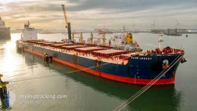
CAPE LEGACY
Bulker
Current Trip
| Time Travelled | --- |
|---|---|
| Remaining Time | 5 days |
| Distance Travelled | 10037.05 nm |
| Remaining Distance | 1612.99 nm |
| AVG Speed | 11.3 Knots |
| MAX Speed | 16.4 Knots |
| AVG Wind | 11.1 knots |
| MAX Wind | 26.4 knots |
| MIN Temp | 16.7°C / 62.06°F |
| MAX Temp | 38.7°C / 101.66°F |
| Draught | 10.5 m |
| Position Received | 6 d ago |
Current Position
| Longitude | 17.90701° |
|---|---|
| Latitude | -34.19809° |
| Status | Under way using engine |
| Speed | 10.9 Knots |
| Course | 314.3° |
| Area | South Atlantic Ocean |
| Station | T-AIS |
| Position Received | 6 d ago |
Info
Information
The current position of CAPE LEGACY is in South Atlantic Ocean with coordinates -34.19809° / 17.90701° as reported on 2024-05-04 14:51 by AIS to our vessel tracker app. The vessel's current speed is 10.9 Knots and is heading at the port of KAMSAR. The estimated time of arrival as calculated by MyShipTracking vessel tracking app is 2024-05-17 02:05 LT
The vessel CAPE LEGACY (IMO: 9589401, MMSI: 538006654) is a Bulker that was built in 2011 ( 13 years old ). It's sailing under the flag of [MH] Marshall Is.
In this page you can find informations about the vessels current position, last detected port calls, and current voyage information. If the vessels is not in coverage by AIS you will find the latest position.
The current position of CAPE LEGACY is detected by our AIS receivers and we are not responsible for the reliability of the data. The last position was recorded while the vessel was in Coverage by the Ais receivers of our vessel tracking app.
The current draught of CAPE LEGACY as reported by AIS is 10.5 meters
Weather
| Temperature | 24.3°C / 75.74°F |
|---|---|
| Wind Speed | 17 knots |
| Direction | 130° SE |
| Pressure | 1011.5 hPa |
| Humidity | 79 % |
| Cloud Coverage | 93 % |
Featured Company
Last Port Calls
Most Visited Ports (Last year)
| Port | Arrivals | |
|---|---|---|
| 2 | ||
| 1 | ||
| 1 | ||
| 1 | ||
| 1 | ||
| 1 |
Last Trips
| Origin | Departure | Destination | Arrival | Distance |
|---|
Events
| Time | Event | Details | Position / Dest | Info |
|---|---|---|---|---|
| 2024-05-04 14:58 | Status Changed | Default Under way using engine |
-34.18407 / 17.89001
KAMSAR
|
Speed: 10.9 kn Course: 314.3° |
| 2024-05-04 14:51 | OUT of Coverage |
-34.19809 / 17.90701
South Atlantic Ocean
KAMSAR
|
Speed: 10.9 kn Course: 314.3° |
|
| 2024-05-04 14:49 | Status Changed | Under way using engine Default |
-34.20306 / 17.91310
KAMSAR
|
Speed: 10 kn Course: 314° |
| 2024-05-04 14:47 | Status Changed | Default Under way using engine |
-34.20667 / 17.91667
KAMSAR
|
Speed: 11 kn Course: 310.4° |
| 2024-05-04 13:55 | Status Changed | Under way using engine Default |
-34.31841 / 18.06176
KAMSAR
|
Speed: 11.7 kn Course: 316° |
| 2024-05-04 13:47 | Status Changed | Default Under way using engine |
-34.33820 / 18.08475
KAMSAR
|
Speed: 11.8 kn Course: 318.1° |
| 2024-05-04 13:36 | Status Changed | Under way using engine Default |
-34.36462 / 18.11609
KAMSAR
|
Speed: 11.1 kn Course: 299° |
| 2024-05-04 13:23 | Status Changed | Default Under way using engine |
-34.38500 / 18.15667
KAMSAR
|
Speed: 11.2 kn Course: 298° |
| 2024-05-04 13:16 | Status Changed | Under way using engine Default |
-34.39596 / 18.17920
KAMSAR
|
Speed: 11.1 kn Course: 300° |
| 2024-05-04 13:13 | Status Changed | Default Under way using engine |
-34.40131 / 18.19072
KAMSAR
|
Speed: 11.2 kn Course: 299.3° |