
CALYPSO 1&2
Other Type
Current Trip
BASEL-ROTTERDAM
| Time Travelled | 2 days |
|---|---|
| Remaining Time | --- |
| Distance Travelled | 174.72 nm |
| Remaining Distance | --- |
| AVG Speed | 7.8 Knots |
| MAX Speed | 10 Knots |
| AVG Wind | 5 knots |
| MAX Wind | 8 knots |
| MIN Temp | 3.2°C / 37.76°F |
| MAX Temp | 10.3°C / 50.54°F |
| Draught | 2 m |
| Position Received | 4 h, 53 m ago |
Current Position
| Longitude | --- |
|---|---|
| Latitude | --- |
| Status | Under way using engine |
| Speed | 9.3 Knots |
| Course | 337.8° |
| Area | North Sea |
| Station | T-AIS |
| Position Received | 4 h, 53 m ago |
Info
Information
The current position of CALYPSO 1&2 is in North Sea with coordinates 49.98179° / 7.86644° as reported on 2025-12-19 11:57 by AIS to our vessel tracker app. The vessel's current speed is 9.3 Knots
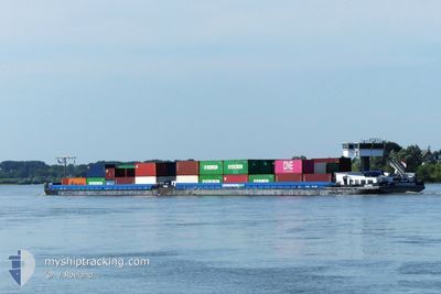
The vessel CALYPSO 1&2 (MMSI: 244740744) is a Other Type It's sailing under the flag of [NL] Netherlands.
In this page you can find informations about the vessels current position, last detected port calls, and current voyage information. If the vessels is not in coverage by AIS you will find the latest position.
The current position of CALYPSO 1&2 is detected by our AIS receivers and we are not responsible for the reliability of the data. The last position was recorded while the vessel was in Coverage by the Ais receivers of our vessel tracking app.
The current draught of CALYPSO 1&2 as reported by AIS is 2 meters
Weather
| Temperature | 9.2°C / 48.56°F |
|---|---|
| Wind Speed | 4 knots |
| Direction | 202° SSW |
| Pressure | 1019.6 hPa |
| Humidity | 94.7 % |
| Cloud Coverage | 100 % |
Featured Company
Last Port Calls
| Port | Arrival | Departure | Time In Port |
|---|---|---|---|
| 2025-12-16 19:10 | 2025-12-17 04:32 | 9 h | |
| 2025-12-16 13:37 | 2025-12-16 14:12 | 34 m | |
| 2025-12-12 08:44 | 2025-12-12 09:27 | 42 m | |
| 2025-12-11 19:18 | 2025-12-12 04:55 | 9 h | |
| 2025-12-11 09:25 | |||
| 2025-12-01 09:34 | 2025-12-05 14:54 | 4 d | |
| 2025-11-29 05:47 | 2025-11-29 07:32 | 1 h | |
| 2025-11-28 17:14 | 2025-11-28 17:45 | 31 m | |
| 2025-11-27 17:25 | 2025-11-28 16:56 | 23 h | |
| 2025-11-27 16:14 | 2025-11-27 16:29 | 14 m |
Most Visited Ports (Last year)
| Port | Arrivals | |
|---|---|---|
| 20 | ||
| 17 | ||
| 16 | ||
| 9 | ||
| 8 | ||
| 8 |
Last Trips
| Origin | Departure | Destination | Arrival | Distance | |
|---|---|---|---|---|---|
| 2025-12-16 15:12 | 2025-12-16 20:10 | 29.05 nm | |||
| 2025-12-12 10:27 | 2025-12-16 14:37 | 14.81 nm | |||
| 2025-12-12 05:55 | 2025-12-12 09:44 | 25.49 nm | |||
| 2025-12-11 10:25 | 2025-12-11 20:18 | 71.74 nm | |||
| 2025-11-29 08:32 | 2025-12-01 10:34 | 109.13 nm | |||
| 2025-11-28 18:45 | 2025-11-29 06:47 | 13.02 nm | |||
| 2025-11-28 17:56 | 2025-11-28 18:14 | 1.10 nm | |||
| 2025-11-27 17:29 | 2025-11-27 18:25 | 4.65 nm | |||
| 2025-11-25 12:09 | 2025-11-27 17:14 | 13.38 nm | |||
| 2025-11-23 07:54 | 2025-11-25 11:40 | 104.36 nm |
Events
| Time | Event | Details | Position / Dest | Info |
|---|---|---|---|---|
| 2025-12-19 11:57 | OUT of Coverage |
49.98179 / 7.86644
North Sea
|
Speed: 9.3 kn Course: 337.8° |
|
| 2025-12-19 06:16 | IN Coverage |
49.65884 / 8.37080
North Sea
|
Speed: 8.4 kn Course: 347.1° |
|
| 2025-12-18 17:51 | OUT of Coverage |
49.51912 / 8.43396
North Sea
|
Speed: 0.6 kn Course: 12.7° |
|
| 2025-12-18 17:51 | Status Changed | Under way using engine Default |
49.51912 / 8.43396
BASEL-ROTTERDAM
|
Speed: 8.6 kn Course: 52° |
| 2025-12-18 17:20 | Status Changed | Default Under way using engine |
49.46500 / 8.46057
BASEL-ROTTERDAM
|
Speed: 8.9 kn Course: 346.1° |
| 2025-12-18 16:06 | Status Changed | Under way using engine Default |
49.33617 / 8.46060
BASEL-ROTTERDAM
|
Speed: 9 kn Course: 16° |
| 2025-12-18 15:53 | IN Coverage |
49.34242 / 8.47448
North Sea
|
Speed: 9 kn Course: 57.7° |
|
| 2025-12-17 20:29 | STOP Moving | 4.9 nm, South West of RHEINMUNSTE |
48.69667 / 7.92333
BASEL-ROTTERDAM
|
Speed: Course: -1° |
| 2025-12-17 08:51 | Status Changed | Default Under way using engine |
49.34557 / 8.48004
BASEL-ROTTERDAM
|
Speed: 6.2 kn Course: 218.9° |
| 2025-12-17 08:48 | OUT of Coverage |
49.34909 / 8.48480
North Sea
|
Speed: 6.2 kn Course: 218.9° |