
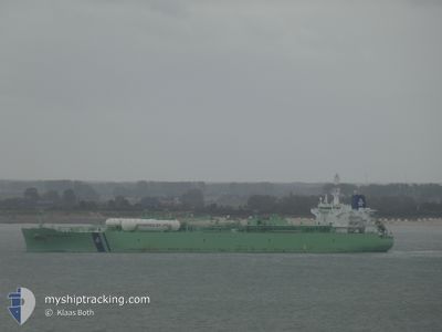
BW MALACCA
Tanker
Current Trip
IN VTZ
| Time Travelled | 9 days |
|---|---|
| Remaining Time | --- |
| Distance Travelled | 423.25 nm |
| Remaining Distance | --- |
| AVG Speed | 10.7 Knots |
| MAX Speed | 16.3 Knots |
| AVG Wind | 7.8 knots |
| MAX Wind | 15 knots |
| MIN Temp | 24.8°C / 76.64°F |
| MAX Temp | 27.1°C / 80.78°F |
| Draught | 11 m |
| Position Received | 22 d ago |
Current Position
| Longitude | --- |
|---|---|
| Latitude | --- |
| Status | Under way using engine |
| Speed | 15.1 Knots |
| Course | 93.2° |
| Area | Laccadive Sea |
| Station | T-AIS |
| Position Received | 22 d ago |
Info
Information
The current position of BW MALACCA is in Laccadive Sea with coordinates 5.56735° / 80.15247° as reported on 2025-02-10 02:01 by AIS to our vessel tracker app. The vessel's current speed is 15.1 Knots
The vessel BW MALACCA (IMO: 9735048, MMSI: 232004100) is a Tanker It's sailing under the flag of [GB] United Kingdom.
In this page you can find informations about the vessels current position, last detected port calls, and current voyage information. If the vessels is not in coverage by AIS you will find the latest position.
The current position of BW MALACCA is detected by our AIS receivers and we are not responsible for the reliability of the data. The last position was recorded while the vessel was in Coverage by the Ais receivers of our vessel tracking app.
The current draught of BW MALACCA as reported by AIS is 11 meters
Weather
| Temperature | 25.8°C / 78.44°F |
|---|---|
| Wind Speed | 12 knots |
| Direction | 247° WSW |
| Pressure | 1008.7 hPa |
| Humidity | 76.7 % |
| Cloud Coverage | 19 % |
Featured Company
Last Port Calls
| Port | Arrival | Departure | Time In Port |
|---|---|---|---|
| 2025-02-21 11:41 | 2025-02-23 21:42 | 2 d | |
| 2025-02-02 01:09 | 2025-02-03 10:39 | 1 d | |
| 2025-01-14 08:17 | 2025-01-15 10:02 | 1 d | |
| 2025-01-08 16:56 | 2025-01-11 01:00 | 2 d |
Most Visited Ports (Last year)
| Port | Arrivals | |
|---|---|---|
| 2 | ||
| 1 | ||
| 1 | ||
| 1 | ||
| 1 | ||
| 1 |
Last Trips
| Origin | Departure | Destination | Arrival | Distance | |
|---|---|---|---|---|---|
| 2025-02-03 10:39 | 2025-02-21 11:41 | 3291.38 nm | |||
| 2025-01-15 10:02 | 2025-02-02 01:09 | 4699.93 nm | |||
| 2025-01-11 01:00 | 2025-01-14 08:17 | 692.50 nm | |||
| 2024-12-27 23:17 | 2025-01-08 16:56 | 4139.15 nm |
Events
| Time | Event | Details | Position / Dest | Info |
|---|---|---|---|---|
| 2025-03-01 03:24 | STOP Moving |
21.04960 / 87.89287
IN VTZ
|
Speed: 0.2 kn Course: 192° |
|
| 2025-02-28 23:38 | START Moving |
21.02316 / 87.89624
IN VTZ
|
Speed: 4.2 kn Course: 355° |
|
| 2025-02-27 02:43 | STOP Moving |
21.00033 / 87.90678
IN VTZ
|
Speed: 0.2 kn Course: 157° |
|
| 2025-02-26 21:04 | START Moving |
20.98423 / 87.92937
IN VTZ
|
Speed: 4.1 kn Course: 307° |
|
| 2025-02-24 16:27 | STOP Moving |
20.98125 / 87.94065
IN VTZ
|
Speed: 0.2 kn Course: 310° |
|
| 2025-02-23 16:12 | PORT DEPARTURE |
|
17.68684 / 83.31445
IN VTZ
|
Speed: 5.3 kn Course: 83° |
| 2025-02-23 16:05 | START Moving |
17.68657 / 83.30469
[IN] VISAKHAPATNAM
|
Speed: 4.7 kn Course: 95° |