
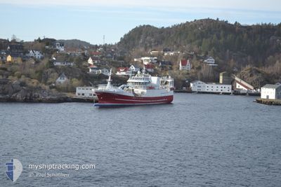
BRENNHOLM
Trawler
Current Trip
CH 16
| Time Travelled | 6 days |
|---|---|
| Remaining Time | --- |
| Distance Travelled | 478.88 nm |
| Remaining Distance | --- |
| AVG Speed | 13.2 Knots |
| MAX Speed | 18.5 Knots |
| AVG Wind | 19.5 knots |
| MAX Wind | 26.3 knots |
| MIN Temp | 5.2°C / 41.36°F |
| MAX Temp | 8.4°C / 47.12°F |
| Draught | 7.5 m |
| Position Received | 2 m ago |
Current Position
| Longitude | --- |
|---|---|
| Latitude | --- |
| Status | Under way using engine |
| Speed | |
| Course | 198° |
| Area | North Sea |
| Station | T-AIS |
| Position Received | 2 m ago |
Info
Information
The current position of BRENNHOLM is in North Sea with coordinates 58.45016° / 5.98195° as reported on 2025-03-05 04:00 by AIS to our vessel tracker app. The vessel's current speed is 0 Knots
The vessel BRENNHOLM (IMO: 9268655, MMSI: 259454000) is a Trawler that was built in 2007 ( 18 years old ). It's sailing under the flag of [NO] Norway.
In this page you can find informations about the vessels current position, last detected port calls, and current voyage information. If the vessels is not in coverage by AIS you will find the latest position.
The current position of BRENNHOLM is detected by our AIS receivers and we are not responsible for the reliability of the data. The last position was recorded while the vessel was in Coverage by the Ais receivers of our vessel tracking app.
The current draught of BRENNHOLM as reported by AIS is 7.5 meters
Weather
| Temperature | 5.2°C / 41.36°F |
|---|---|
| Wind Speed | 13 knots |
| Direction | 254° WSW |
| Pressure | 1005.1 hPa |
| Humidity | 98.2 % |
| Cloud Coverage | 100 % |
Featured Company
Last Port Calls
| Port | Arrival | Departure | Time In Port |
|---|---|---|---|
| 2025-02-26 07:48 | 2025-02-26 08:56 | 1 h | |
| 2025-02-24 22:04 | 2025-02-25 00:00 | 1 h | |
| 2025-02-24 02:29 | 2025-02-24 21:31 | 19 h | |
| 2025-02-13 10:34 | 2025-02-14 15:41 | 1 d | |
| 2025-02-12 13:47 | 2025-02-13 10:30 | 20 h | |
| 2025-02-04 09:33 | 2025-02-04 10:28 | 55 m | |
| 2025-02-01 16:08 | 2025-02-01 19:04 | 2 h | |
| 2025-01-13 19:15 | 2025-01-15 15:40 | 1 d | |
| 2025-01-07 06:15 | 2025-01-07 12:35 | 6 h |
Last Trips
| Origin | Departure | Destination | Arrival | Distance | |
|---|---|---|---|---|---|
| 2025-02-25 01:00 | 2025-02-26 07:48 | 375.03 nm | |||
| 2025-02-24 22:31 | 2025-02-24 23:04 | 4.64 nm | |||
| 2025-02-14 16:41 | 2025-02-24 03:29 | 895.85 nm | |||
| 2025-02-13 11:30 | 2025-02-13 11:34 | 0.21 nm | |||
| 2025-02-04 10:28 | 2025-02-12 14:47 | 503.23 nm | |||
| 2025-02-01 20:04 | 2025-02-04 09:33 | 469.85 nm | |||
| 2025-01-15 16:40 | 2025-02-01 17:08 | 427.11 nm | |||
| 2025-01-07 13:35 | 2025-01-13 20:15 | 1787.84 nm | |||
| 2024-12-17 08:15 | 2025-01-07 07:15 | 242.88 nm |
Events
| Time | Event | Details | Position / Dest | Info |
|---|---|---|---|---|
| 2025-03-04 20:53 | STOP Moving | 0.43 nm, West of EGERSUND |
58.45017 / 5.98201
CH 16
|
Speed: 0.1 kn Course: 200° |
| 2025-03-04 15:12 | Detected in Sea | Norwegian part of the North Sea |
58.44230 / 4.01808
North Sea
CH 16
|
Speed: 13.2 kn Course: 95.4° |
| 2025-03-04 15:12 | IN Coverage |
58.44230 / 4.01808
North Sea
CH 16
|
Speed: 13.2 kn Course: 95.4° |
|
| 2025-03-03 22:14 | OUT of Coverage |
58.69560 / -2.58601
North Sea
CH 16
|
Speed: 13.7 kn Course: 96.3° |
|
| 2025-03-03 20:34 | Change Sea Area | United Kingdom part of the North Sea United Kingdom part of the North Atlantic Ocean |
58.70631 / -3.40065
North Sea
CH 16
|
Speed: 10.8 kn Course: 87.8° |
| 2025-03-03 17:24 | Detected in Sea | United Kingdom part of the North Atlantic Ocean |
58.66938 / -4.45179
North Atlantic Ocean
CH 16
|
Speed: 9.6 kn Course: 85.9° |
| 2025-03-03 17:24 | IN Coverage |
58.66938 / -4.45179
North Atlantic Ocean
CH 16
|
Speed: 9.6 kn Course: 85.9° |
|
| 2025-02-26 12:15 | OUT of Coverage |
57.51913 / -6.86684
Inner Seas off the West Coast of Scotland
CH 16
|
Speed: 13.5 kn Course: 201.4° |
|
| 2025-02-26 12:04 | IN Coverage |
57.55376 / -6.83969
Inner Seas off the West Coast of Scotland
CH 16
|
Speed: 13.7 kn Course: 204.1° |
|
| 2025-02-26 09:17 | OUT of Coverage |
58.11120 / -6.32928
Inner Seas off the West Coast of Scotland
CH 16
|
Speed: 13 kn Course: 175.5° |