
BONA
Bulk Carrier
Current Trip
BR STM
| Time Travelled | 1 day |
|---|---|
| Remaining Time | --- |
| Distance Travelled | 324.29 nm |
| Remaining Distance | --- |
| AVG Speed | 13.9 Knots |
| MAX Speed | 16.7 Knots |
| AVG Wind | 5.1 knots |
| MAX Wind | 10.7 knots |
| MIN Temp | 22.4°C / 72.32°F |
| MAX Temp | 36.7°C / 98.06°F |
| Draught | 10.3 m |
| Position Received | 20 d ago |
Current Position
| Longitude | --- |
|---|---|
| Latitude | --- |
| Status | Under way using engine |
| Speed | 11.8 Knots |
| Course | 232.7° |
| Area | North Atlantic Ocean |
| Station | T-AIS |
| Position Received | 20 d ago |
Info
Information
The current position of BONA is in North Atlantic Ocean with coordinates 27.39341° / -15.73090° as reported on 2025-12-16 10:15 by AIS to our vessel tracker app. The vessel's current speed is 11.8 Knots
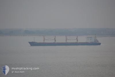
The vessel BONA (IMO: 9594432, MMSI: 636018042) is a Bulk Carrier that was built in 2012 ( 14 years old ). It's sailing under the flag of [LR] Liberia.
In this page you can find informations about the vessels current position, last detected port calls, and current voyage information. If the vessels is not in coverage by AIS you will find the latest position.
The current position of BONA is detected by our AIS receivers and we are not responsible for the reliability of the data. The last position was recorded while the vessel was in Coverage by the Ais receivers of our vessel tracking app.
The current draught of BONA as reported by AIS is 10.3 meters
Weather
| Temperature | 26.8°C / 80.24°F |
|---|---|
| Wind Speed | 9 knots |
| Direction | 66° ENE |
| Pressure | 1009.5 hPa |
| Humidity | 81.7 % |
| Cloud Coverage | 100 % |
Featured Company
Most Visited Ports (Last year)
| Port | Arrivals | |
|---|---|---|
| 3 | ||
| 3 | ||
| 2 | ||
| 1 | ||
| 1 | ||
| 1 |
Events
| Time | Event | Details | Position / Dest | Info |
|---|---|---|---|---|
| 2026-01-05 10:02 | STOP Moving | 5.02 nm, North East of MACAPA |
.06833 / -50.97833
BR STM
|
Speed: Course: -1° |
| 2026-01-04 11:36 | START Moving | 4.39 nm, West of SANTAREM |
-2.39688 / -54.78242
BR STM
|
Speed: 9.7 kn Course: 123° |
| 2026-01-03 23:56 | STOP Moving | 4.72 nm, West of SANTAREM |
-2.39167 / -54.78667
BR STM
|
Speed: Course: -1° |
| 2026-01-03 23:29 | START Moving | 2.58 nm, West of SANTAREM |
-2.40500 / -54.75333
BR STM
|
Speed: 7 kn Course: -1° |
| 2026-01-03 23:29 | PORT DEPARTURE |
|
-2.40500 / -54.75333
BR STM
|
Speed: 2 kn Course: -1° |
| 2025-12-27 23:08 | STOP Moving |
-2.41333 / -54.73333
[BR] SANTAREM
|
Speed: Course: -1° |
|
| 2025-12-27 23:04 | PORT ARRIVAL |
|
-2.41333 / -54.73333
[BR] SANTAREM
|
Speed: 3 kn Course: -1° |