
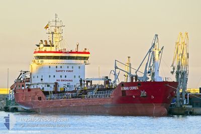
BOMAR CERES
Oil/Chemical Tanker
Current Trip
| Time Travelled | 22 h, 23 mins |
|---|---|
| Remaining Time | 1 day |
| Distance Travelled | 191.78 nm |
| Remaining Distance | 226.61 nm |
| AVG Speed | 8.9 Knots |
| MAX Speed | 10.7 Knots |
| AVG Wind | 17.8 knots |
| MAX Wind | 28 knots |
| MIN Temp | 11.9°C / 53.42°F |
| MAX Temp | 16.4°C / 61.52°F |
| Draught | 6.4 m |
| Position Received | 8 h, 34 m ago |
Current Position
| Longitude | --- |
|---|---|
| Latitude | --- |
| Status | Under way using engine |
| Speed | 8.5 Knots |
| Course | 323° |
| Area | North Atlantic Ocean |
| Station | T-AIS |
| Position Received | 8 h, 34 m ago |
Info
Information
The current position of BOMAR CERES is in North Atlantic Ocean with coordinates 36.74172° / -9.28570° as reported on 2025-12-20 23:51 by AIS to our vessel tracker app. The vessel's current speed is 8.5 Knots and is heading at the port of LEIXOES. The estimated time of arrival as calculated by MyShipTracking vessel tracking app is 2025-12-22 13:44 LT
The vessel BOMAR CERES (IMO: 9367231, MMSI: 256815000) is a Oil/Chemical Tanker that was built in 2007 ( 18 years old ). It's sailing under the flag of [MT] Malta.
In this page you can find informations about the vessels current position, last detected port calls, and current voyage information. If the vessels is not in coverage by AIS you will find the latest position.
The current position of BOMAR CERES is detected by our AIS receivers and we are not responsible for the reliability of the data. The last position was recorded while the vessel was in Coverage by the Ais receivers of our vessel tracking app.
The current draught of BOMAR CERES as reported by AIS is 6.4 meters
Weather
| Temperature | 13.7°C / 56.66°F |
|---|---|
| Wind Speed | 20 knots |
| Direction | 317° NW |
| Pressure | 1011.5 hPa |
| Humidity | 61.4 % |
| Cloud Coverage | 100 % |
Featured Company
Last Port Calls
| Port | Arrival | Departure | Time In Port |
|---|---|---|---|
| 2025-12-18 12:43 | 2025-12-20 11:03 | 1 d | |
| 2025-12-13 09:41 | 2025-12-14 11:19 | 1 d | |
| 2025-12-08 12:54 | 2025-12-09 02:12 | 13 h | |
| 2025-12-07 10:47 | 2025-12-08 02:15 | 15 h | |
| 2025-12-01 04:16 | 2025-12-01 20:09 | 15 h | |
| 2025-11-29 20:43 | 2025-12-01 03:40 | 1 d | |
| 2025-11-27 12:45 | 2025-11-28 12:37 | 23 h | |
| 2025-11-25 07:57 | 2025-11-26 08:35 | 1 d | |
| 2025-11-21 18:08 | 2025-11-23 21:47 | 2 d | |
| 2025-11-11 09:14 | 2025-11-11 09:53 | 39 m |
Last Trips
| Origin | Departure | Destination | Arrival | Distance | |
|---|---|---|---|---|---|
| 2025-12-14 11:19 | 2025-12-18 12:43 | 283.83 nm | |||
| 2025-12-09 02:12 | 2025-12-13 09:41 | 796.45 nm | |||
| 2025-12-08 02:15 | 2025-12-08 12:54 | 70.18 nm | |||
| 2025-12-01 20:09 | 2025-12-07 10:47 | 1418.10 nm | |||
| 2025-12-01 03:40 | 2025-12-01 04:16 | 3.07 nm | |||
| 2025-11-28 12:37 | 2025-11-29 20:43 | 312.86 nm | |||
| 2025-11-26 08:35 | 2025-11-27 12:45 | 206.98 nm | |||
| 2025-11-23 21:47 | 2025-11-25 07:57 | 220.70 nm | |||
| 2025-11-11 09:53 | 2025-11-21 18:08 | 2133.76 nm | |||
| 2025-11-11 07:16 | 2025-11-11 09:14 | 10.22 nm |
Events
| Time | Event | Details | Position / Dest | Info |
|---|---|---|---|---|
| 2025-12-21 00:00 | Status Changed | Default Under way using engine |
36.75800 / -9.29942
PTLEI
|
Speed: 8.5 kn Course: 323° |
| 2025-12-20 23:51 | OUT of Coverage |
36.74172 / -9.28570
North Atlantic Ocean
PTLEI
|
Speed: 8.5 kn Course: 323° |
|
| 2025-12-20 23:49 | Status Changed | Under way using engine Default |
36.73713 / -9.28207
PTLEI
|
Speed: 8.4 kn Course: 327° |
| 2025-12-20 23:36 | IN Coverage |
36.73713 / -9.28207
North Atlantic Ocean
PTLEI
|
Speed: 8.4 kn Course: 327° |
|
| 2025-12-20 21:40 | Status Changed | Default Under way using engine |
36.62447 / -8.95270
PTLEI
|
Speed: 8.4 kn Course: 273° |
| 2025-12-20 21:34 | Status Changed | Under way using engine Default |
36.62078 / -8.93517
PTLEI
|
Speed: 8.7 kn Course: 263° |
| 2025-12-20 21:34 | OUT of Coverage |
36.62078 / -8.93517
North Atlantic Ocean
PTLEI
|
Speed: 8.4 kn Course: 273° |
|
| 2025-12-20 21:32 | Status Changed | Default Under way using engine |
36.62097 / -8.93027
PTLEI
|
Speed: 8.4 kn Course: 265° |
| 2025-12-20 15:33 | Change Sea Area | Portuguese part of the North Atlantic Ocean Spanish part of the North Atlantic Ocean |
36.70710 / -7.80403
North Atlantic Ocean
PTLEI
|
Speed: 9.8 kn Course: 264° |
| 2025-12-20 15:33 | Status Changed | Under way using engine Default |
36.70710 / -7.80403
PTLEI
|
Speed: 9.8 kn Course: 264° |