
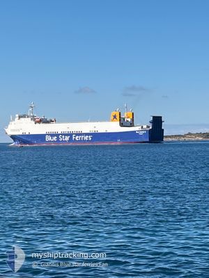
BLUE CARRIER 2
Ro-Ro Cargo
Current Trip
| Time Travelled | 4 h, 30 mins |
|---|---|
| Remaining Time | 6 h, 13 mins |
| Distance Travelled | 69.44 nm |
| Remaining Distance | 105.75 nm |
| AVG Speed | 15.9 Knots |
| MAX Speed | 16.6 Knots |
| AVG Wind | 9.7 knots |
| MAX Wind | 13.5 knots |
| MIN Temp | 13.7°C / 56.66°F |
| MAX Temp | 17.4°C / 63.32°F |
| Draught | 5.5 m |
| Position Received | 1 m ago |
Current Position
| Longitude | --- |
|---|---|
| Latitude | --- |
| Status | Under way using engine |
| Speed | 16.3 Knots |
| Course | 256.6° |
| Area | Aegean Sea |
| Station | T-AIS |
| Position Received | 1 m ago |
Info
Information
The current position of BLUE CARRIER 2 is in Aegean Sea with coordinates 37.54857° / 25.44293° as reported on 2025-12-06 10:43 by AIS to our vessel tracker app. The vessel's current speed is 16.3 Knots and is heading at the port of PIRAEUS. The estimated time of arrival as calculated by MyShipTracking vessel tracking app is 2025-12-06 18:57 LT
The vessel BLUE CARRIER 2 (IMO: 9125384, MMSI: 241895000) is a Ro-Ro Cargo that was built in 1997 ( 28 years old ). It's sailing under the flag of [GR] Greece.
In this page you can find informations about the vessels current position, last detected port calls, and current voyage information. If the vessels is not in coverage by AIS you will find the latest position.
The current position of BLUE CARRIER 2 is detected by our AIS receivers and we are not responsible for the reliability of the data. The last position was recorded while the vessel was in Coverage by the Ais receivers of our vessel tracking app.
The current draught of BLUE CARRIER 2 as reported by AIS is 5.5 meters
Weather
| Temperature | 16.2°C / 61.16°F |
|---|---|
| Wind Speed | 9 knots |
| Direction | 146° SE |
| Pressure | 1005.5 hPa |
| Humidity | 73.5 % |
| Cloud Coverage | 97 % |
Featured Company
Last Port Calls
| Port | Arrival | Departure | Time In Port |
|---|---|---|---|
| 2025-12-06 07:27 | 2025-12-06 08:14 | 47 m | |
| 2025-12-06 02:07 | 2025-12-06 02:45 | 38 m | |
| 2025-12-05 19:56 | 2025-12-05 22:08 | 2 h | |
| 2025-12-05 14:45 | 2025-12-05 15:35 | 49 m | |
| 2025-12-05 07:46 | 2025-12-05 08:42 | 56 m | |
| 2025-12-04 11:27 | 2025-12-04 18:46 | 7 h | |
| 2025-12-03 22:04 | 2025-12-03 22:50 | 46 m | |
| 2025-12-03 12:37 | 2025-12-03 18:10 | 5 h | |
| 2025-12-03 07:43 | 2025-12-03 08:47 | 1 h | |
| 2025-12-02 09:35 | 2025-12-02 18:44 | 9 h |
Last Trips
| Origin | Departure | Destination | Arrival | Distance | |
|---|---|---|---|---|---|
| 2025-12-06 02:45 | 2025-12-06 07:27 | 67.07 nm | |||
| 2025-12-05 22:08 | 2025-12-06 02:07 | 60.86 nm | |||
| 2025-12-05 15:35 | 2025-12-05 19:56 | 59.05 nm | |||
| 2025-12-05 08:42 | 2025-12-05 14:45 | 83.46 nm | |||
| 2025-12-04 18:46 | 2025-12-05 07:46 | 179.41 nm | |||
| 2025-12-03 22:50 | 2025-12-04 11:27 | 192.86 nm | |||
| 2025-12-03 18:10 | 2025-12-03 22:04 | 60.91 nm | |||
| 2025-12-03 08:47 | 2025-12-03 12:37 | 57.94 nm | |||
| 2025-12-02 18:44 | 2025-12-03 07:43 | 198.37 nm | |||
| 2025-12-01 21:52 | 2025-12-02 09:35 | 181.31 nm |
Events
| Time | Event | Details | Position / Dest | Info |
|---|---|---|---|---|
| 2025-12-06 08:44 | Draught Changed | 5.5 5 |
37.68039 / 26.10040
PIRAEUS
|
Speed: 16.2 kn Course: 253.4° |
| 2025-12-06 08:44 | Destination Changed | PIRAEUS SAMOS |
37.68039 / 26.10040
PIRAEUS
|
Speed: 16.2 kn Course: 253.4° |
| 2025-12-06 08:44 | ETA Changed | 2025/12/06 17:30 |
37.68039 / 26.10040
PIRAEUS
|
Speed: 16.2 kn Course: 253.4° |
| 2025-12-06 08:44 | Status Changed | Under way using engine Default |
37.68091 / 26.10255
SAMOS
|
Speed: 16 kn Course: 253° |
| 2025-12-06 08:34 | IN Coverage |
37.68014 / 26.09930
Aegean Sea
PIRAEUS
|
Speed: 16.2 kn Course: 253.3° |
|
| 2025-12-06 07:46 | Status Changed | Default Under way using engine |
37.75174 / 26.40680
SAMOS
|
Speed: 15.7 kn Course: 254.9° |
| 2025-12-06 07:41 | OUT of Coverage |
37.75777 / 26.43435
Aegean Sea
|
Speed: 15.7 kn Course: 254.9° |
|
| 2025-12-06 07:39 | IN Coverage |
37.75973 / 26.44337
Aegean Sea
|
Speed: 15.5 kn Course: 255° |
|
| 2025-12-06 07:38 | Status Changed | Under way using engine Default |
37.76161 / 26.45286
SAMOS
|
Speed: 15 kn Course: 257° |
| 2025-12-06 06:14 | PORT DEPARTURE |
|
37.79431 / 26.90151
SAMOS
|
Speed: 9.1 kn Course: 316° |