
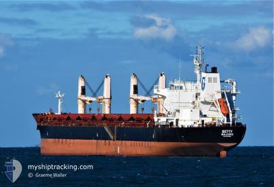
BETTY
Bulk Carrier
Current Trip
CO PBO
| Time Travelled | 9 days |
|---|---|
| Remaining Time | --- |
| Distance Travelled | 2535.39 nm |
| Remaining Distance | --- |
| AVG Speed | 10.7 Knots |
| MAX Speed | 12.4 Knots |
| AVG Wind | 15.1 knots |
| MAX Wind | 29.7 knots |
| MIN Temp | 17.8°C / 64.04°F |
| MAX Temp | 28.6°C / 83.48°F |
| Draught | 6.4 m |
| Position Received | 7 d ago |
Current Position
| Longitude | --- |
|---|---|
| Latitude | --- |
| Status | Under way using engine |
| Speed | 10.6 Knots |
| Course | 39.8° |
| Area | Caribbean Sea |
| Station | T-AIS |
| Position Received | 7 d ago |
Info
Information
The current position of BETTY is in Caribbean Sea with coordinates 16.78479° / -61.63559° as reported on 2024-12-06 17:04 by AIS to our vessel tracker app. The vessel's current speed is 10.6 Knots
The vessel BETTY (IMO: 9522881, MMSI: 538009422) is a Bulk Carrier that was built in 2011 ( 13 years old ). It's sailing under the flag of [MH] Marshall Is.
In this page you can find informations about the vessels current position, last detected port calls, and current voyage information. If the vessels is not in coverage by AIS you will find the latest position.
The current position of BETTY is detected by our AIS receivers and we are not responsible for the reliability of the data. The last position was recorded while the vessel was in Coverage by the Ais receivers of our vessel tracking app.
The current draught of BETTY as reported by AIS is 6.4 meters
Weather
| Temperature | 17.8°C / 64.04°F |
|---|---|
| Wind Speed | 30 knots |
| Direction | 35° NE |
| Pressure | 1021.9 hPa |
| Humidity | 66 % |
| Cloud Coverage | 91 % |
Featured Company
Last Port Calls
| Port | Arrival | Departure | Time In Port |
|---|---|---|---|
| 2024-12-03 00:52 | 2024-12-03 16:22 | 15 h | |
| 2024-11-26 19:18 | 2024-11-30 07:08 | 3 d | |
| 2024-11-20 23:51 | 2024-11-24 11:16 | 3 d | |
| 2024-11-01 01:43 | 2024-11-07 15:04 | 6 d | |
| 2024-10-17 08:39 | 2024-10-25 12:07 | 8 d |
Most Visited Ports (Last year)
| Port | Arrivals | |
|---|---|---|
| 1 | ||
| 1 | ||
| 1 | ||
| 1 | ||
| 1 | ||
| 1 |
Last Trips
| Origin | Departure | Destination | Arrival | Distance | |
|---|---|---|---|---|---|
| 2024-11-30 07:08 | 2024-12-03 00:52 | 345.28 nm | |||
| 2024-11-24 11:16 | 2024-11-26 19:18 | 542.21 nm | |||
| 2024-11-07 15:04 | 2024-11-20 23:51 | 3508.41 nm | |||
| 2024-10-25 12:07 | 2024-11-01 01:43 | 49.83 nm | |||
| 2024-09-21 20:17 | 2024-10-17 08:39 | 6470.03 nm |
Events
| Time | Event | Details | Position / Dest | Info |
|---|---|---|---|---|
| 2024-12-06 17:06 | Status Changed | Default Under way using engine |
16.79091 / -61.62966
CO PBO
|
Speed: 10.6 kn Course: 39.8° |
| 2024-12-06 17:04 | Change Sea Area | Antigua and Barbuda part of the Caribbean Sea Guadeloupe and Martinique part of the Caribbean Sea |
16.78479 / -61.63559
Caribbean Sea
|
Speed: 10.6 kn Course: 39.8° |
| 2024-12-06 17:04 | Status Changed | Under way using engine Default |
16.78479 / -61.63559
CO PBO
|
Speed: 10.8 kn Course: 40° |
| 2024-12-06 17:04 | OUT of Coverage |
16.78479 / -61.63559
Caribbean Sea
|
Speed: 10.6 kn Course: 39.8° |
|
| 2024-12-06 16:50 | IN Coverage |
16.78479 / -61.63559
Caribbean Sea
|
Speed: 10.6 kn Course: 39.8° |
|
| 2024-12-06 15:49 | Status Changed | Default Under way using engine |
16.65820 / -61.81682
CO PBO
|
Speed: 10.7 kn Course: 66.4° |
| 2024-12-06 15:45 | OUT of Coverage |
16.65409 / -61.82691
Caribbean Sea
|
Speed: 10.7 kn Course: 66.4° |
|
| 2024-12-06 15:40 | Change Sea Area | Guadeloupe and Martinique part of the Caribbean Sea Montserrat part of the Caribbean Sea |
16.64784 / -61.84214
Caribbean Sea
|
Speed: 10.8 kn Course: 66.9° |
| 2024-12-06 15:40 | Status Changed | Under way using engine Default |
16.64784 / -61.84214
CO PBO
|
Speed: 10.8 kn Course: 69° |
| 2024-12-06 15:14 | Status Changed | Default Under way using engine |
16.61783 / -61.91739
CO PBO
|
Speed: 10.8 kn Course: 66.4° |