
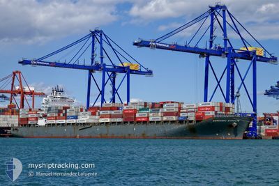
BERNHARD SCHULTE
Container Ship
Current Trip
| Time Travelled | 5 days |
|---|---|
| Remaining Time | 7 days |
| Distance Travelled | 1261.23 nm |
| Remaining Distance | 1955.53 nm |
| AVG Speed | 15.9 Knots |
| MAX Speed | 19.2 Knots |
| AVG Wind | 10.6 knots |
| MAX Wind | 29.6 knots |
| MIN Temp | 8.9°C / 48.02°F |
| MAX Temp | 20.7°C / 69.26°F |
| Draught | 11.9 m |
| Position Received | 12 h, 55 m ago |
Current Position
| Longitude | -27.53809° |
|---|---|
| Latitude | 40.51165° |
| Status | Under way using engine |
| Speed | 13.4 Knots |
| Course | 282.3° |
| Area | North Atlantic Ocean |
| Station | T-AIS |
| Position Received | 12 h, 55 m ago |
Info
Information
The current position of BERNHARD SCHULTE is in North Atlantic Ocean with coordinates 40.51165° / -27.53809° as reported on 2024-05-05 23:23 by AIS to our vessel tracker app. The vessel's current speed is 13.4 Knots and is heading at the port of NEW YORK. The estimated time of arrival as calculated by MyShipTracking vessel tracking app is 2024-05-13 16:38 LT
The vessel BERNHARD SCHULTE (IMO: 9484546, MMSI: 477639300) is a Container Ship that was built in 2010 ( 14 years old ). It's sailing under the flag of [HK] Hong Kong.
In this page you can find informations about the vessels current position, last detected port calls, and current voyage information. If the vessels is not in coverage by AIS you will find the latest position.
The current position of BERNHARD SCHULTE is detected by our AIS receivers and we are not responsible for the reliability of the data. The last position was recorded while the vessel was in Coverage by the Ais receivers of our vessel tracking app.
The current draught of BERNHARD SCHULTE as reported by AIS is 11.9 meters
Weather
| Temperature | 17.4°C / 63.32°F |
|---|---|
| Wind Speed | 19 knots |
| Direction | 198° SSW |
| Pressure | 1001.1 hPa |
| Humidity | 87.2 % |
| Cloud Coverage | 100 % |
Featured Company
Last Port Calls
| Port | Arrival | Departure | Time In Port |
|---|---|---|---|
| 2024-04-30 13:18 | 2024-05-01 05:22 | 16 h | |
| 2024-04-26 15:31 | 2024-04-27 16:30 | 1 d | |
| 2024-04-23 04:21 | 2024-04-24 11:50 | 1 d | |
| 2024-04-21 07:31 | 2024-04-21 19:09 | 11 h | |
| 2024-04-19 08:18 | 2024-04-20 10:40 | 1 d | |
| 2024-04-17 01:28 | 2024-04-17 12:04 | 10 h | |
| 2024-04-11 19:30 | 2024-04-12 06:56 | 11 h | |
| 2024-03-27 18:02 | 2024-03-28 12:56 | 18 h | |
| 2024-03-25 20:47 | 2024-03-26 11:44 | 14 h | |
| 2024-03-23 13:16 | 2024-03-24 23:55 | 1 d |
Last Trips
| Origin | Departure | Destination | Arrival | Distance | |
|---|---|---|---|---|---|
| 2024-04-27 18:30 | 2024-04-30 15:18 | 884.04 nm | |||
| 2024-04-24 14:50 | 2024-04-26 17:31 | 972.07 nm | |||
| 2024-04-21 22:09 | 2024-04-23 07:21 | 353.97 nm | |||
| 2024-04-20 13:40 | 2024-04-21 10:31 | 242.74 nm | |||
| 2024-04-17 15:04 | 2024-04-19 11:18 | 663.78 nm | |||
| 2024-04-12 08:56 | 2024-04-17 04:28 | 2046.44 nm | |||
| 2024-03-28 08:56 | 2024-04-11 21:30 | 3911.07 nm | |||
| 2024-03-26 07:44 | 2024-03-27 14:02 | 496.54 nm | |||
| 2024-03-24 19:55 | 2024-03-25 16:47 | 288.15 nm | |||
| 2024-03-15 07:43 | 2024-03-23 09:16 | 3348.00 nm |
Events
| Time | Event | Details | Position / Dest | Info |
|---|---|---|---|---|
| 2024-05-05 23:28 | Status Changed | Default Under way using engine |
40.51500 / -27.56167
USNYC
|
Speed: 13.4 kn Course: 282.3° |
| 2024-05-05 23:23 | OUT of Coverage |
40.51165 / -27.53809
North Atlantic Ocean
USNYC
|
Speed: 13.4 kn Course: 282.3° |
|
| 2024-05-05 23:17 | Status Changed | Under way using engine Default |
40.50737 / -27.51255
USNYC
|
Speed: 13.4 kn Course: 282° |
| 2024-05-05 23:09 | Status Changed | Default Under way using engine |
40.50049 / -27.47078
USNYC
|
Speed: 13.5 kn Course: 281.2° |
| 2024-05-05 22:54 | Status Changed | Under way using engine Default |
40.48853 / -27.39845
USNYC
|
Speed: 13 kn Course: 282° |
| 2024-05-05 22:43 | IN Coverage |
40.48853 / -27.39845
North Atlantic Ocean
USNYC
|
Speed: 13.6 kn Course: 282.5° |
|
| 2024-05-05 20:25 | Status Changed | Default Under way using engine |
40.37500 / -26.69667
USNYC
|
Speed: 13.3 kn Course: 282.1° |
| 2024-05-05 20:22 | OUT of Coverage |
40.37437 / -26.68488
North Atlantic Ocean
USNYC
|
Speed: 13.3 kn Course: 282.1° |
|
| 2024-05-05 19:59 | Change Sea Area | Portuguese (Azores) part of the North Atlantic Ocean Portuguese part of the North Atlantic Ocean |
40.35765 / -26.57636
North Atlantic Ocean
USNYC
|
Speed: 13.2 kn Course: 280.2° |
| 2024-05-05 19:59 | Status Changed | Under way using engine Default |
40.35765 / -26.57636
USNYC
|
Speed: 13 kn Course: 280° |