
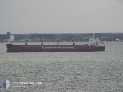
BERLINDA
Cargo
Current Trip
MUPLU > CIABJ
| Time Travelled | 1 h, 58 mins |
|---|---|
| Remaining Time | --- |
| Distance Travelled | 7.64 nm |
| Remaining Distance | --- |
| AVG Speed | 5.9 Knots |
| MAX Speed | 6.6 Knots |
| AVG Wind | 6.5 knots |
| MAX Wind | 7 knots |
| MIN Temp | 27.3°C / 81.14°F |
| MAX Temp | 27.6°C / 81.68°F |
| Draught | 11.5 m |
| Position Received | 12 d ago |
Current Position
| Longitude | --- |
|---|---|
| Latitude | --- |
| Status | Under way using engine |
| Speed | 14.6 Knots |
| Course | 330.2° |
| Area | South Atlantic Ocean |
| Station | T-AIS |
| Position Received | 12 d ago |
Info
Information
The current position of BERLINDA is in South Atlantic Ocean with coordinates -34.26874° / 18.11217° as reported on 2025-11-24 06:39 by AIS to our vessel tracker app. The vessel's current speed is 14.6 Knots
The vessel BERLINDA (IMO: 9744051, MMSI: 257972000) is a Cargo It's sailing under the flag of [NO] Norway.
In this page you can find informations about the vessels current position, last detected port calls, and current voyage information. If the vessels is not in coverage by AIS you will find the latest position.
The current position of BERLINDA is detected by our AIS receivers and we are not responsible for the reliability of the data. The last position was recorded while the vessel was in Coverage by the Ais receivers of our vessel tracking app.
The current draught of BERLINDA as reported by AIS is 11.5 meters
Weather
| Temperature | 27.5°C / 81.5°F |
|---|---|
| Wind Speed | 6 knots |
| Direction | 185° S |
| Pressure | 1012 hPa |
| Humidity | 78.4 % |
| Cloud Coverage | 100 % |
Featured Company
Last Port Calls
| Port | Arrival | Departure | Time In Port |
|---|---|---|---|
| 2025-12-04 18:35 | 2025-12-06 07:55 | 1 d | |
| 2025-10-22 18:48 | 2025-10-27 05:12 | 4 d | |
| 2025-10-17 11:28 | 2025-10-20 22:44 | 3 d |
Most Visited Ports (Last year)
| Port | Arrivals | |
|---|---|---|
| 3 | ||
| 3 | ||
| 1 | ||
| 1 | ||
| 1 | ||
| 1 |
Last Trips
| Origin | Departure | Destination | Arrival | Distance | |
|---|---|---|---|---|---|
| 2025-10-27 05:12 | 2025-12-04 18:35 | 9258.64 nm | |||
| 2025-10-20 22:44 | 2025-10-22 18:48 | 506.07 nm | |||
| 2025-09-14 12:00 | 2025-10-17 11:28 | 888.26 nm |
Events
| Time | Event | Details | Position / Dest | Info |
|---|---|---|---|---|
| 2025-12-06 09:17 | STOP Moving | 7.84 nm, South of ABIDJAN |
5.19126 / -4.06613
MUPLU > CIABJ
|
Speed: 0.1 kn Course: 236° |
| 2025-12-06 07:55 | PORT DEPARTURE |
|
5.24739 / -4.00105
MUPLU > CIABJ
|
Speed: 7.1 kn Course: 128° |
| 2025-12-06 07:31 | START Moving |
5.28043 / -4.02020
[CI] ABIDJAN
|
Speed: 4.6 kn Course: 190° |
|
| 2025-12-04 19:23 | STOP Moving |
5.28681 / -4.01619
[CI] ABIDJAN
|
Speed: 0.3 kn Course: 62° |
|
| 2025-12-04 18:35 | PORT ARRIVAL |
|
5.24899 / -4.00364
[CI] ABIDJAN
|
Speed: 7 kn Course: 310° |
| 2025-12-04 17:35 | START Moving | 7.3 nm, South of ABIDJAN |
5.19494 / -4.03934
MUPLU > CIABJ
|
Speed: 5.2 kn Course: 103° |
| 2025-12-02 19:33 | STOP Moving | 7 nm, South of ABIDJAN |
5.20003 / -4.03955
MUPLU > CIABJ
|
Speed: 0.3 kn Course: 243° |