
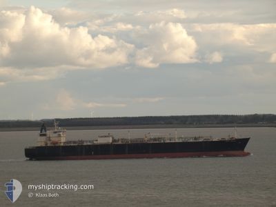
BERGE NANTONG
Lpg Tanker
Current Trip
| Time Travelled | 2 days |
|---|---|
| Remaining Time | 5 days |
| Distance Travelled | 1004.74 nm |
| Remaining Distance | 1963.54 nm |
| AVG Speed | 13.4 Knots |
| MAX Speed | 15.4 Knots |
| AVG Wind | 5.6 knots |
| MAX Wind | 16.3 knots |
| MIN Temp | 27.7°C / 81.86°F |
| MAX Temp | 31.5°C / 88.7°F |
| Draught | 11.8 m |
| Position Received | 1 d ago |
Current Position
| Longitude | 57.33558° |
|---|---|
| Latitude | 25.05887° |
| Status | Under way using engine |
| Speed | 15.1 Knots |
| Course | 121° |
| Area | Gulf of Oman |
| Station | T-AIS |
| Position Received | 1 d ago |
Info
Information
The current position of BERGE NANTONG is in Gulf of Oman with coordinates 25.05887° / 57.33558° as reported on 2024-05-07 06:44 by AIS to our vessel tracker app. The vessel's current speed is 15.1 Knots and is heading at the port of VISAKHAPATNAM. The estimated time of arrival as calculated by MyShipTracking vessel tracking app is 2024-05-14 13:32 LT
The vessel BERGE NANTONG (IMO: 9317987, MMSI: 477241500) is a Lpg Tanker that was built in 2006 ( 18 years old ). It's sailing under the flag of [HK] Hong Kong.
In this page you can find informations about the vessels current position, last detected port calls, and current voyage information. If the vessels is not in coverage by AIS you will find the latest position.
The current position of BERGE NANTONG is detected by our AIS receivers and we are not responsible for the reliability of the data. The last position was recorded while the vessel was in Coverage by the Ais receivers of our vessel tracking app.
The current draught of BERGE NANTONG as reported by AIS is 11.8 meters
Weather
| Temperature | 29.2°C / 84.56°F |
|---|---|
| Wind Speed | 11 knots |
| Direction | 262° W |
| Pressure | 1007.3 hPa |
| Humidity | 74.1 % |
| Cloud Coverage | 2 % |
Featured Company
Last Port Calls
| Port | Arrival | Departure | Time In Port |
|---|---|---|---|
| 2024-05-04 18:48 | 2024-05-06 01:37 | 1 d | |
| 2024-04-16 18:41 | |||
| 2024-04-03 23:07 | 2024-04-05 03:40 | 1 d | |
| 2024-03-06 11:58 | 2024-03-07 03:10 | 15 h | |
| 2024-03-04 13:06 |
Most Visited Ports (Last year)
| Port | Arrivals | |
|---|---|---|
| 3 | ||
| 2 | ||
| 2 | ||
| 1 | ||
| 1 | ||
| 1 |
Last Trips
| Origin | Departure | Destination | Arrival | Distance | |
|---|---|---|---|---|---|
| 2024-04-05 07:40 | 2024-04-17 00:11 | 2993.27 nm | |||
| 2024-03-07 07:10 | 2024-04-04 03:07 | 6528.52 nm | |||
| 2024-03-04 17:06 | 2024-03-06 15:58 | 9.18 nm |
Events
| Time | Event | Details | Position / Dest | Info |
|---|---|---|---|---|
| 2024-05-07 06:52 | Status Changed | Default Under way using engine |
25.04218 / 57.36832
INVTZ
|
Speed: 15.1 kn Course: 121° |
| 2024-05-07 06:44 | OUT of Coverage |
25.05887 / 57.33558
Gulf of Oman
INVTZ
|
Speed: 15.1 kn Course: 121° |
|
| 2024-05-07 03:25 | Change Sea Area | Iranian part of the Gulf of Oman Omani part of the Gulf of Oman |
25.72805 / 56.85002
Gulf of Oman
INVTZ
|
Speed: 14.1 kn Course: 161° |
| 2024-05-07 02:43 | Change Sea Area | Omani part of the Gulf of Oman Omani part of the Persian Gulf |
25.89237 / 56.81237
Gulf of Oman
INVTZ
|
Speed: 14.6 kn Course: 162° |
| 2024-05-07 02:40 | IN Coverage |
25.89237 / 56.81237
Gulf of Oman
INVTZ
|
Speed: 14.6 kn Course: 162° |
|
| 2024-05-06 21:12 | Status Changed | Default Under way using engine |
26.23860 / 55.95227
INVTZ
|
Speed: 14.2 kn Course: 54° |
| 2024-05-06 21:06 | OUT of Coverage |
26.22345 / 55.93003
Persian Gulf
INVTZ
|
Speed: 14.2 kn Course: 54° |
|
| 2024-05-06 20:52 | Change Sea Area | Omani part of the Persian Gulf United Arab Emirates part of the Persian Gulf |
26.19253 / 55.87887
Persian Gulf
INVTZ
|
Speed: 13.8 kn Course: 56° |
| 2024-05-06 10:19 | START Moving |
25.14730 / 53.62095
INVTZ
|
Speed: 3.1 kn Course: 94° |
|
| 2024-05-06 10:12 | Status Changed | Under way using engine Not under command |
25.14795 / 53.61778
INVTZ
|
Speed: 0.3 kn Course: 109° |