
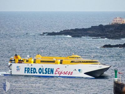
BENCOMO EXPRESS
High speed craft
Current Trip
| Trip Time | 2 h, 16 mins |
|---|---|
| Trip Distance | 70.04 nm |
| AVG Speed | 30.1 Knots |
| MAX Speed | 32.4 Knots |
| Draught | 3.7 m |
| AVG Wind | 8.4 knots |
| MAX Wind | 12.5 knots |
| MIN Temp | 16.6°C / 61.88°F |
| MAX Temp | 19.7°C / 67.46°F |
| Position Received | 2 h, 53 m ago |
Current Position
| Longitude | --- |
|---|---|
| Latitude | --- |
| Status | Under way using engine |
| Speed | 32.4 Knots |
| Course | 264.6° |
| Area | North Atlantic Ocean |
| Station | T-AIS |
| Position Received | 2 h, 53 m ago |
Info
Information
The current position of BENCOMO EXPRESS is in North Atlantic Ocean with coordinates 28.00696° / -16.79903° as reported on 2025-12-15 08:56 by AIS to our vessel tracker app. The vessel's current speed is 32.4 Knots and is currently inside the port of LA PALMA.
The vessel BENCOMO EXPRESS (IMO: 9206712, MMSI: 224840000) is a High speed craft that was built in 1999 ( 26 years old ). It's sailing under the flag of [ES] Spain.
In this page you can find informations about the vessels current position, last detected port calls, and current voyage information. If the vessels is not in coverage by AIS you will find the latest position.
The current position of BENCOMO EXPRESS is detected by our AIS receivers and we are not responsible for the reliability of the data. The last position was recorded while the vessel was in Coverage by the Ais receivers of our vessel tracking app.
The current draught of BENCOMO EXPRESS as reported by AIS is 3.7 meters
Weather
| Temperature | 16.5°C / 61.7°F |
|---|---|
| Wind Speed | 6 knots |
| Direction | 6° N |
| Pressure | 1022.8 hPa |
| Humidity | 72.8 % |
| Cloud Coverage | 54 % |
Featured Company
Last Port Calls
| Port | Arrival | Departure | Time In Port |
|---|---|---|---|
| 2025-12-15 11:04 | |||
| 2025-12-15 07:56 | 2025-12-15 08:48 | 51 m | |
| 2025-12-14 21:16 | 2025-12-15 07:08 | 9 h | |
| 2025-12-14 19:32 | 2025-12-14 20:31 | 59 m | |
| 2025-12-14 12:51 | 2025-12-14 17:04 | 4 h | |
| 2025-12-14 10:19 | 2025-12-14 10:47 | 27 m | |
| 2025-12-14 08:47 | 2025-12-14 09:35 | 48 m | |
| 2025-12-13 21:03 | 2025-12-14 08:03 | 10 h | |
| 2025-12-13 19:20 | 2025-12-13 20:03 | 43 m | |
| 2025-12-13 12:07 | 2025-12-13 17:03 | 4 h |
Most Visited Ports (Last year)
| Port | Arrivals | |
|---|---|---|
| 856 | ||
| 506 | ||
| 302 | ||
| 22 | ||
| 1 |
Last Trips
| Origin | Departure | Destination | Arrival | Distance | |
|---|---|---|---|---|---|
| 2025-12-15 08:48 | 2025-12-15 11:04 | 70.04 nm | |||
| 2025-12-15 07:08 | 2025-12-15 07:56 | 22.71 nm | |||
| 2025-12-14 20:31 | 2025-12-14 21:16 | 22.60 nm | |||
| 2025-12-14 17:04 | 2025-12-14 19:32 | 71.32 nm | |||
| 2025-12-14 10:47 | 2025-12-14 12:51 | 59.37 nm | |||
| 2025-12-14 09:35 | 2025-12-14 10:19 | 21.52 nm | |||
| 2025-12-14 08:03 | 2025-12-14 08:47 | 22.08 nm | |||
| 2025-12-13 20:03 | 2025-12-13 21:03 | 20.89 nm | |||
| 2025-12-13 17:03 | 2025-12-13 19:20 | 69.49 nm | |||
| 2025-12-13 08:39 | 2025-12-13 12:07 | 71.94 nm |
Events
| Time | Event | Details | Position / Dest | Info |
|---|---|---|---|---|
| 2025-12-15 11:11 | STOP Moving |
28.67782 / -17.76706
[ES] LA PALMA
|
Speed: 0.1 kn Course: 261° |
|
| 2025-12-15 11:04 | PORT ARRIVAL |
|
28.67147 / -17.76559
[ES] LA PALMA
|
Speed: 31.3 kn Course: 326° |
| 2025-12-15 09:04 | Status Changed | Default Under way using engine |
28.04493 / -16.86495
CRT
|
Speed: 32.4 kn Course: 264.6° |
| 2025-12-15 08:56 | Status Changed | Under way using engine Default |
28.00696 / -16.79904
CRT
|
Speed: 31.3 kn Course: 231° |
| 2025-12-15 08:56 | OUT of Coverage |
28.00696 / -16.79904
North Atlantic Ocean
|
Speed: 32.4 kn Course: 264.6° |
|
| 2025-12-15 08:48 | START Moving | 0.91 nm, South West of LOS CRISTIANOS |
28.03280 / -16.72860
CRT
|
Speed: 31.7 kn Course: -1° |
| 2025-12-15 08:48 | PORT DEPARTURE |
|
28.03280 / -16.72860
CRT
|
Speed: 4.8 kn Course: -1° |
| 2025-12-15 08:36 | IN Coverage |
28.00696 / -16.79904
North Atlantic Ocean
|
Speed: 32.4 kn Course: 264.6° |
|
| 2025-12-15 08:04 | STOP Moving |
28.04737 / -16.71825
[ES] LOS CRISTIANOS
|
Speed: Course: 127° |
|
| 2025-12-15 07:25 | OUT of Coverage |
28.03081 / -16.96159
North Atlantic Ocean
[ES] LOS CRISTIANOS
|
Speed: 31.6 kn Course: 108.6° |