
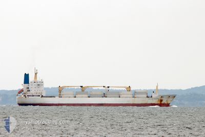
BELUGA REEFER
Reefer
Current Trip
| Time Travelled | 16 days |
|---|---|
| Remaining Time | --- |
| Distance Travelled | 3935.98 nm |
| Remaining Distance | --- |
| AVG Speed | 16.3 Knots |
| MAX Speed | 20.3 Knots |
| AVG Wind | 10.3 knots |
| MAX Wind | 22 knots |
| MIN Temp | -0.2°C / 31.64°F |
| MAX Temp | 20.5°C / 68.9°F |
| Draught | 9.2 m |
| Position Received | 15 h, 47 m ago |
Current Position
| Longitude | 9.67652° |
|---|---|
| Latitude | 68.06231° |
| Status | Under way using engine |
| Speed | 16.3 Knots |
| Course | 221.8° |
| Area | Norwegian Sea |
| Station | T-AIS |
| Position Received | 15 h, 47 m ago |
Info
Information
The current position of BELUGA REEFER is in Norwegian Sea with coordinates 68.06231° / 9.67652° as reported on 2024-06-06 23:41 by AIS to our vessel tracker app. The vessel's current speed is 16.3 Knots and is heading at the port of DAKAR. The estimated time of arrival as calculated by MyShipTracking vessel tracking app is 2024-06-15 12:00 LT
The vessel BELUGA REEFER (IMO: 9015204, MMSI: 308121000) is a Reefer that was built in 1992 ( 32 years old ). It's sailing under the flag of [BS] Bahamas.
In this page you can find informations about the vessels current position, last detected port calls, and current voyage information. If the vessels is not in coverage by AIS you will find the latest position.
The current position of BELUGA REEFER is detected by our AIS receivers and we are not responsible for the reliability of the data. The last position was recorded while the vessel was in Coverage by the Ais receivers of our vessel tracking app.
The current draught of BELUGA REEFER as reported by AIS is 9.2 meters
Weather
| Temperature | 9.3°C / 48.74°F |
|---|---|
| Wind Speed | 14 knots |
| Direction | 180° S |
| Pressure | 1002.8 hPa |
| Humidity | 75.2 % |
| Cloud Coverage | 83 % |
Featured Company
Last Port Calls
| Port | Arrival | Departure | Time In Port |
|---|---|---|---|
| 2024-05-16 15:54 | 2024-05-22 09:45 | 5 d | |
| 2024-04-22 06:18 | 2024-04-27 23:55 | 5 d | |
| 2024-04-14 11:49 | 2024-04-20 05:35 | 5 d |
Most Visited Ports (Last year)
| Port | Arrivals | |
|---|---|---|
| 5 | ||
| 3 | ||
| 2 | ||
| 2 | ||
| 2 | ||
| 1 |
Last Trips
| Origin | Departure | Destination | Arrival | Distance | |
|---|---|---|---|---|---|
| 2024-04-28 01:55 | 2024-05-16 18:54 | 7606.41 nm | |||
| 2024-04-20 07:35 | 2024-04-22 08:18 | 818.75 nm | |||
| 2024-03-24 16:45 | 2024-04-14 13:49 | 8441.05 nm |
Events
| Time | Event | Details | Position / Dest | Info |
|---|---|---|---|---|
| 2024-06-06 23:41 | OUT of Coverage |
68.06231 / 9.67652
Norwegian Sea
SNDKR
|
Speed: 16.3 kn Course: 221.8° |
|
| 2024-06-06 01:28 | Change Sea Area | Norwegian part of the Norwegian Sea Norwegian part of the Barentsz Sea |
71.68013 / 24.66304
Norwegian Sea
SNDKR
|
Speed: 16.5 kn Course: 257.7° |
| 2024-06-05 15:44 | Change Sea Area | Norwegian part of the Barentsz Sea Russian part of the Barentsz Sea |
70.61570 / 32.54559
Barentsz Sea
SNDKR
|
Speed: 16.9 kn Course: 309.7° |
| 2024-06-05 13:58 | Draught Changed | 9.2 7.5 |
70.27913 / 33.64239
SNDKR
|
Speed: 16.8 kn Course: 311.6° |
| 2024-06-05 13:58 | Destination Changed | SNDKR RUARH |
70.27913 / 33.64239
SNDKR
|
Speed: 16.8 kn Course: 311.6° |
| 2024-06-05 13:58 | ETA Changed | 2024/06/15 12:00 2024/05/28 20:30 |
70.27913 / 33.64239
SNDKR
|
Speed: 16.8 kn Course: 311.6° |
| 2024-06-05 13:42 | Status Changed | Under way using engine Default |
70.23232 / 33.79921
RUARH
|
Speed: 16 kn Course: 311° |
| 2024-06-05 13:42 | IN Coverage |
70.23922 / 33.77610
Barentsz Sea
|
Speed: 17.1 kn Course: 311.5° |
|
| 2024-05-28 21:02 | STOP Moving |
64.96833 / 40.03667
RUARH
|
Speed: Course: -1° |