
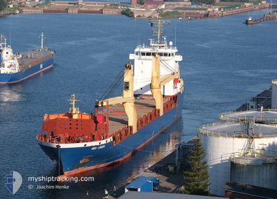
BBC LISBON
General Cargo
Current Trip
TRISK
| Time Travelled | 16 h, 51 mins |
|---|---|
| Remaining Time | --- |
| Distance Travelled | 6.58 nm |
| Remaining Distance | --- |
| AVG Speed | 6.7 Knots |
| MAX Speed | 7.7 Knots |
| AVG Wind | 2.2 knots |
| MAX Wind | 4 knots |
| MIN Temp | 8.8°C / 47.84°F |
| MAX Temp | 12.6°C / 54.68°F |
| Draught | 5.4 m |
| Position Received | 2 d ago |
Current Position
| Longitude | --- |
|---|---|
| Latitude | --- |
| Status | Under way using engine |
| Speed | 11.4 Knots |
| Course | 40.3° |
| Area | Mediterranean Sea - Eastern Basin |
| Station | T-AIS |
| Position Received | 2 d ago |
Info
Information
The current position of BBC LISBON is in Mediterranean Sea - Eastern Basin with coordinates 36.49413° / 35.85319° as reported on 2025-12-11 02:47 by AIS to our vessel tracker app. The vessel's current speed is 11.4 Knots
The vessel BBC LISBON (IMO: 9513634, MMSI: 305688000) is a General Cargo that was built in 2011 ( 14 years old ). It's sailing under the flag of [AG] Antigua Barbuda.
In this page you can find informations about the vessels current position, last detected port calls, and current voyage information. If the vessels is not in coverage by AIS you will find the latest position.
The current position of BBC LISBON is detected by our AIS receivers and we are not responsible for the reliability of the data. The last position was recorded while the vessel was in Coverage by the Ais receivers of our vessel tracking app.
The current draught of BBC LISBON as reported by AIS is 5.4 meters
Weather
| Temperature | 10.4°C / 50.72°F |
|---|---|
| Wind Speed | 2 knots |
| Direction | 359° N |
| Pressure | 1019.6 hPa |
| Humidity | 54.5 % |
| Cloud Coverage | --- |
Featured Company
Last Port Calls
| Port | Arrival | Departure | Time In Port |
|---|---|---|---|
| 2025-12-12 07:25 | 2025-12-13 03:45 | 20 h | |
| 2025-12-05 16:57 | 2025-12-09 10:53 | 3 d | |
| 2025-11-29 16:58 | 2025-12-01 00:41 | 1 d | |
| 2025-11-13 08:12 | 2025-11-18 06:58 | 4 d | |
| 2025-10-03 06:10 | 2025-10-28 05:50 | 25 d | |
| 2025-10-01 15:58 |
Most Visited Ports (Last year)
| Port | Arrivals | |
|---|---|---|
| 3 | ||
| 2 | ||
| 2 | ||
| 2 | ||
| 2 | ||
| 1 |
Last Trips
| Origin | Departure | Destination | Arrival | Distance | |
|---|---|---|---|---|---|
| 2025-12-09 10:53 | 2025-12-12 07:25 | 481.70 nm | |||
| 2025-12-01 00:41 | 2025-12-05 16:57 | 1235.85 nm | |||
| 2025-11-18 06:58 | 2025-11-29 16:58 | 2159.57 nm | |||
| 2025-10-28 05:50 | 2025-11-13 08:12 | 1579.43 nm | |||
| 2025-10-01 15:58 | 2025-10-03 06:10 | 150.83 nm |
Events
| Time | Event | Details | Position / Dest | Info |
|---|---|---|---|---|
| 2025-12-13 01:45 | STOP Moving | 6.16 nm, North of ISKENDERUN |
36.71045 / 36.14267
TRISK
|
Speed: 0.2 kn Course: 8° |
| 2025-12-13 00:45 | PORT DEPARTURE |
|
36.61962 / 36.16596
TRISK
|
Speed: 6.8 kn Course: 305° |
| 2025-12-13 00:25 | START Moving |
36.59624 / 36.18811
[TR] ISKENDERUN
|
Speed: 3.2 kn Course: 355° |
|
| 2025-12-12 05:00 | STOP Moving |
36.59401 / 36.18679
[TR] ISKENDERUN
|
Speed: 0.2 kn Course: 109° |
|
| 2025-12-12 04:25 | PORT ARRIVAL |
|
36.61517 / 36.17480
[TR] ISKENDERUN
|
Speed: 6.6 kn Course: 103° |
| 2025-12-12 04:05 | START Moving | 1.9 nm, West of ISKENDERUN |
36.61939 / 36.13713
TRISK
|
Speed: 3.4 kn Course: 90° |
| 2025-12-11 05:23 | STOP Moving | 1.76 nm, West of ISKENDERUN |
36.61486 / 36.13903
TRISK
|
Speed: 0.2 kn Course: 172° |
| 2025-12-11 02:57 | Status Changed | Default Under way using engine |
36.51805 / 35.87803
TRISK
|
Speed: 11.4 kn Course: 40.3° |
| 2025-12-11 02:47 | OUT of Coverage |
36.49413 / 35.85319
Mediterranean Sea - Eastern Basin
TRISK
|
Speed: 11.4 kn Course: 40.3° |
|
| 2025-12-10 23:58 | Detected in Sea | Turkish part of the Mediterranean Sea - Eastern Basin |
36.10288 / 35.42873
Mediterranean Sea - Eastern Basin
TRISK
|
Speed: 11.3 kn Course: 37.5° |