
BBC EDGE
General Cargo
Current Trip
MOREHEAD CITY
| Time Travelled | 1 day |
|---|---|
| Remaining Time | --- |
| Distance Travelled | 445.10 nm |
| Remaining Distance | --- |
| AVG Speed | 11 Knots |
| MAX Speed | 14.9 Knots |
| AVG Wind | 11.6 knots |
| MAX Wind | 21 knots |
| MIN Temp | 15°C / 59°F |
| MAX Temp | 21.2°C / 70.16°F |
| Draught | 5 m |
| Position Received | 1 d ago |
Current Position
| Longitude | --- |
|---|---|
| Latitude | --- |
| Status | Under way using engine |
| Speed | 13.8 Knots |
| Course | 149.8° |
| Area | North Atlantic Ocean |
| Station | T-AIS |
| Position Received | 1 d ago |
Info
Information
The current position of BBC EDGE is in North Atlantic Ocean with coordinates 34.33992° / -76.58414° as reported on 2025-12-17 23:10 by AIS to our vessel tracker app. The vessel's current speed is 13.8 Knots
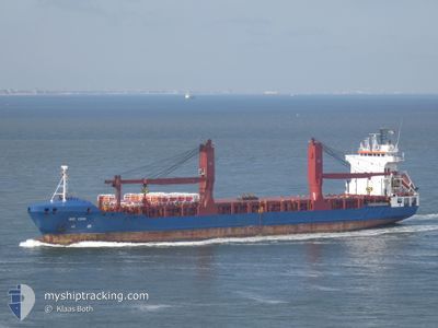
The vessel BBC EDGE (IMO: 9407598, MMSI: 305472000) is a General Cargo that was built in 2009 ( 16 years old ). It's sailing under the flag of [AG] Antigua Barbuda.
In this page you can find informations about the vessels current position, last detected port calls, and current voyage information. If the vessels is not in coverage by AIS you will find the latest position.
The current position of BBC EDGE is detected by our AIS receivers and we are not responsible for the reliability of the data. The last position was recorded while the vessel was in Coverage by the Ais receivers of our vessel tracking app.
The current draught of BBC EDGE as reported by AIS is 5 meters
Weather
| Temperature | 20.9°C / 69.62°F |
|---|---|
| Wind Speed | 22 knots |
| Direction | 180° S |
| Pressure | 1022 hPa |
| Humidity | 74.3 % |
| Cloud Coverage | 100 % |
Featured Company
Last Port Calls
| Port | Arrival | Departure | Time In Port |
|---|---|---|---|
| 2025-12-17 07:37 | 2025-12-17 15:35 | 7 h | |
| 2025-12-09 08:03 | 2025-12-12 13:15 | 3 d | |
| 2025-11-24 19:25 | 2025-11-27 06:56 | 2 d | |
| 2025-11-21 21:28 | 2025-11-22 14:39 | 17 h | |
| 2025-11-18 12:27 | 2025-11-20 10:32 | 1 d | |
| 2025-10-31 17:17 | 2025-11-02 09:13 | 1 d | |
| 2025-10-06 14:15 | 2025-10-07 17:33 | 1 d |
Last Trips
| Origin | Departure | Destination | Arrival | Distance | |
|---|---|---|---|---|---|
| 2025-12-12 13:15 | 2025-12-17 07:37 | 1398.76 nm | |||
| 2025-11-27 06:56 | 2025-12-09 08:03 | 3330.88 nm | |||
| 2025-11-22 14:39 | 2025-11-24 19:25 | 748.45 nm | |||
| 2025-11-20 10:32 | 2025-11-21 21:28 | 444.50 nm | |||
| 2025-11-02 09:13 | 2025-11-18 12:27 | 4312.19 nm | |||
| 2025-10-07 17:33 | 2025-10-31 17:17 | 6917.32 nm | |||
| 2025-09-22 17:58 | 2025-10-06 14:15 | 3917.54 nm |
Events
| Time | Event | Details | Position / Dest | Info |
|---|---|---|---|---|
| 2025-12-17 23:26 | Status Changed | Default Under way using engine |
34.30318 / -76.52389
MOREHEAD CITY
|
Speed: 13.8 kn Course: 149.8° |
| 2025-12-17 23:10 | OUT of Coverage |
34.33992 / -76.58414
North Atlantic Ocean
|
Speed: 13.8 kn Course: 149.8° |
|
| 2025-12-17 20:35 | PORT DEPARTURE |
|
34.71338 / -76.69566
MOREHEAD CITY
|
Speed: 7.7 kn Course: 128° |
| 2025-12-17 20:31 | Status Changed | Under way using engine Moored |
34.71455 / -76.70433
[US] MOREHEAD CITY
|
Speed: 1.9 kn Course: 108° |
| 2025-12-17 20:29 | START Moving |
34.71506 / -76.70425
[US] MOREHEAD CITY
|
Speed: 3.1 kn Course: 199° |
|
| 2025-12-17 20:12 | Status Changed | Moored Default |
34.71536 / -76.70113
[US] MOREHEAD CITY
|
Speed: Course: 266° |
| 2025-12-17 20:06 | Status Changed | Default Moored |
34.71536 / -76.70113
[US] MOREHEAD CITY
|
Speed: Course: 266° |
| 2025-12-17 19:33 | Status Changed | Moored Default |
34.71536 / -76.70113
[US] MOREHEAD CITY
|
Speed: Course: 265° |
| 2025-12-17 19:30 | Status Changed | Default Moored |
34.71537 / -76.70113
[US] MOREHEAD CITY
|
Speed: Course: 265° |
| 2025-12-17 19:09 | Status Changed | Moored Default |
34.71537 / -76.70114
[US] MOREHEAD CITY
|
Speed: Course: 266° |