
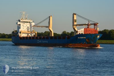
BBC BAHRAIN
General Cargo
Current Trip
| Time Travelled | 3 h, 32 mins |
|---|---|
| Remaining Time | 2 h, 52 mins |
| Distance Travelled | 38.87 nm |
| Remaining Distance | 37.19 nm |
| AVG Speed | 11.3 Knots |
| MAX Speed | 11.9 Knots |
| AVG Wind | 4.6 knots |
| MAX Wind | 6.1 knots |
| MIN Temp | 2.4°C / 36.32°F |
| MAX Temp | 2.6°C / 36.68°F |
| Draught | 6.8 m |
| Position Received | 2 d ago |
Current Position
| Longitude | 18.69236° |
|---|---|
| Latitude | 62.12583° |
| Status | Under way using engine |
| Speed | 10.8 Knots |
| Course | 118.8° |
| Area | Gulf of Bothnia |
| Station | T-AIS |
| Position Received | 2 d ago |
Info
Information
The current position of BBC BAHRAIN is in Gulf of Bothnia with coordinates 62.12583° / 18.69236° as reported on 2024-05-06 21:05 by AIS to our vessel tracker app. The vessel's current speed is 10.8 Knots and is heading at the port of PORI. The estimated time of arrival as calculated by MyShipTracking vessel tracking app is 2024-05-09 04:08 LT
The vessel BBC BAHRAIN (IMO: 9578751, MMSI: 305847000) is a General Cargo that was built in 2012 ( 12 years old ). It's sailing under the flag of [AG] Antigua Barbuda.
In this page you can find informations about the vessels current position, last detected port calls, and current voyage information. If the vessels is not in coverage by AIS you will find the latest position.
The current position of BBC BAHRAIN is detected by our AIS receivers and we are not responsible for the reliability of the data. The last position was recorded while the vessel was in Coverage by the Ais receivers of our vessel tracking app.
The current draught of BBC BAHRAIN as reported by AIS is 6.8 meters
Weather
| Temperature | 2.5°C / 36.5°F |
|---|---|
| Wind Speed | 6 knots |
| Direction | 207° SSW |
| Pressure | 1026.2 hPa |
| Humidity | 75.1 % |
| Cloud Coverage | 99 % |
Featured Company
Last Port Calls
| Port | Arrival | Departure | Time In Port |
|---|---|---|---|
| 2024-05-07 05:28 | 2024-05-08 21:44 | 1 d | |
| 2024-05-01 04:59 | 2024-05-06 17:12 | 5 d | |
| 2024-04-28 05:53 | 2024-04-30 11:28 | 2 d | |
| 2024-04-16 20:14 | 2024-04-19 06:50 | 2 d | |
| 2024-04-14 16:29 | 2024-04-14 20:39 | 4 h | |
| 2024-04-10 06:04 | 2024-04-11 17:48 | 1 d | |
| 2024-04-05 02:50 | 2024-04-08 01:24 | 2 d | |
| 2024-04-03 12:36 | |||
| 2024-03-22 21:35 | 2024-03-25 20:34 | 2 d | |
| 2024-03-19 17:47 | 2024-03-22 13:58 | 2 d |
Most Visited Ports (Last year)
| Port | Arrivals | |
|---|---|---|
| 4 | ||
| 4 | ||
| 3 | ||
| 2 | ||
| 2 | ||
| 2 |
Last Trips
| Origin | Departure | Destination | Arrival | Distance | |
|---|---|---|---|---|---|
| 2024-05-06 19:12 | 2024-05-07 08:28 | 129.47 nm | |||
| 2024-04-30 14:28 | 2024-05-01 06:59 | 198.10 nm | |||
| 2024-04-19 07:50 | 2024-04-28 08:53 | 2295.46 nm | |||
| 2024-04-14 22:39 | 2024-04-16 21:14 | 456.99 nm | |||
| 2024-04-11 19:48 | 2024-04-14 18:29 | 868.48 nm | |||
| 2024-04-08 03:24 | 2024-04-10 08:04 | 645.92 nm | |||
| 2024-04-03 14:36 | 2024-04-05 04:50 | 411.19 nm | |||
| 2024-03-22 14:58 | 2024-03-22 22:35 | 86.51 nm | |||
| 2024-03-13 19:49 | 2024-03-19 18:47 | 633.15 nm | |||
| 2024-02-25 01:24 | 2024-03-13 09:14 | 3910.04 nm |
Events
| Time | Event | Details | Position / Dest | Info |
|---|---|---|---|---|
| 2024-05-08 21:45 | START Moving | 0.73 nm, West of MANTYLUOTO |
61.60037 / 21.46082
FIPOR
|
Speed: 6.1 kn Course: 231° |
| 2024-05-08 21:44 | PORT DEPARTURE |
|
61.60037 / 21.46082
FIPOR
|
Speed: 1 kn Course: 291° |
| 2024-05-07 05:29 | STOP Moving |
61.59997 / 21.46665
[FI] MANTYLUOTO
|
Speed: 0.3 kn Course: 75° |
|
| 2024-05-07 05:28 | PORT ARRIVAL |
|
61.59997 / 21.46665
[FI] MANTYLUOTO
|
Speed: 1 kn Course: 92° |
| 2024-05-06 21:12 | Status Changed | Default Under way using engine |
62.11519 / 18.73541
FIPOR
|
Speed: 10.8 kn Course: 118.8° |
| 2024-05-06 21:05 | OUT of Coverage |
62.12583 / 18.69236
Gulf of Bothnia
FIPOR
|
Speed: 10.8 kn Course: 118.8° |
|
| 2024-05-06 18:13 | Draught Changed | 6.8 5 |
62.35117 / 17.68353
FIPOR
|
Speed: 10.8 kn Course: 117.7° |
| 2024-05-06 18:13 | Destination Changed | FIPOR SETUN |
62.35117 / 17.68353
FIPOR
|
Speed: 10.8 kn Course: 117.7° |
| 2024-05-06 18:13 | ETA Changed | 2024/05/07 03:00 2024/05/01 03:30 |
62.35117 / 17.68353
FIPOR
|
Speed: 10.8 kn Course: 117.7° |
| 2024-05-06 17:42 | Status Changed | Under way using engine Default |
62.35233 / 17.51071
SETUN
|
Speed: 11.8 kn Course: 74° |