
BARNEY
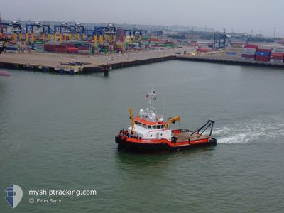
Tug
Current Trip
| Time Travelled | 1 day |
|---|---|
| Remaining Time | --- |
| Distance Travelled | 45.69 nm |
| Remaining Distance | --- |
| AVG Speed | 4.9 Knots |
| MAX Speed | 9.2 Knots |
| AVG Wind | 9 knots |
| MAX Wind | 12 knots |
| MIN Temp | 2°C / 35.6°F |
| MAX Temp | 7.1°C / 44.78°F |
| Draught | 2.2 m |
| Position Received | Now |
Current Position
| Longitude | --- |
|---|---|
| Latitude | --- |
| Status | Moored |
| Speed | |
| Course | 249° |
| Area | North Sea |
| Station | T-AIS |
| Position Received | Now |
Info
Information
The current position of BARNEY is in North Sea with coordinates 51.94917° / 1.29057° as reported on 2025-03-13 23:30 by AIS to our vessel tracker app. The vessel's current speed is 0 Knots
The vessel BARNEY (IMO: 9740938, MMSI: 244850156) is a Tug It's sailing under the flag of [NL] Netherlands.
In this page you can find informations about the vessels current position, last detected port calls, and current voyage information. If the vessels is not in coverage by AIS you will find the latest position.
The current position of BARNEY is detected by our AIS receivers and we are not responsible for the reliability of the data. The last position was recorded while the vessel was in Coverage by the Ais receivers of our vessel tracking app.
The current draught of BARNEY as reported by AIS is 2.2 meters
Weather
| Temperature | 1.1°C / 33.98°F |
|---|---|
| Wind Speed | 4 knots |
| Direction | 351° N |
| Pressure | 1007 hPa |
| Humidity | 86.8 % |
| Cloud Coverage | 8 % |
Featured Company
Last Port Calls
| Port | Arrival | Departure | Time In Port |
|---|---|---|---|
| 2025-03-12 07:06 | 2025-03-12 08:23 | 1 h | |
| 2025-03-11 07:08 | 2025-03-11 14:11 | 7 h | |
| 2025-03-10 07:09 | 2025-03-10 11:54 | 4 h | |
| 2025-03-09 06:57 | 2025-03-09 10:16 | 3 h | |
| 2025-03-08 17:17 | 2025-03-08 18:06 | 48 m | |
| 2025-03-08 17:04 | 2025-03-08 17:15 | 11 m | |
| 2025-03-08 16:29 | 2025-03-08 17:02 | 32 m | |
| 2025-03-08 16:13 | 2025-03-08 16:26 | 12 m | |
| 2025-03-08 16:01 | 2025-03-08 16:11 | 10 m | |
| 2025-03-08 15:40 | 2025-03-08 15:59 | 19 m |
Most Visited Ports (Last year)
| Port | Arrivals | |
|---|---|---|
| 574 | ||
| 152 | ||
| 8 | ||
| 7 | ||
| 6 | ||
| 5 |
Last Trips
| Origin | Departure | Destination | Arrival | Distance | |
|---|---|---|---|---|---|
| 2025-03-11 14:11 | 2025-03-12 07:06 | 8.34 nm | |||
| 2025-03-10 11:54 | 2025-03-11 07:08 | 12.57 nm | |||
| 2025-03-09 10:16 | 2025-03-10 07:09 | 15.59 nm | |||
| 2025-03-08 18:06 | 2025-03-09 06:57 | 0.98 nm | |||
| 2025-03-08 17:15 | 2025-03-08 17:17 | 0.22 nm | |||
| 2025-03-08 17:02 | 2025-03-08 17:04 | 0.21 nm | |||
| 2025-03-08 16:26 | 2025-03-08 16:29 | 0.27 nm | |||
| 2025-03-08 16:11 | 2025-03-08 16:13 | 0.23 nm | |||
| 2025-03-08 15:59 | 2025-03-08 16:01 | 0.22 nm | |||
| 2025-03-08 15:37 | 2025-03-08 15:40 | 0.25 nm |
Events
| Time | Event | Details | Position / Dest | Info |
|---|---|---|---|---|
| 2025-03-13 18:36 | Status Changed | Moored Restricted manoeuverability |
51.94918 / 1.29057
GBHRW
|
Speed: Course: 252° |
| 2025-03-13 18:32 | STOP Moving | 0.67 nm, South West of FELIXSTOWE |
51.94920 / 1.29059
GBHRW
|
Speed: 0.3 kn Course: 242° |
| 2025-03-13 18:27 | START Moving | 0.5 nm, South of FELIXSTOWE |
51.95058 / 1.29999
GBHRW
|
Speed: 3.2 kn Course: 295° |
| 2025-03-13 18:13 | STOP Moving | 0.3 nm, South of FELIXSTOWE |
51.95428 / 1.29654
GBHRW
|
Speed: 0.1 kn Course: 108° |
| 2025-03-13 18:11 | START Moving | 0.42 nm, South of FELIXSTOWE |
51.95199 / 1.29945
GBHRW
|
Speed: 8.1 kn Course: 317.4° |
| 2025-03-13 18:08 | STOP Moving | 0.5 nm, South of FELIXSTOWE |
51.95063 / 1.30151
GBHRW
|
Speed: 0.3 kn Course: 171° |
| 2025-03-13 18:02 | START Moving | 0.32 nm, South of FELIXSTOWE |
51.95353 / 1.30001
GBHRW
|
Speed: 3.2 kn Course: 138° |
| 2025-03-13 17:35 | STOP Moving | 0.23 nm, South West of FELIXSTOWE |
51.95654 / 1.29481
GBHRW
|
Speed: 0.2 kn Course: 136° |
| 2025-03-13 17:27 | START Moving | 0.48 nm, South of FELIXSTOWE |
51.95124 / 1.30351
GBHRW
|
Speed: 3.2 kn Course: 332° |
| 2025-03-13 17:03 | STOP Moving | 0.26 nm, South West of FELIXSTOWE |
51.95624 / 1.29399
GBHRW
|
Speed: 0.1 kn Course: 90° |