
BAR :
Cargo
Current Trip
| Trip Time | 33 days |
|---|---|
| Trip Distance | 7226.01 nm |
| AVG Speed | 9.3 Knots |
| MAX Speed | 15.4 Knots |
| Draught | 10.5 m |
| AVG Wind | 17.2 knots |
| MAX Wind | 43 knots |
| MIN Temp | 1.5°C / 34.7°F |
| MAX Temp | 26.1°C / 78.98°F |
| Position Received | 28 d ago |
Current Position
| Longitude | --- |
|---|---|
| Latitude | --- |
| Status | Under way using engine |
| Speed | 11 Knots |
| Course | 275.8° |
| Area | The Coastal Waters of Southeast Alaska and British Columbia |
| Station | T-AIS |
| Position Received | 28 d ago |
Info
Information
The current position of BAR : is in The Coastal Waters of Southeast Alaska and British Columbia with coordinates 54.37327° / -131.62579° as reported on 2025-11-13 07:41 by AIS to our vessel tracker app. The vessel's current speed is 11 Knots and is currently inside the port of NAGOYA.
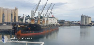
The vessel BAR : (IMO: 9693496, MMSI: 262007000) is a Cargo It's sailing under the flag of [ME] Montenegro.
In this page you can find informations about the vessels current position, last detected port calls, and current voyage information. If the vessels is not in coverage by AIS you will find the latest position.
The current position of BAR : is detected by our AIS receivers and we are not responsible for the reliability of the data. The last position was recorded while the vessel was in Coverage by the Ais receivers of our vessel tracking app.
The current draught of BAR : as reported by AIS is 10.5 meters
Weather
| Temperature | 7.1°C / 44.78°F |
|---|---|
| Wind Speed | 20 knots |
| Direction | 325° NW |
| Pressure | 1024 hPa |
| Humidity | 56.4 % |
| Cloud Coverage | 2 % |
Featured Company
Last Port Calls
| Port | Arrival | Departure | Time In Port |
|---|---|---|---|
| 2025-12-10 11:57 | |||
| 2025-11-03 18:04 | 2025-11-06 16:20 | 2 d | |
| 2025-10-19 22:03 | 2025-10-21 00:08 | 1 d | |
| 2025-10-17 09:21 | 2025-10-17 09:33 | 11 m | |
| 2025-10-03 09:25 | 2025-10-11 02:35 | 7 d |
Last Trips
| Origin | Departure | Destination | Arrival | Distance | |
|---|---|---|---|---|---|
| 2025-11-06 16:20 | 2025-12-10 11:57 | 7226.01 nm | |||
| 2025-10-21 00:08 | 2025-11-03 18:04 | 1276.89 nm | |||
| 2025-10-17 09:33 | 2025-10-19 22:03 | 469.75 nm | |||
| 2025-10-11 02:35 | 2025-10-17 09:21 | 1025.40 nm | |||
| 2025-09-09 00:44 | 2025-10-03 09:25 | 7273.25 nm |
Events
| Time | Event | Details | Position / Dest | Info |
|---|---|---|---|---|
| 2025-12-10 03:05 | STOP Moving |
35.00609 / 136.84305
[JP] NAGOYA
|
Speed: 0.3 kn Course: 41° |
|
| 2025-12-10 02:57 | PORT ARRIVAL |
|
35.00580 / 136.84026
[JP] NAGOYA
|
Speed: 8.5 kn Course: 35° |
| 2025-12-09 22:18 | START Moving | 10.99 nm, South East of IRAKO |
34.47021 / 137.19304
PRINC RUPERT
|
Speed: 4.2 kn Course: 305° |
| 2025-12-09 21:54 | STOP Moving | 11.58 nm, South East of IRAKO |
34.46333 / 137.20166
PRINC RUPERT
|
Speed: Course: -1° |