
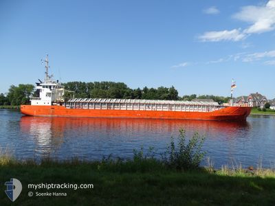
BALTIC EXPRESS
General Cargo
Current Trip
| Time Travelled | 1 day |
|---|---|
| Remaining Time | 7 h, 5 mins |
| Distance Travelled | 156.55 nm |
| Remaining Distance | 78.72 nm |
| AVG Speed | 8 Knots |
| MAX Speed | 10.7 Knots |
| AVG Wind | 15.9 knots |
| MAX Wind | 21 knots |
| MIN Temp | 5.7°C / 42.26°F |
| MAX Temp | 9.2°C / 48.56°F |
| Draught | 3 m |
| Position Received | 4 h, 14 m ago |
Current Position
| Longitude | --- |
|---|---|
| Latitude | --- |
| Status | Under way using engine |
| Speed | 10.3 Knots |
| Course | 46.3° |
| Area | Baltic Sea |
| Station | T-AIS |
| Position Received | 4 h, 14 m ago |
Info
Information
The current position of BALTIC EXPRESS is in Baltic Sea with coordinates 54.40186° / 12.15911° as reported on 2025-12-13 00:49 by AIS to our vessel tracker app. The vessel's current speed is 10.3 Knots and is heading at the port of SWINOUJSCIE. The estimated time of arrival as calculated by MyShipTracking vessel tracking app is 2025-12-13 13:08 LT
The vessel BALTIC EXPRESS (IMO: 9243851, MMSI: 341412000) is a General Cargo that was built in 2001 ( 24 years old ). It's sailing under the flag of [KN] St Kitts Nevis.
In this page you can find informations about the vessels current position, last detected port calls, and current voyage information. If the vessels is not in coverage by AIS you will find the latest position.
The current position of BALTIC EXPRESS is detected by our AIS receivers and we are not responsible for the reliability of the data. The last position was recorded while the vessel was in Coverage by the Ais receivers of our vessel tracking app.
The current draught of BALTIC EXPRESS as reported by AIS is 3 meters
Weather
| Temperature | 6.3°C / 43.34°F |
|---|---|
| Wind Speed | 11 knots |
| Direction | 210° SSW |
| Pressure | 1022.5 hPa |
| Humidity | 89.6 % |
| Cloud Coverage | 100 % |
Featured Company
Last Port Calls
| Port | Arrival | Departure | Time In Port |
|---|---|---|---|
| 2025-12-09 06:59 | 2025-12-11 10:29 | 2 d | |
| 2025-12-05 21:46 | 2025-12-07 10:44 | 1 d | |
| 2025-12-03 02:21 | 2025-12-04 12:01 | 1 d | |
| 2025-11-24 15:41 | 2025-11-25 19:35 | 1 d | |
| 2025-11-14 05:49 | 2025-11-19 19:05 | 5 d | |
| 2025-11-10 22:29 | 2025-11-12 22:20 | 1 d | |
| 2025-11-04 10:24 | 2025-11-07 13:17 | 3 d | |
| 2025-11-01 07:28 | 2025-11-03 16:02 | 2 d | |
| 2025-10-31 16:23 | 2025-10-31 16:28 | 5 m | |
| 2025-10-25 22:28 | 2025-10-29 14:44 | 3 d |
Most Visited Ports (Last year)
| Port | Arrivals | |
|---|---|---|
| 7 | ||
| 6 | ||
| 5 | ||
| 5 | ||
| 4 | ||
| 3 |
Last Trips
| Origin | Departure | Destination | Arrival | Distance | |
|---|---|---|---|---|---|
| 2025-12-07 10:44 | 2025-12-09 06:59 | 392.16 nm | |||
| 2025-12-04 12:01 | 2025-12-05 21:46 | 294.43 nm | |||
| 2025-11-25 19:35 | 2025-12-03 02:21 | 185.13 nm | |||
| 2025-11-19 19:05 | 2025-11-24 15:41 | 618.39 nm | |||
| 2025-11-12 22:20 | 2025-11-14 05:49 | 268.34 nm | |||
| 2025-11-07 13:17 | 2025-11-10 22:29 | 598.95 nm | |||
| 2025-11-03 16:02 | 2025-11-04 10:24 | 113.28 nm | |||
| 2025-10-31 16:28 | 2025-11-01 07:28 | 94.59 nm | |||
| 2025-10-29 14:44 | 2025-10-31 16:23 | 305.95 nm | |||
| 2025-10-24 19:41 | 2025-10-25 22:28 | 235.98 nm |
Events
| Time | Event | Details | Position / Dest | Info |
|---|---|---|---|---|
| 2025-12-13 00:57 | Status Changed | Default Under way using engine |
54.41946 / 12.18503
SWINOUJSCIE
|
Speed: 10.3 kn Course: 46.3° |
| 2025-12-13 00:49 | OUT of Coverage |
54.40186 / 12.15911
Baltic Sea
SWINOUJSCIE
|
Speed: 10.3 kn Course: 46.3° |
|
| 2025-12-13 00:29 | Change Sea Area | German part of the Baltic Sea Danish part of the Baltic Sea |
54.39676 / 12.06020
Baltic Sea
SWINOUJSCIE
|
Speed: 10.3 kn Course: 90.9° |
| 2025-12-12 22:09 | Change Sea Area | Danish part of the Baltic Sea German part of the Baltic Sea |
54.49722 / 11.45226
Baltic Sea
SWINOUJSCIE
|
Speed: 9.7 kn Course: 115.6° |
| 2025-12-12 21:10 | START Moving | 0.3 nm, North East of PUTTGARDEN |
54.50660 / 11.23667
SWINOUJSCIE
|
Speed: 4.9 kn Course: 18° |
| 2025-12-12 21:01 | Status Changed | Under way using engine Moored |
54.50426 / 11.23679
SWINOUJSCIE
|
Speed: Course: 214° |
| 2025-12-12 21:01 | Draught Changed | 3 3.9 |
54.50426 / 11.23680
SWINOUJSCIE
|
Speed: Course: 214° |
| 2025-12-12 21:01 | Destination Changed | SWINOUJSCIE PUTTGARDEN |
54.50426 / 11.23680
SWINOUJSCIE
|
Speed: Course: 214° |
| 2025-12-12 21:01 | ETA Changed | 2025/12/13 12:00 2025/12/11 20:00 |
54.50426 / 11.23680
SWINOUJSCIE
|
Speed: Course: 214° |
| 2025-12-12 20:43 | Status Changed | Moored Default |
54.50428 / 11.23680
PUTTGARDEN
|
Speed: Course: 214° |