
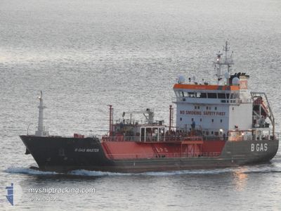
B GAS MASTER
Lpg Tanker
Current Trip
| Time Travelled | 2 days |
|---|---|
| Remaining Time | --- |
| Distance Travelled | 366.57 nm |
| Remaining Distance | --- |
| AVG Speed | 11.2 Knots |
| MAX Speed | 16.8 Knots |
| AVG Wind | 9 knots |
| MAX Wind | 23.5 knots |
| MIN Temp | 9.6°C / 49.28°F |
| MAX Temp | 12.2°C / 53.96°F |
| Draught | 5.6 m |
| Position Received | 1 m ago |
Current Position
| Longitude | 1.39872° |
|---|---|
| Latitude | 51.41318° |
| Status | At anchor |
| Speed | 0.1 Knots |
| Course | 47° |
| Area | North Sea |
| Station | T-AIS |
| Position Received | 1 m ago |
Info
Information
The current position of B GAS MASTER is in North Sea with coordinates 51.41318° / 1.39872° as reported on 2024-05-07 18:01 by AIS to our vessel tracker app. The vessel's current speed is 0.1 Knots and is heading at the port of ANCHORAGE. The estimated time of arrival as calculated by MyShipTracking vessel tracking app is 2024-05-06 18:00 LT
The vessel B GAS MASTER (IMO: 9344203, MMSI: 215389000) is a Lpg Tanker that was built in 2007 ( 17 years old ). It's sailing under the flag of [MT] Malta.
In this page you can find informations about the vessels current position, last detected port calls, and current voyage information. If the vessels is not in coverage by AIS you will find the latest position.
The current position of B GAS MASTER is detected by our AIS receivers and we are not responsible for the reliability of the data. The last position was recorded while the vessel was in Coverage by the Ais receivers of our vessel tracking app.
The current draught of B GAS MASTER as reported by AIS is 5.6 meters
Weather
| Temperature | 11.9°C / 53.42°F |
|---|---|
| Wind Speed | 11 knots |
| Direction | 28° NNE |
| Pressure | 1024.6 hPa |
| Humidity | 89.5 % |
| Cloud Coverage | 25 % |
Featured Company
Last Port Calls
| Port | Arrival | Departure | Time In Port |
|---|---|---|---|
| 2024-05-04 07:31 | 2024-05-04 23:46 | 16 h | |
| 2024-04-28 12:55 | 2024-04-29 20:58 | 1 d | |
| 2024-04-22 22:19 | 2024-04-24 04:15 | 1 d | |
| 2024-04-17 08:17 | 2024-04-18 17:14 | 1 d | |
| 2024-04-12 14:05 | 2024-04-13 05:18 | 15 h | |
| 2024-04-12 13:04 | 2024-04-12 13:38 | 34 m | |
| 2024-04-07 00:47 | 2024-04-08 09:58 | 1 d | |
| 2024-03-29 08:19 | 2024-03-31 07:00 | 1 d | |
| 2024-03-20 23:04 | 2024-03-22 02:21 | 1 d | |
| 2024-03-18 13:11 | 2024-03-19 01:33 | 12 h |
Most Visited Ports (Last year)
| Port | Arrivals | |
|---|---|---|
| 27 | ||
| 17 | ||
| 4 | ||
| 3 | ||
| 2 | ||
| 2 |
Last Trips
| Origin | Departure | Destination | Arrival | Distance | |
|---|---|---|---|---|---|
| 2024-04-29 22:58 | 2024-05-04 09:31 | 1051.16 nm | |||
| 2024-04-24 06:15 | 2024-04-28 14:55 | 1049.73 nm | |||
| 2024-04-18 19:14 | 2024-04-23 00:19 | 1050.56 nm | |||
| 2024-04-13 07:18 | 2024-04-17 10:17 | 1042.23 nm | |||
| 2024-04-12 15:38 | 2024-04-12 16:05 | 1.40 nm | |||
| 2024-04-08 11:58 | 2024-04-12 15:04 | 1052.77 nm | |||
| 2024-03-31 08:00 | 2024-04-07 02:47 | 1086.71 nm | |||
| 2024-03-22 03:21 | 2024-03-29 08:19 | 1081.94 nm | |||
| 2024-03-19 02:33 | 2024-03-21 00:04 | 122.95 nm | |||
| 2024-03-14 11:16 | 2024-03-18 14:11 | 601.65 nm |
Events
| Time | Event | Details | Position / Dest | Info |
|---|---|---|---|---|
| 2024-05-06 15:46 | Status Changed | At anchor Under way using engine |
51.41371 / 1.39994
MARGATE ANCHORAGE
|
Speed: 0.1 kn Course: 331° |
| 2024-05-06 15:46 | STOP Moving | 5.35 nm, North of RAMSGATE |
51.41373 / 1.39990
MARGATE ANCHORAGE
|
Speed: 0.3 kn Course: 323° |
| 2024-05-06 09:05 | Change Sea Area | United Kingdom part of the North Sea Dutch part of the North Sea |
51.89150 / 2.54906
North Sea
MARGATE ANCHORAGE
|
Speed: 9.8 kn Course: 235.1° |
| 2024-05-06 06:25 | Status Changed | Under way using engine Default |
52.25147 / 3.03995
MARGATE ANCHORAGE
|
Speed: 10.8 kn Course: 207° |
| 2024-05-06 06:21 | Status Changed | Default Under way using engine |
52.26395 / 3.05084
MARGATE ANCHORAGE
|
Speed: 10.7 kn Course: 206.8° |
| 2024-05-06 06:12 | Status Changed | Under way using engine Default |
52.28631 / 3.06908
MARGATE ANCHORAGE
|
Speed: 10.6 kn Course: 207° |
| 2024-05-06 06:05 | IN Coverage |
52.28631 / 3.06908
North Sea
MARGATE ANCHORAGE
|
Speed: 10.7 kn Course: 206.8° |
|
| 2024-05-06 04:33 | Status Changed | Default Under way using engine |
52.49088 / 3.35052
MARGATE ANCHORAGE
|
Speed: 9 kn Course: 220.2° |
| 2024-05-06 04:31 | Status Changed | Under way using engine Default |
52.49355 / 3.35497
MARGATE ANCHORAGE
|
Speed: 9.1 kn Course: 214° |
| 2024-05-06 04:31 | OUT of Coverage |
52.49355 / 3.35497
North Sea
MARGATE ANCHORAGE
|
Speed: 9 kn Course: 220.2° |