
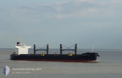
ATLANTIC ELM
Bulk Carrier
Current Trip
| Time Travelled | 19 h, 14 mins |
|---|---|
| Remaining Time | --- |
| Distance Travelled | 223.38 nm |
| Remaining Distance | --- |
| AVG Speed | 11.4 Knots |
| MAX Speed | 12.7 Knots |
| AVG Wind | 12.5 knots |
| MAX Wind | 17.3 knots |
| MIN Temp | 24.5°C / 76.1°F |
| MAX Temp | 26.2°C / 79.16°F |
| Draught | 8.3 m |
| Position Received | Now |
Current Position
| Longitude | -91.53018° |
|---|---|
| Latitude | 27.67554° |
| Status | Under way using engine |
| Speed | 1.9 Knots |
| Course | 99° |
| Area | Gulf of Mexico |
| Station | T-AIS |
| Position Received | Now |
Info
Information
The current position of ATLANTIC ELM is in Gulf of Mexico with coordinates 27.67554° / -91.53018° as reported on 2024-05-10 05:20 by AIS to our vessel tracker app. The vessel's current speed is 1.9 Knots and is heading at the port of NEW ORLEANS. The estimated time of arrival as calculated by MyShipTracking vessel tracking app is 2024-05-13 23:00 LT
The vessel ATLANTIC ELM (IMO: 9558244, MMSI: 229081000) is a Bulk Carrier that was built in 2012 ( 12 years old ). It's sailing under the flag of [MT] Malta.
In this page you can find informations about the vessels current position, last detected port calls, and current voyage information. If the vessels is not in coverage by AIS you will find the latest position.
The current position of ATLANTIC ELM is detected by our AIS receivers and we are not responsible for the reliability of the data. The last position was recorded while the vessel was in Coverage by the Ais receivers of our vessel tracking app.
The current draught of ATLANTIC ELM as reported by AIS is 8.3 meters
Weather
| Temperature | 25.7°C / 78.26°F |
|---|---|
| Wind Speed | 16 knots |
| Direction | 178° S |
| Pressure | 1008.4 hPa |
| Humidity | 93.5 % |
| Cloud Coverage | 11 % |
Featured Company
Last Port Calls
| Port | Arrival | Departure | Time In Port |
|---|---|---|---|
| 2024-04-24 22:37 | 2024-05-09 10:06 | 14 d | |
| 2024-03-03 22:25 | 2024-03-23 02:11 | 19 d |
Last Trips
| Origin | Departure | Destination | Arrival | Distance | |
|---|---|---|---|---|---|
| 2024-03-23 04:11 | 2024-04-24 17:37 | 7198.11 nm | |||
| 2024-02-24 06:51 | 2024-03-04 00:25 | 537.85 nm |
Events
| Time | Event | Details | Position / Dest | Info |
|---|---|---|---|---|
| 2024-05-10 05:03 | Status Changed | Under way using engine Default |
27.67199 / -91.53806
USMSY
|
Speed: 2.2 kn Course: 134° |
| 2024-05-10 04:58 | IN Coverage |
27.67202 / -91.53691
Gulf of Mexico
USMSY
|
Speed: 1.7 kn Course: 83.5° |
|
| 2024-05-10 03:46 | Status Changed | Default Under way using engine |
27.68167 / -91.79166
USMSY
|
Speed: 12.7 kn Course: 89° |
| 2024-05-10 03:38 | OUT of Coverage |
27.68205 / -91.82258
Gulf of Mexico
USMSY
|
Speed: 12.7 kn Course: 89° |
|
| 2024-05-10 03:33 | Status Changed | Under way using engine Default |
27.68172 / -91.84401
USMSY
|
Speed: 12.7 kn Course: 92° |
| 2024-05-10 02:55 | Status Changed | Default Under way using engine |
27.68430 / -91.99431
USMSY
|
Speed: 12.5 kn Course: 92.5° |
| 2024-05-10 02:13 | Status Changed | Under way using engine Default |
27.71309 / -92.14753
USMSY
|
Speed: 11.8 kn Course: 111° |
| 2024-05-10 02:06 | IN Coverage |
27.71228 / -92.14516
Gulf of Mexico
USMSY
|
Speed: 11.9 kn Course: 111.5° |
|
| 2024-05-09 22:13 | Status Changed | Default Under way using engine |
28.17617 / -92.84859
USMSY
|
Speed: 12.1 kn Course: 132.8° |
| 2024-05-09 22:07 | OUT of Coverage |
28.18982 / -92.86567
Gulf of Mexico
USMSY
|
Speed: 12.1 kn Course: 132.8° |