
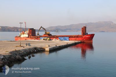
ATHLOS
General Cargo
Current Trip
| Time Travelled | 11 h, 1 mins |
|---|---|
| Remaining Time | 2 h, 35 mins |
| Distance Travelled | 89.99 nm |
| Remaining Distance | 22.55 nm |
| AVG Speed | 8.3 Knots |
| MAX Speed | 8.9 Knots |
| AVG Wind | 13.3 knots |
| MAX Wind | 16 knots |
| MIN Temp | 13°C / 55.4°F |
| MAX Temp | 16.8°C / 62.24°F |
| Draught | 3 m |
| Position Received | 9 m ago |
Current Position
| Longitude | --- |
|---|---|
| Latitude | --- |
| Status | Under way using engine |
| Speed | 8.3 Knots |
| Course | 117.3° |
| Area | Aegean Sea |
| Station | T-AIS |
| Position Received | 9 m ago |
Info
Information
The current position of ATHLOS is in Aegean Sea with coordinates 36.73797° / 26.72038° as reported on 2024-12-15 06:54 by AIS to our vessel tracker app. The vessel's current speed is 8.3 Knots and is heading at the port of GYALI. The estimated time of arrival as calculated by MyShipTracking vessel tracking app is 2024-12-15 11:39 LT
The vessel ATHLOS (IMO: 8500408, MMSI: 240317300) is a General Cargo that was built in 1985 ( 39 years old ). It's sailing under the flag of [GR] Greece.
In this page you can find informations about the vessels current position, last detected port calls, and current voyage information. If the vessels is not in coverage by AIS you will find the latest position.
The current position of ATHLOS is detected by our AIS receivers and we are not responsible for the reliability of the data. The last position was recorded while the vessel was in Coverage by the Ais receivers of our vessel tracking app.
The current draught of ATHLOS as reported by AIS is 3 meters
Weather
| Temperature | 16.5°C / 61.7°F |
|---|---|
| Wind Speed | 16 knots |
| Direction | 177° S |
| Pressure | 1023.6 hPa |
| Humidity | 70 % |
| Cloud Coverage | 57 % |
Featured Company
Last Port Calls
| Port | Arrival | Departure | Time In Port |
|---|---|---|---|
| 2024-12-14 15:16 | 2024-12-14 22:03 | 6 h | |
| 2024-12-13 13:22 | 2024-12-13 23:55 | 10 h | |
| 2024-12-11 10:54 | 2024-12-12 16:48 | 1 d | |
| 2024-12-08 00:24 | 2024-12-10 14:16 | 2 d | |
| 2024-12-07 08:21 | 2024-12-07 18:49 | 10 h | |
| 2024-12-06 01:18 | 2024-12-06 16:54 | 15 h | |
| 2024-12-04 12:38 | 2024-12-05 11:20 | 22 h | |
| 2024-12-03 02:05 | 2024-12-03 20:24 | 18 h | |
| 2024-12-02 07:43 | 2024-12-02 16:41 | 8 h | |
| 2024-12-01 19:22 |
Last Trips
| Origin | Departure | Destination | Arrival | Distance | |
|---|---|---|---|---|---|
| 2024-12-13 23:55 | 2024-12-14 15:16 | 115.18 nm | |||
| 2024-12-12 16:48 | 2024-12-13 13:22 | 161.29 nm | |||
| 2024-12-10 14:16 | 2024-12-11 10:54 | 136.22 nm | |||
| 2024-12-07 18:49 | 2024-12-08 00:24 | 46.83 nm | |||
| 2024-12-06 16:54 | 2024-12-07 08:21 | 47.54 nm | |||
| 2024-12-05 11:20 | 2024-12-06 01:18 | 120.02 nm | |||
| 2024-12-03 20:24 | 2024-12-04 12:38 | 117.53 nm | |||
| 2024-12-02 16:41 | 2024-12-03 02:05 | 77.05 nm | |||
| 2024-12-01 19:22 | 2024-12-02 07:43 | 70.36 nm | |||
| 2024-11-28 19:20 | 2024-11-29 07:15 | 76.43 nm |
Events
| Time | Event | Details | Position / Dest | Info |
|---|---|---|---|---|
| 2024-12-14 20:34 | Draught Changed | 3 4 |
37.51295 / 25.28921
GIALI
|
Speed: 8.5 kn Course: 358.3° |
| 2024-12-14 20:34 | Destination Changed | GIALI MYKONOS |
37.51295 / 25.28921
GIALI
|
Speed: 8.5 kn Course: 358.3° |
| 2024-12-14 20:34 | ETA Changed | 2024/12/15 08:00 2024/12/14 14:00 |
37.51295 / 25.28921
GIALI
|
Speed: 8.5 kn Course: 358.3° |
| 2024-12-14 20:03 | PORT DEPARTURE |
|
37.46125 / 25.31812
MYKONOS
|
Speed: 6.8 kn Course: 270° |
| 2024-12-14 20:00 | Status Changed | Under way using engine Moored |
37.46119 / 25.32420
[GR] MYKONOS
|
Speed: 1.4 kn Course: 343° |
| 2024-12-14 20:00 | START Moving |
37.46119 / 25.32420
[GR] MYKONOS
|
Speed: 3.2 kn Course: 268° |
|
| 2024-12-14 13:37 | Status Changed | Moored Under way using engine |
37.46269 / 25.32580
[GR] MYKONOS
|
Speed: Course: 356° |
| 2024-12-14 13:24 | STOP Moving |
37.46267 / 25.32572
[GR] MYKONOS
|
Speed: 0.2 kn Course: 0° |
|
| 2024-12-14 13:16 | PORT ARRIVAL |
|
37.46083 / 25.32166
[GR] MYKONOS
|
Speed: 3.5 kn Course: 64° |
| 2024-12-14 07:01 | Status Changed | Under way using engine Default |
37.50368 / 24.37124
MYKONOS
|
Speed: 6.8 kn Course: 87° |