
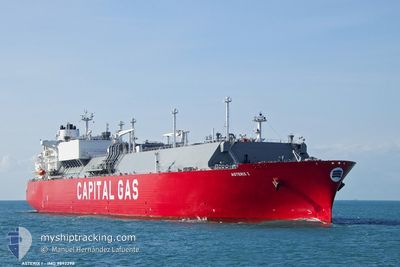
ASTERIX I
Tanker
Current Trip
GULF OF MEXICO
| Time Travelled | 53 days |
|---|---|
| Remaining Time | --- |
| Distance Travelled | 6559.47 nm |
| Remaining Distance | --- |
| AVG Speed | 13 Knots |
| MAX Speed | 19.8 Knots |
| AVG Wind | 13.1 knots |
| MAX Wind | 30.8 knots |
| MIN Temp | 10.3°C / 50.54°F |
| MAX Temp | 27.2°C / 80.96°F |
| Draught | 9.3 m |
| Position Received | 1 d ago |
Current Position
| Longitude | --- |
|---|---|
| Latitude | --- |
| Status | Under way using engine |
| Speed | 12.4 Knots |
| Course | 252° |
| Area | Strait of Gibraltar |
| Station | T-AIS |
| Position Received | 1 d ago |
Info
Information
The current position of ASTERIX I is in Strait of Gibraltar with coordinates 35.93201° / -5.91407° as reported on 2025-03-02 06:00 by AIS to our vessel tracker app. The vessel's current speed is 12.4 Knots
The vessel ASTERIX I (IMO: 9892298, MMSI: 241832000) is a Tanker It's sailing under the flag of [GR] Greece.
In this page you can find informations about the vessels current position, last detected port calls, and current voyage information. If the vessels is not in coverage by AIS you will find the latest position.
The current position of ASTERIX I is detected by our AIS receivers and we are not responsible for the reliability of the data. The last position was recorded while the vessel was in Coverage by the Ais receivers of our vessel tracking app.
The current draught of ASTERIX I as reported by AIS is 9.3 meters
Weather
| Temperature | 16°C / 60.8°F |
|---|---|
| Wind Speed | 2 knots |
| Direction | 153° SSE |
| Pressure | 1010.5 hPa |
| Humidity | 70.5 % |
| Cloud Coverage | 98 % |
Featured Company
Last Port Calls
| Port | Arrival | Departure | Time In Port |
|---|---|---|---|
| 2025-02-23 08:59 | 2025-02-23 18:01 | 9 h | |
| 2025-02-14 10:49 | 2025-02-14 19:53 | 9 h | |
| 2025-01-07 17:35 | 2025-01-08 18:59 | 1 d |
Most Visited Ports (Last year)
| Port | Arrivals | |
|---|---|---|
| 4 | ||
| 2 | ||
| 1 | ||
| 1 | ||
| 1 | ||
| 1 |
Last Trips
| Origin | Departure | Destination | Arrival | Distance | |
|---|---|---|---|---|---|
| 2025-01-08 18:59 | 2025-02-23 08:59 | 11295.34 nm | |||
| 2025-01-08 18:59 | 2025-02-14 10:49 | 11112.64 nm |
Events
| Time | Event | Details | Position / Dest | Info |
|---|---|---|---|---|
| 2025-03-02 06:04 | Status Changed | Default Under way using engine |
35.92672 / -5.92924
GULF OF MEXICO
|
Speed: 12.4 kn Course: 252° |
| 2025-03-02 06:00 | OUT of Coverage |
35.93201 / -5.91407
Strait of Gibraltar
GULF OF MEXICO
|
Speed: 12.4 kn Course: 252° |
|
| 2025-03-02 05:38 | Status Changed | Under way using engine Default |
35.93998 / -5.82291
GULF OF MEXICO
|
Speed: 12 kn Course: 267° |
| 2025-03-02 05:35 | Status Changed | Default Under way using engine |
35.94088 / -5.81050
GULF OF MEXICO
|
Speed: 11.6 kn Course: 262.5° |
| 2025-03-02 05:30 | Change Sea Area | Moroccan part of the Strait of Gibraltar Spanish part of the Strait of Gibraltar |
35.94258 / -5.79106
Strait of Gibraltar
GULF OF MEXICO
|
Speed: 11.6 kn Course: 262.5° |
| 2025-03-02 05:22 | Status Changed | Under way using engine Default |
35.94599 / -5.75923
GULF OF MEXICO
|
Speed: 12.5 kn Course: 260° |
| 2025-03-02 05:15 | Status Changed | Default Under way using engine |
35.94786 / -5.73107
GULF OF MEXICO
|
Speed: 11.9 kn Course: 264.1° |
| 2025-03-02 03:46 | Change Sea Area | Spanish part of the Strait of Gibraltar Gibraltarian part of the Strait of Gibraltar |
36.00990 / -5.33793
Strait of Gibraltar
GULF OF MEXICO
|
Speed: 13 kn Course: 253.6° |
| 2025-03-02 03:44 | Change Sea Area | Gibraltarian part of the Strait of Gibraltar Gibraltarian part of the Alboran Sea |
36.01195 / -5.32941
Strait of Gibraltar
GULF OF MEXICO
|
Speed: 13.1 kn Course: 254.1° |
| 2025-03-02 03:14 | Change Sea Area | Gibraltarian part of the Alboran Sea Spanish part of the Alboran Sea |
36.03131 / -5.19512
Alboran Sea
GULF OF MEXICO
|
Speed: 13.6 kn Course: 261.6° |