
ARTEMIS I
Tanker C
Current Trip
| Trip Time | 18 days |
|---|---|
| Trip Distance | 1057.10 nm |
| AVG Speed | 6.3 Knots |
| MAX Speed | 9 Knots |
| Draught | 1.4 m |
| AVG Wind | 6.2 knots |
| MAX Wind | 20.5 knots |
| MIN Temp | 0.1°C / 32.18°F |
| MAX Temp | 16.1°C / 60.98°F |
| Position Received | 1 m ago |
Current Position
| Longitude | --- |
|---|---|
| Latitude | --- |
| Status | Under way using engine |
| Speed | |
| Course | --- |
| Area | Black Sea |
| Station | T-AIS |
| Position Received | 1 m ago |
Info
Information
The current position of ARTEMIS I is in Black Sea with coordinates 48.13417° / 17.14958° as reported on 2025-12-07 06:23 by AIS to our vessel tracker app. The vessel's current speed is 0 Knots and is currently inside the port of BRATISLAVA.
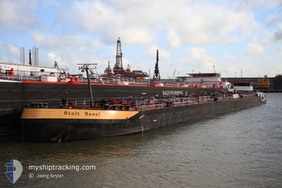
The vessel ARTEMIS I (MMSI: 264163388) is a Tanker C It's sailing under the flag of [RO] Romania.
In this page you can find informations about the vessels current position, last detected port calls, and current voyage information. If the vessels is not in coverage by AIS you will find the latest position.
The current position of ARTEMIS I is detected by our AIS receivers and we are not responsible for the reliability of the data. The last position was recorded while the vessel was in Coverage by the Ais receivers of our vessel tracking app.
The current draught of ARTEMIS I as reported by AIS is 1.4 meters
Weather
| Temperature | 5.7°C / 42.26°F |
|---|---|
| Wind Speed | 2 knots |
| Direction | 127° SE |
| Pressure | 1016.1 hPa |
| Humidity | 93.1 % |
| Cloud Coverage | 100 % |
Featured Company
Last Port Calls
| Port | Arrival | Departure | Time In Port |
|---|---|---|---|
| 2025-12-06 10:43 | |||
| 2025-11-16 07:12 | 2025-11-17 19:29 | 1 d | |
| 2025-11-10 11:27 | |||
| 2025-11-08 13:08 | 2025-11-09 12:51 | 23 h | |
| 2025-11-08 07:53 | 2025-11-08 12:50 | 4 h | |
| 2025-11-05 07:53 | 2025-11-07 01:41 | 1 d | |
| 2025-10-26 03:11 | 2025-10-29 02:17 | 3 d | |
| 2025-10-24 14:32 | 2025-10-25 03:20 | 12 h | |
| 2025-10-23 14:44 | 2025-10-24 14:16 | 23 h | |
| 2025-10-16 14:50 |
Most Visited Ports (Last year)
| Port | Arrivals | |
|---|---|---|
| 11 | ||
| 8 | ||
| 4 | ||
| 3 | ||
| 2 | ||
| 1 |
Last Trips
| Origin | Departure | Destination | Arrival | Distance | |
|---|---|---|---|---|---|
| 2025-11-17 19:29 | 2025-12-06 10:43 | 1057.10 nm | |||
| 2025-11-09 12:51 | 2025-11-16 07:12 | 230.97 nm | |||
| 2025-11-09 12:51 | 2025-11-10 11:27 | 63.81 nm | |||
| 2025-11-08 12:50 | 2025-11-08 13:08 | 1.87 nm | |||
| 2025-11-07 01:41 | 2025-11-08 07:53 | 83.73 nm | |||
| 2025-10-29 02:17 | 2025-11-05 07:53 | 336.20 nm | |||
| 2025-10-25 03:20 | 2025-10-26 03:11 | 83.30 nm | |||
| 2025-10-24 14:16 | 2025-10-24 14:32 | 1.22 nm | |||
| 2025-10-11 07:48 | 2025-10-23 14:44 | 565.25 nm | |||
| 2025-10-11 07:48 | 2025-10-16 14:50 | 335.08 nm |
Events
| Time | Event | Details | Position / Dest | Info |
|---|---|---|---|---|
| 2025-12-06 10:01 | STOP Moving |
48.13415 / 17.14959
[SK] BRATISLAVA
|
Speed: 0.3 kn Course: 511° |
|
| 2025-12-06 09:43 | PORT ARRIVAL |
|
48.11457 / 17.14230
[SK] BRATISLAVA
|
Speed: 6.9 kn Course: 43.6° |
| 2025-12-06 09:19 | START Moving | 3.67 nm, South of BRATISLAVA |
48.07984 / 17.15279
BRATISLAVA
|
Speed: 5.5 kn Course: 354.5° |
| 2025-12-05 12:05 | STOP Moving | 3.8 nm, South of BRATISLAVA |
48.07771 / 17.15344
BRATISLAVA
|
Speed: 0.3 kn Course: 511° |
| 2025-12-05 09:10 | START Moving | 13.2 nm, North West of GONYU |
47.88454 / 17.53789
BRATISLAVA
|
Speed: 6.8 kn Course: 317.8° |
| 2025-12-05 09:04 | STOP Moving | 13.07 nm, North West of GONYU |
47.88282 / 17.53979
BRATISLAVA
|
Speed: Course: 511° |
| 2025-12-05 08:45 | IN Coverage |
47.88246 / 17.54038
Black Sea
BRATISLAVA
|
Speed: 1.6 kn Course: 305° |
|
| 2025-12-05 07:44 | OUT of Coverage |
47.85581 / 17.56667
Black Sea
BRATISLAVA
|
Speed: 8.3 kn Course: 320.6° |
|
| 2025-12-05 07:44 | IN Coverage |
47.85581 / 17.56667
Black Sea
BRATISLAVA
|
Speed: 8.3 kn Course: 320.6° |
|
| 2025-12-04 20:04 | STOP Moving | 4.56 nm, West of KOMAROM |
47.75167 / 18.01500
BRATISLAVA
|
Speed: Course: -1° |