
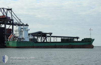
LONGWOLF
General Cargo
Current Trip
| Trip Time | 4 days |
|---|---|
| Trip Distance | 1031.33 nm |
| AVG Speed | 13 Knots |
| MAX Speed | 15.2 Knots |
| Draught | 5 m |
| AVG Wind | 7.3 knots |
| MAX Wind | 20.6 knots |
| MIN Temp | 10.5°C / 50.9°F |
| MAX Temp | 17.6°C / 63.68°F |
| Position Received | 3 d ago |
Current Position
| Longitude | 18.04065° |
|---|---|
| Latitude | 40.66523° |
| Status | Under way using engine |
| Speed | 12.1 Knots |
| Course | 265° |
| Area | Adriatic Sea |
| Station | T-AIS |
| Position Received | 3 d ago |
Info
Information
The current position of LONGWOLF is in Adriatic Sea with coordinates 40.66523° / 18.04065° as reported on 2024-04-23 04:01 by AIS to our vessel tracker app. The vessel's current speed is 12.1 Knots and is currently inside the port of BRINDISI.
The vessel LONGWOLF (IMO: 9504126, MMSI: 245543000) is a General Cargo that was built in 2010 ( 14 years old ). It's sailing under the flag of [NL] Netherlands.
In this page you can find informations about the vessels current position, last detected port calls, and current voyage information. If the vessels is not in coverage by AIS you will find the latest position.
The current position of LONGWOLF is detected by our AIS receivers and we are not responsible for the reliability of the data. The last position was recorded while the vessel was in Coverage by the Ais receivers of our vessel tracking app.
The current draught of LONGWOLF as reported by AIS is 5 meters
Weather
| Temperature | 15.2°C / 59.36°F |
|---|---|
| Wind Speed | 6 knots |
| Direction | 190° S |
| Pressure | 1015.5 hPa |
| Humidity | 66.9 % |
| Cloud Coverage | 100 % |
Featured Company
Last Port Calls
| Port | Arrival | Departure | Time In Port |
|---|---|---|---|
| 2024-04-23 04:19 | |||
| 2024-04-17 21:33 | 2024-04-18 18:28 | 20 h | |
| 2024-04-08 17:11 | 2024-04-13 11:08 | 4 d | |
| 2024-04-01 11:15 | 2024-04-02 21:57 | 1 d | |
| 2024-03-23 16:54 | 2024-03-28 12:26 | 4 d | |
| 2024-03-14 02:04 | 2024-03-15 05:30 | 1 d | |
| 2024-03-05 07:21 | 2024-03-07 22:45 | 2 d | |
| 2024-03-01 06:27 | 2024-03-02 11:32 | 1 d | |
| 2024-02-27 11:44 | 2024-02-28 13:21 | 1 d | |
| 2024-02-23 04:23 | 2024-02-26 21:42 | 3 d |
Last Trips
| Origin | Departure | Destination | Arrival | Distance | |
|---|---|---|---|---|---|
| 2024-04-18 20:28 | 2024-04-23 06:19 | 1031.33 nm | |||
| 2024-04-13 13:08 | 2024-04-17 23:33 | 1238.90 nm | |||
| 2024-04-02 23:57 | 2024-04-08 19:11 | 712.41 nm | |||
| 2024-03-28 13:26 | 2024-04-01 13:15 | 90.67 nm | |||
| 2024-03-15 06:30 | 2024-03-23 17:54 | 1704.26 nm | |||
| 2024-03-08 00:45 | 2024-03-14 03:04 | 1274.63 nm | |||
| 2024-03-02 12:32 | 2024-03-05 09:21 | 888.55 nm | |||
| 2024-02-28 15:21 | 2024-03-01 07:27 | 500.83 nm | |||
| 2024-02-26 22:42 | 2024-02-27 13:44 | 177.89 nm | |||
| 2024-02-20 02:59 | 2024-02-23 05:23 | 512.66 nm |
Events
| Time | Event | Details | Position / Dest | Info |
|---|---|---|---|---|
| 2024-04-23 04:19 | PORT ARRIVAL |
|
40.64783 / 17.96503
[IT] BRINDISI
|
Speed: 12.1 kn Course: 265° |
| 2024-04-23 04:01 | OUT of Coverage |
40.66523 / 18.04065
Adriatic Sea
ITBDS
|
Speed: 12.1 kn Course: 265° |
|
| 2024-04-23 03:40 | IN Coverage |
40.65953 / 18.11504
Adriatic Sea
ITBDS
|
Speed: 6 kn Course: 326.6° |
|
| 2024-04-23 01:18 | Status Changed | Default At anchor |
40.65231 / 18.11774
ITBDS
|
Speed: 0.1 kn Course: 345° |
| 2024-04-23 00:46 | OUT of Coverage |
40.65235 / 18.11771
Adriatic Sea
ITBDS
|
Speed: 0.1 kn Course: 165° |
|
| 2024-04-23 00:40 | Status Changed | At anchor Default |
40.65234 / 18.11769
ITBDS
|
Speed: Course: 352° |
| 2024-04-23 00:40 | IN Coverage |
40.65234 / 18.11769
Adriatic Sea
ITBDS
|
Speed: 0.1 kn Course: 78° |
|
| 2024-04-22 22:35 | Status Changed | Default At anchor |
40.65225 / 18.11721
ITBDS
|
Speed: Course: 0° |
| 2024-04-22 22:26 | Status Changed | At anchor Default |
40.65227 / 18.11723
ITBDS
|
Speed: 0.1 kn Course: 270° |
| 2024-04-22 22:26 | OUT of Coverage |
40.65227 / 18.11723
Adriatic Sea
ITBDS
|
Speed: Course: 0° |