
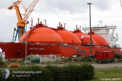
ARCTIC LADY
Lng Tanker
Current Trip
| Time Travelled | 22 days |
|---|---|
| Remaining Time | 4 h, 3 mins |
| Distance Travelled | 1586.69 nm |
| Remaining Distance | 39.87 nm |
| AVG Speed | 12.1 Knots |
| MAX Speed | 16.3 Knots |
| AVG Wind | 11 knots |
| MAX Wind | 24 knots |
| MIN Temp | 2.4°C / 36.32°F |
| MAX Temp | 13.1°C / 55.58°F |
| Draught | 9.8 m |
| Position Received | 1 m ago |
Current Position
| Longitude | 23.32250° |
|---|---|
| Latitude | 71.23821° |
| Status | Under way using engine |
| Speed | 9.5 Knots |
| Course | 180.2° |
| Area | Norwegian Sea |
| Station | T-AIS |
| Position Received | 1 m ago |
Info
Information
The current position of ARCTIC LADY is in Norwegian Sea with coordinates 71.23821° / 23.32250° as reported on 2024-05-13 04:47 by AIS to our vessel tracker app. The vessel's current speed is 9.5 Knots and is heading at the port of MELKOYA. The estimated time of arrival as calculated by MyShipTracking vessel tracking app is 2024-05-13 10:52 LT
The vessel ARCTIC LADY (IMO: 9284192, MMSI: 257742000) is a Lng Tanker that was built in 2006 ( 18 years old ). It's sailing under the flag of [NO] Norway.
In this page you can find informations about the vessels current position, last detected port calls, and current voyage information. If the vessels is not in coverage by AIS you will find the latest position.
The current position of ARCTIC LADY is detected by our AIS receivers and we are not responsible for the reliability of the data. The last position was recorded while the vessel was in Coverage by the Ais receivers of our vessel tracking app.
The current draught of ARCTIC LADY as reported by AIS is 9.8 meters
Weather
| Temperature | 4.1°C / 39.38°F |
|---|---|
| Wind Speed | 9 knots |
| Direction | 108° ESE |
| Pressure | 1017.5 hPa |
| Humidity | 86.9 % |
| Cloud Coverage | 100 % |
Featured Company
Most Visited Ports (Last year)
| Port | Arrivals | |
|---|---|---|
| 12 | ||
| 4 | ||
| 3 | ||
| 3 | ||
| 1 |
Events
| Time | Event | Details | Position / Dest | Info |
|---|---|---|---|---|
| 2024-05-11 19:19 | ETA Changed | 2024/05/13 06:00 2024/05/13 08:00 |
68.66452 / 11.70102
NOMLK
|
Speed: 10.3 kn Course: 49° |
| 2024-05-11 09:31 | Destination Changed | NOMLK NOHFT |
67.30714 / 9.02674
NOMLK
|
Speed: 10.6 kn Course: 24.9° |
| 2024-05-11 09:23 | Status Changed | Under way using engine Default |
67.28597 / 9.00064
NOHFT
|
Speed: 11 kn Course: 26° |
| 2024-05-11 09:20 | Status Changed | Default Under way using engine |
67.27834 / 8.99167
NOHFT
|
Speed: 10.9 kn Course: 27.7° |
| 2024-05-11 08:38 | Status Changed | Under way using engine Default |
67.16254 / 8.85821
NOHFT
|
Speed: 10.7 kn Course: 23° |
| 2024-05-11 08:20 | IN Coverage |
67.16254 / 8.85821
Norwegian Sea
NOHFT
|
Speed: 10.8 kn Course: 23.5° |
|
| 2024-05-11 07:50 | Status Changed | Default Under way using engine |
67.03333 / 8.71333
NOHFT
|
Speed: 10.6 kn Course: 25.4° |
| 2024-05-11 07:13 | Status Changed | Under way using engine Default |
66.93691 / 8.59915
NOHFT
|
Speed: 11 kn Course: 25° |
| 2024-05-11 07:13 | OUT of Coverage |
66.93691 / 8.59915
Norwegian Sea
NOHFT
|
Speed: 10.6 kn Course: 25.4° |
|
| 2024-05-11 07:08 | IN Coverage |
66.93691 / 8.59915
Norwegian Sea
NOHFT
|
Speed: 10.6 kn Course: 25.4° |