
AQUALIBRA
Cargo
Current Trip
GT PRQ
| Time Travelled | 18 h, 5 mins |
|---|---|
| Remaining Time | --- |
| Distance Travelled | 73.91 nm |
| Remaining Distance | --- |
| AVG Speed | 11.1 Knots |
| MAX Speed | 13.9 Knots |
| AVG Wind | 9.9 knots |
| MAX Wind | 21 knots |
| MIN Temp | 4.7°C / 40.46°F |
| MAX Temp | 7.5°C / 45.5°F |
| Draught | 10.8 m |
| Position Received | 2025-10-29 00:44 |
Current Position
| Longitude | --- |
|---|---|
| Latitude | --- |
| Status | Under way using engine |
| Speed | 11.7 Knots |
| Course | 284° |
| Area | North Pacific Ocean |
| Station | T-AIS |
| Position Received | 2025-10-29 00:44 |
Info
Information
The current position of AQUALIBRA is in North Pacific Ocean with coordinates 27.61037° / -128.85232° as reported on 2025-10-29 00:44 by AIS to our vessel tracker app. The vessel's current speed is 11.7 Knots
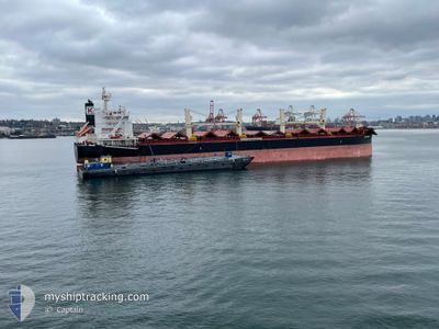
The vessel AQUALIBRA (IMO: 9765603, MMSI: 636018249) is a Cargo It's sailing under the flag of [LR] Liberia.
In this page you can find informations about the vessels current position, last detected port calls, and current voyage information. If the vessels is not in coverage by AIS you will find the latest position.
The current position of AQUALIBRA is detected by our AIS receivers and we are not responsible for the reliability of the data. The last position was recorded while the vessel was in Coverage by the Ais receivers of our vessel tracking app.
The current draught of AQUALIBRA as reported by AIS is 10.8 meters
Weather
| Temperature | 6.4°C / 43.52°F |
|---|---|
| Wind Speed | 21 knots |
| Direction | 239° WSW |
| Pressure | 1022.2 hPa |
| Humidity | 55.5 % |
| Cloud Coverage | 1 % |
Featured Company
Last Port Calls
| Port | Arrival | Departure | Time In Port |
|---|---|---|---|
| 2025-12-04 07:13 | 2025-12-05 18:40 | 1 d | |
| 2025-11-28 11:29 | 2025-12-01 02:00 | 2 d | |
| 2025-10-09 09:37 | 2025-10-23 17:08 | 14 d |
Most Visited Ports (Last year)
| Port | Arrivals | |
|---|---|---|
| 2 | ||
| 2 | ||
| 1 | ||
| 1 | ||
| 1 | ||
| 1 |
Last Trips
| Origin | Departure | Destination | Arrival | Distance | |
|---|---|---|---|---|---|
| 2025-12-01 02:00 | 2025-12-04 07:13 | 719.18 nm | |||
| 2025-10-23 17:08 | 2025-11-28 11:29 | 7842.60 nm | |||
| 2025-09-27 18:35 | 2025-10-09 09:37 | 3233.48 nm |
Events
| Time | Event | Details | Position / Dest | Info |
|---|---|---|---|---|
| 2025-12-05 09:40 | PORT DEPARTURE |
|
35.44587 / 129.38779
GT PRQ
|
Speed: 8.1 kn Course: 110° |
| 2025-12-05 09:25 | START Moving |
35.44226 / 129.36171
[KR] ONSAN
|
Speed: 3.3 kn Course: 16° |
|
| 2025-12-03 22:25 | STOP Moving |
35.44018 / 129.36058
[KR] ONSAN
|
Speed: 0.1 kn Course: 67° |
|
| 2025-12-03 22:13 | PORT ARRIVAL |
|
35.44009 / 129.36032
[KR] ONSAN
|
Speed: 2.8 kn Course: 126° |
| 2025-12-03 21:16 | START Moving | 3.54 nm, East of ONSAN |
35.41752 / 129.44530
GT PRQ
|
Speed: 4.5 kn Course: 267° |
| 2025-12-03 01:39 | STOP Moving | 3.73 nm, East of ONSAN |
35.41437 / 129.44814
GT PRQ
|
Speed: 0.2 kn Course: 302° |
| 2025-11-30 18:00 | PORT DEPARTURE |
|
39.16783 / 119.05009
GT PRQ
|
Speed: 11.3 kn Course: 135° |
| 2025-11-30 17:44 | START Moving |
39.19883 / 119.01009
[CN] JINGTANG
|
Speed: 4.1 kn Course: 133° |
|
| 2025-11-28 03:57 | STOP Moving |
39.20363 / 119.00872
[CN] JINGTANG
|
Speed: 0.3 kn Course: 303° |
|
| 2025-11-28 03:29 | PORT ARRIVAL |
|
39.18922 / 119.02268
[CN] JINGTANG
|
Speed: 7.7 kn Course: 316° |