
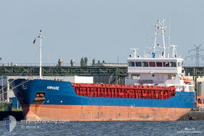
ANMARE
General Cargo
Current Trip
| Time Travelled | 16 days |
|---|---|
| Remaining Time | 9 h, 32 mins |
| Distance Travelled | 1372.53 nm |
| Remaining Distance | 77.66 nm |
| AVG Speed | 9.5 Knots |
| MAX Speed | 13.2 Knots |
| AVG Wind | 16.3 knots |
| MAX Wind | 28.6 knots |
| MIN Temp | 1.3°C / 34.34°F |
| MAX Temp | 12.6°C / 54.68°F |
| Draught | 4 m |
| Position Received | 2 m ago |
Current Position
| Longitude | -5.65820° |
|---|---|
| Latitude | 52.86154° |
| Status | Under way using engine |
| Speed | 8.1 Knots |
| Course | 357.2° |
| Area | Irish Sea and St. George's Channel |
| Station | T-AIS |
| Position Received | 2 m ago |
Info
Information
The current position of ANMARE is in Irish Sea and St. George's Channel with coordinates 52.86154° / -5.65820° as reported on 2024-04-26 04:12 by AIS to our vessel tracker app. The vessel's current speed is 8.1 Knots and is heading at the port of DUNDALK. The estimated time of arrival as calculated by MyShipTracking vessel tracking app is 2024-04-26 13:46 LT
The vessel ANMARE (IMO: 9434589, MMSI: 305493000) is a General Cargo that was built in 2009 ( 15 years old ). It's sailing under the flag of [AG] Antigua Barbuda.
In this page you can find informations about the vessels current position, last detected port calls, and current voyage information. If the vessels is not in coverage by AIS you will find the latest position.
The current position of ANMARE is detected by our AIS receivers and we are not responsible for the reliability of the data. The last position was recorded while the vessel was in Coverage by the Ais receivers of our vessel tracking app.
The current draught of ANMARE as reported by AIS is 4 meters
Weather
| Temperature | 8.1°C / 46.58°F |
|---|---|
| Wind Speed | 11 knots |
| Direction | 74° ENE |
| Pressure | 1002.8 hPa |
| Humidity | 66.6 % |
| Cloud Coverage | 100 % |
Featured Company
Last Port Calls
| Port | Arrival | Departure | Time In Port |
|---|---|---|---|
| 2024-04-09 04:39 | 2024-04-09 21:41 | 17 h | |
| 2024-03-23 15:26 | 2024-03-25 12:41 | 1 d | |
| 2024-03-22 06:14 | 2024-03-23 06:30 | 1 d | |
| 2024-03-20 05:43 | 2024-03-21 14:01 | 1 d | |
| 2024-03-18 17:30 | |||
| 2024-03-13 11:07 | |||
| 2024-03-09 14:23 | |||
| 2024-02-21 16:09 | 2024-02-24 10:35 | 2 d | |
| 2024-02-17 14:14 | 2024-02-20 22:36 | 3 d | |
| 2024-02-15 20:00 | 2024-02-17 13:52 | 1 d |
Most Visited Ports (Last year)
| Port | Arrivals | |
|---|---|---|
| 12 | ||
| 4 | ||
| 2 | ||
| 2 | ||
| 2 | ||
| 2 |
Last Trips
| Origin | Departure | Destination | Arrival | Distance | |
|---|---|---|---|---|---|
| 2024-03-25 13:41 | 2024-04-09 06:39 | 3101.56 nm | |||
| 2024-03-23 07:30 | 2024-03-23 16:26 | 61.75 nm | |||
| 2024-03-21 15:01 | 2024-03-22 07:14 | 60.18 nm | |||
| 2024-03-18 18:30 | 2024-03-20 06:43 | 281.70 nm | |||
| 2024-02-20 23:36 | 2024-02-21 17:09 | 143.87 nm | |||
| 2024-02-17 14:52 | 2024-02-17 15:14 | 2.48 nm | |||
| 2024-02-14 21:10 | 2024-02-15 21:00 | 198.23 nm | |||
| 2024-02-10 23:32 | 2024-02-12 19:14 | 406.99 nm | |||
| 2024-02-07 11:12 | 2024-02-09 23:34 | 441.44 nm | |||
| 2024-02-06 16:54 | 2024-02-07 06:12 | 62.24 nm |
Events
| Time | Event | Details | Position / Dest | Info |
|---|---|---|---|---|
| 2024-04-26 03:55 | Change Sea Area | Irish part of the Irish Sea and St. George's Channel United Kingdom part of the English Channel |
52.82515 / -5.65432
Irish Sea and St. George's Channel
DUNDALK
|
Speed: 8 kn Course: 357° |
| 2024-04-26 03:53 | Status Changed | Under way using engine Default |
52.81921 / -5.65368
DUNDALK
|
Speed: 8 kn Course: 356° |
| 2024-04-26 03:46 | IN Coverage |
52.82515 / -5.65432
Irish Sea and St. George's Channel
DUNDALK
|
Speed: 8 kn Course: 357° |
|
| 2024-04-25 08:06 | Status Changed | Default Under way using engine |
49.90027 / -5.01608
DUNDALK
|
Speed: 9.7 kn Course: 264.6° |
| 2024-04-25 08:00 | Status Changed | Under way using engine Default |
49.90172 / -4.98993
DUNDALK
|
Speed: 9.4 kn Course: 264° |
| 2024-04-25 08:00 | OUT of Coverage |
49.90172 / -4.98993
English Channel
DUNDALK
|
Speed: 9.7 kn Course: 264.6° |
|
| 2024-04-25 07:42 | Status Changed | Default Under way using engine |
49.90548 / -4.91759
DUNDALK
|
Speed: 9.3 kn Course: 265.3° |
| 2024-04-25 07:37 | Status Changed | Under way using engine Default |
49.90662 / -4.89421
DUNDALK
|
Speed: 9.3 kn Course: 266° |
| 2024-04-25 07:18 | Status Changed | Default Under way using engine |
49.91065 / -4.82047
DUNDALK
|
Speed: 9 kn Course: 254.7° |
| 2024-04-25 07:11 | Status Changed | Under way using engine Default |
49.91525 / -4.79304
DUNDALK
|
Speed: 9 kn Course: 254° |