
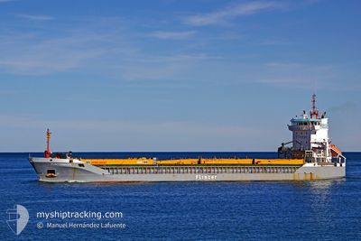
ANGELO
General Cargo
Current Trip
| Time Travelled | 9 h, 35 mins |
|---|---|
| Remaining Time | 5 days |
| Distance Travelled | 100.26 nm |
| Remaining Distance | 1474.40 nm |
| AVG Speed | 10.3 Knots |
| MAX Speed | 12 Knots |
| AVG Wind | 12.7 knots |
| MAX Wind | 14.2 knots |
| MIN Temp | 17.3°C / 63.14°F |
| MAX Temp | 19.8°C / 67.64°F |
| Draught | 5.9 m |
| Position Received | 1 m ago |
Current Position
| Longitude | 15.99120° |
|---|---|
| Latitude | 42.15270° |
| Status | Under way using engine |
| Speed | 11.3 Knots |
| Course | 139.6° |
| Area | Adriatic Sea |
| Station | T-AIS |
| Position Received | 1 m ago |
Info
Information
The current position of ANGELO is in Adriatic Sea with coordinates 42.15270° / 15.99120° as reported on 2024-05-08 23:02 by AIS to our vessel tracker app. The vessel's current speed is 11.3 Knots and is heading at the port of NEMRUT. The estimated time of arrival as calculated by MyShipTracking vessel tracking app is 2024-05-14 11:01 LT
The vessel ANGELO (IMO: 9180877, MMSI: 305791000) is a General Cargo that was built in 1999 ( 25 years old ). It's sailing under the flag of [AG] Antigua Barbuda.
In this page you can find informations about the vessels current position, last detected port calls, and current voyage information. If the vessels is not in coverage by AIS you will find the latest position.
The current position of ANGELO is detected by our AIS receivers and we are not responsible for the reliability of the data. The last position was recorded while the vessel was in Coverage by the Ais receivers of our vessel tracking app.
The current draught of ANGELO as reported by AIS is 5.9 meters
Weather
| Temperature | 17.5°C / 63.5°F |
|---|---|
| Wind Speed | 13 knots |
| Direction | 306° NW |
| Pressure | 1014.5 hPa |
| Humidity | 86 % |
| Cloud Coverage | 93 % |
Featured Company
Last Port Calls
| Port | Arrival | Departure | Time In Port |
|---|---|---|---|
| 2024-04-26 14:59 | 2024-05-08 13:28 | 11 d | |
| 2024-04-19 10:23 | 2024-04-19 10:25 | 2 m | |
| 2024-04-08 15:21 | 2024-04-10 19:01 | 2 d | |
| 2024-03-11 11:55 | 2024-03-13 18:41 | 2 d | |
| 2024-03-07 15:54 | 2024-03-08 05:23 | 13 h | |
| 2024-03-06 08:38 | |||
| 2024-03-01 14:46 | 2024-03-01 16:03 | 1 h |
Last Trips
| Origin | Departure | Destination | Arrival | Distance | |
|---|---|---|---|---|---|
| 2024-04-19 12:25 | 2024-04-26 16:59 | 223.78 nm | |||
| 2024-04-10 22:01 | 2024-04-19 12:23 | 1367.59 nm | |||
| 2024-03-13 21:41 | 2024-04-08 18:21 | 2429.49 nm | |||
| 2024-03-08 07:23 | 2024-03-11 14:55 | 754.07 nm | |||
| 2024-03-01 19:03 | 2024-03-06 10:38 | 850.01 nm | |||
| 2024-02-28 07:56 | 2024-03-01 17:46 | 339.98 nm |
Events
| Time | Event | Details | Position / Dest | Info |
|---|---|---|---|---|
| 2024-05-08 21:11 | Detected in Sea | Italian part of the Adriatic Sea |
42.47088 / 15.80641
Adriatic Sea
TRNEM
|
Speed: 11.7 kn Course: 160.5° |
| 2024-05-08 17:40 | Draught Changed | 5.9 4.2 |
43.04749 / 15.59033
TRNEM
|
Speed: 9.8 kn Course: 194.3° |
| 2024-05-08 17:40 | Destination Changed | TRNEM HRSIB |
43.04749 / 15.59033
TRNEM
|
Speed: 9.8 kn Course: 194.3° |
| 2024-05-08 17:40 | ETA Changed | 2024/05/12 04:00 2024/04/26 15:00 |
43.04749 / 15.59033
TRNEM
|
Speed: 9.8 kn Course: 194.3° |
| 2024-05-08 17:38 | Status Changed | Under way using engine Default |
43.05281 / 15.59214
HRSIB
|
Speed: 9 kn Course: 197° |
| 2024-05-08 17:38 | IN Coverage |
43.04482 / 15.58946
Adriatic Sea
TRNEM
|
Speed: 9.8 kn Course: 193.4° |
|
| 2024-05-08 13:29 | START Moving | 0.67 nm, East of JADRIJA |
43.72666 / 15.86500
HRSIB
|
Speed: 10 kn Course: -1° |
| 2024-05-08 13:28 | PORT DEPARTURE |
|
43.72666 / 15.86500
HRSIB
|
Speed: 2.3 kn Course: 298° |
| 2024-05-08 11:50 | Status Changed | Default Moored |
43.72718 / 15.89885
[HR] SIBENIK
|
Speed: Course: 139° |
| 2024-05-08 11:47 | OUT of Coverage |
43.72716 / 15.89883
Adriatic Sea
[HR] SIBENIK
|
Speed: Course: 300.2° |