
AMRUMBANK
Fishing
Current Trip
| Trip Time | 9 days |
|---|---|
| Trip Distance | 358.55 nm |
| AVG Speed | 8.6 Knots |
| MAX Speed | 10 Knots |
| Draught | 0 m |
| AVG Wind | 22.5 knots |
| MAX Wind | 25.8 knots |
| MIN Temp | 13.5°C / 56.3°F |
| MAX Temp | 16.2°C / 61.16°F |
| Position Received | 2 m ago |
Current Position
| Longitude | 8.22344° |
|---|---|
| Latitude | 56.70311° |
| Status | Moored |
| Speed | |
| Course | 83° |
| Area | North Sea |
| Station | T-AIS |
| Position Received | 2 m ago |
Info
Information
The current position of AMRUMBANK is in North Sea with coordinates 56.70311° / 8.22344° as reported on 2024-07-27 05:52 by AIS to our vessel tracker app. The vessel's current speed is 0 Knots and is currently inside the port of THYBORON.
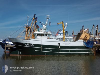
The vessel AMRUMBANK (IMO: 9833046, MMSI: 211801150) is a Fishing It's sailing under the flag of [DE] Germany.
In this page you can find informations about the vessels current position, last detected port calls, and current voyage information. If the vessels is not in coverage by AIS you will find the latest position.
The current position of AMRUMBANK is detected by our AIS receivers and we are not responsible for the reliability of the data. The last position was recorded while the vessel was in Coverage by the Ais receivers of our vessel tracking app.
Weather
| Temperature | 14.9°C / 58.82°F |
|---|---|
| Wind Speed | 11 knots |
| Direction | 270° W |
| Pressure | 1011 hPa |
| Humidity | 79.8 % |
| Cloud Coverage | 13 % |
Featured Company
Last Port Calls
| Port | Arrival | Departure | Time In Port |
|---|---|---|---|
| 2024-07-24 12:53 | |||
| 2024-07-12 13:13 | 2024-07-15 08:41 | 2 d | |
| 2024-07-05 03:23 | 2024-07-08 09:27 | 3 d | |
| 2024-06-27 04:10 | 2024-07-01 01:50 | 3 d | |
| 2024-06-26 05:04 | 2024-06-27 04:07 | 23 h | |
| 2024-06-10 07:19 | 2024-06-16 23:35 | 6 d | |
| 2024-05-29 09:44 | 2024-06-03 02:26 | 4 d | |
| 2024-05-14 17:55 | 2024-05-21 08:43 | 6 d | |
| 2024-05-01 16:10 | 2024-05-06 16:27 | 5 d |
Most Visited Ports (Last year)
| Port | Arrivals | |
|---|---|---|
| 11 | ||
| 8 | ||
| 7 | ||
| 4 | ||
| 2 | ||
| 2 |
Last Trips
| Origin | Departure | Destination | Arrival | Distance | |
|---|---|---|---|---|---|
| 2024-07-15 08:41 | 2024-07-24 12:53 | 358.55 nm | |||
| 2024-07-08 09:27 | 2024-07-12 13:13 | 426.72 nm | |||
| 2024-07-01 01:50 | 2024-07-05 03:23 | 290.04 nm | |||
| 2024-06-27 04:07 | 2024-06-27 04:10 | 3.28 nm | |||
| 2024-06-16 23:35 | 2024-06-26 05:04 | 217.68 nm | |||
| 2024-06-03 02:26 | 2024-06-10 07:19 | 86.54 nm | |||
| 2024-05-21 08:43 | 2024-05-29 09:44 | 662.05 nm | |||
| 2024-05-06 16:27 | 2024-05-14 17:55 | 485.98 nm | |||
| 2024-04-22 08:46 | 2024-05-01 16:10 | 331.38 nm |
Events
| Time | Event | Details | Position / Dest | Info |
|---|---|---|---|---|
| 2024-07-24 11:04 | Status Changed | Moored Under way using engine |
56.70284 / 8.22145
[DK] THYBORON
|
Speed: Course: 264° |
| 2024-07-24 10:59 | STOP Moving |
56.70268 / 8.22129
[DK] THYBORON
|
Speed: 0.3 kn Course: 246° |
|
| 2024-07-24 10:53 | PORT ARRIVAL |
|
56.69995 / 8.22588
[DK] THYBORON
|
Speed: 5.5 kn Course: 268.1° |
| 2024-07-24 06:28 | Destination Changed | THYBORON (DK) FISHING GROUNDS |
56.76696 / 7.03743
THYBORON (DK)
|
Speed: 9 kn Course: 91.7° |
| 2024-07-24 04:07 | Change Sea Area | Danish part of the North Sea Norwegian part of the North Sea |
56.77138 / 6.42285
North Sea
|
Speed: 8.4 kn Course: 95.5° |
| 2024-07-24 04:05 | IN Coverage |
56.77138 / 6.42285
North Sea
|
Speed: 8.4 kn Course: 95.5° |
|
| 2024-07-23 15:27 | OUT of Coverage |
57.01962 / 4.18907
North Sea
|
Speed: 3.5 kn Course: 169.8° |
|
| 2024-07-23 13:42 | IN Coverage |
57.12085 / 4.19124
North Sea
|
Speed: 3.6 kn Course: 185.1° |
|
| 2024-07-23 12:39 | OUT of Coverage |
57.18231 / 4.19820
North Sea
|
Speed: 3.5 kn Course: 184.7° |
|
| 2024-07-23 11:38 | IN Coverage |
57.24164 / 4.19650
North Sea
|
Speed: 3.6 kn Course: 171.5° |