
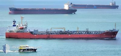
AMAGI GALAXY
Oil/Chemical Tanker
Current Trip
TH MAT
| Time Travelled | 2 days |
|---|---|
| Remaining Time | --- |
| Distance Travelled | 672.48 nm |
| Remaining Distance | --- |
| AVG Speed | 14.1 Knots |
| MAX Speed | 15.1 Knots |
| AVG Wind | 8.6 knots |
| MAX Wind | 12.1 knots |
| MIN Temp | 29.4°C / 84.92°F |
| MAX Temp | 30.3°C / 86.54°F |
| Draught | 10.1 m |
| Position Received | 4 d ago |
Current Position
| Longitude | 101.15497° |
|---|---|
| Latitude | 12.62640° |
| Status | Under way using engine |
| Speed | 10.7 Knots |
| Course | 359° |
| Area | Gulf of Thailand |
| Station | T-AIS |
| Position Received | 4 d ago |
Info
Information
The current position of AMAGI GALAXY is in Gulf of Thailand with coordinates 12.62640° / 101.15497° as reported on 2024-04-21 16:09 by AIS to our vessel tracker app. The vessel's current speed is 10.7 Knots
The vessel AMAGI GALAXY (IMO: 9490313, MMSI: 538004105) is a Oil/Chemical Tanker that was built in 2010 ( 14 years old ). It's sailing under the flag of [MH] Marshall Is.
In this page you can find informations about the vessels current position, last detected port calls, and current voyage information. If the vessels is not in coverage by AIS you will find the latest position.
The current position of AMAGI GALAXY is detected by our AIS receivers and we are not responsible for the reliability of the data. The last position was recorded while the vessel was in Coverage by the Ais receivers of our vessel tracking app.
The current draught of AMAGI GALAXY as reported by AIS is 10.1 meters
Weather
| Temperature | 29.7°C / 85.46°F |
|---|---|
| Wind Speed | 9 knots |
| Direction | 149° SSE |
| Pressure | 1006.6 hPa |
| Humidity | 73.9 % |
| Cloud Coverage | 81 % |
Featured Company
Last Port Calls
| Port | Arrival | Departure | Time In Port |
|---|---|---|---|
| 2024-04-23 00:28 | 2024-04-24 03:40 | 1 d | |
| 2024-04-21 16:19 | 2024-04-22 16:40 | 1 d | |
| 2024-04-17 15:40 | 2024-04-18 15:02 | 23 h | |
| 2024-03-28 21:44 | 2024-03-30 21:14 | 1 d | |
| 2024-03-18 18:01 | 2024-03-20 19:26 | 2 d | |
| 2024-03-14 09:52 | 2024-03-17 00:24 | 2 d | |
| 2024-03-02 12:38 | 2024-03-03 15:17 | 1 d | |
| 2024-02-22 03:23 | 2024-02-23 08:07 | 1 d | |
| 2024-02-17 13:23 | 2024-02-18 19:59 | 1 d | |
| 2024-02-01 14:47 |
Most Visited Ports (Last year)
| Port | Arrivals | |
|---|---|---|
| 4 | ||
| 4 | ||
| 4 | ||
| 3 | ||
| 3 | ||
| 3 |
Last Trips
| Origin | Departure | Destination | Arrival | Distance | |
|---|---|---|---|---|---|
| 2024-04-22 23:40 | 2024-04-23 07:28 | 10.62 nm | |||
| 2024-04-18 23:02 | 2024-04-21 23:19 | 821.82 nm | |||
| 2024-03-31 00:14 | 2024-04-17 23:40 | 4097.27 nm | |||
| 2024-03-20 23:26 | 2024-03-29 00:44 | 1352.72 nm | |||
| 2024-03-17 03:24 | 2024-03-18 22:01 | 318.30 nm | |||
| 2024-03-03 20:47 | 2024-03-14 12:52 | 1559.42 nm | |||
| 2024-02-23 13:37 | 2024-03-02 18:08 | 983.65 nm | |||
| 2024-02-19 01:29 | 2024-02-22 08:53 | 631.87 nm | |||
| 2024-02-01 23:47 | 2024-02-17 18:53 | 4269.58 nm |
Events
| Time | Event | Details | Position / Dest | Info |
|---|---|---|---|---|
| 2024-04-24 03:40 | PORT DEPARTURE |
|
12.62910 / 101.15505
TH MAT
|
Speed: 9.2 kn Course: 161° |
| 2024-04-24 03:28 | START Moving |
12.65275 / 101.14817
[TH] MAP TA PHUT
|
Speed: 3.8 kn Course: 152° |
|
| 2024-04-23 00:32 | STOP Moving |
12.65522 / 101.14449
[TH] MAP TA PHUT
|
Speed: 0.3 kn Course: 131° |
|
| 2024-04-23 00:28 | PORT ARRIVAL |
|
12.65533 / 101.14481
[TH] MAP TA PHUT
|
Speed: 1 kn Course: 143° |
| 2024-04-22 23:09 | START Moving | 4.86 nm, South East of MAP TA PHUT |
12.59167 / 101.20413
TH MAT
|
Speed: 4 kn Course: 275° |
| 2024-04-22 17:38 | STOP Moving | 5 nm, South East of MAP TA PHUT |
12.59335 / 101.20927
TH MAT
|
Speed: 0.1 kn Course: 146° |
| 2024-04-22 16:40 | PORT DEPARTURE |
|
12.62777 / 101.15518
TH MAT
|
Speed: 5.8 kn Course: 166° |
| 2024-04-22 16:21 | START Moving |
12.65422 / 101.15048
[TH] MAP TA PHUT
|
Speed: 3.2 kn Course: 195° |
|
| 2024-04-21 17:03 | Status Changed | Default Under way using engine |
12.65510 / 101.15500
[TH] MAP TA PHUT
|
Speed: 10.7 kn Course: 359° |
| 2024-04-21 16:09 | OUT of Coverage |
12.62640 / 101.15497
Gulf of Thailand
[TH] MAP TA PHUT
|
Speed: 10.7 kn Course: 359° |