
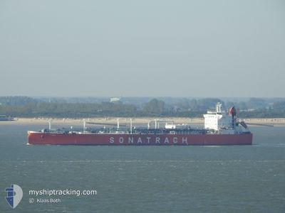
ALRAR
Lpg Tanker
Current Trip
| Time Travelled | 1 day |
|---|---|
| Remaining Time | 2 h, 28 mins |
| Distance Travelled | 482.02 nm |
| Remaining Distance | 253.32 nm |
| AVG Speed | 13.6 Knots |
| MAX Speed | 14.6 Knots |
| AVG Wind | 15.3 knots |
| MAX Wind | 25 knots |
| MIN Temp | 9.5°C / 49.1°F |
| MAX Temp | 19.6°C / 67.28°F |
| Draught | 6.3 m |
| Position Received | 15 h, 41 m ago |
Current Position
| Longitude | --- |
|---|---|
| Latitude | --- |
| Status | Under way using engine |
| Speed | 12.9 Knots |
| Course | 81.5° |
| Area | Mediterranean Sea - Eastern Basin |
| Station | T-AIS |
| Position Received | 15 h, 41 m ago |
Info
Information
The current position of ALRAR is in Mediterranean Sea - Eastern Basin with coordinates 35.94679° / 29.80873° as reported on 2025-12-11 11:02 by AIS to our vessel tracker app. The vessel's current speed is 12.9 Knots and is heading at the port of ALANYA. The estimated time of arrival as calculated by MyShipTracking vessel tracking app is 2025-12-12 08:12 LT
The vessel ALRAR (IMO: 9284013, MMSI: 636012377) is a Lpg Tanker that was built in 2004 ( 21 years old ). It's sailing under the flag of [LR] Liberia.
In this page you can find informations about the vessels current position, last detected port calls, and current voyage information. If the vessels is not in coverage by AIS you will find the latest position.
The current position of ALRAR is detected by our AIS receivers and we are not responsible for the reliability of the data. The last position was recorded while the vessel was in Coverage by the Ais receivers of our vessel tracking app.
The current draught of ALRAR as reported by AIS is 6.3 meters
Weather
| Temperature | 14.3°C / 57.74°F |
|---|---|
| Wind Speed | 6 knots |
| Direction | 45° NE |
| Pressure | 1015.1 hPa |
| Humidity | 46.2 % |
| Cloud Coverage | --- |
Featured Company
Last Port Calls
| Port | Arrival | Departure | Time In Port |
|---|---|---|---|
| 2025-12-09 09:09 | 2025-12-10 11:29 | 1 d | |
| 2025-11-25 18:25 | 2025-11-27 16:01 | 1 d | |
| 2025-11-10 08:58 | 2025-11-15 23:28 | 5 d | |
| 2025-11-01 15:40 | 2025-11-03 20:22 | 2 d | |
| 2025-10-23 07:00 | 2025-10-25 17:02 | 2 d | |
| 2025-10-15 13:43 | 2025-10-18 04:32 | 2 d | |
| 2025-10-03 19:53 | 2025-10-05 16:21 | 1 d |
Last Trips
| Origin | Departure | Destination | Arrival | Distance | |
|---|---|---|---|---|---|
| 2025-11-27 16:01 | 2025-12-09 09:09 | 2592.17 nm | |||
| 2025-11-15 23:28 | 2025-11-25 18:25 | 1950.52 nm | |||
| 2025-11-03 20:22 | 2025-11-10 08:58 | 1672.54 nm | |||
| 2025-10-25 17:02 | 2025-11-01 15:40 | 1936.31 nm | |||
| 2025-10-18 04:32 | 2025-10-23 07:00 | 929.92 nm | |||
| 2025-10-05 16:21 | 2025-10-15 13:43 | 1675.65 nm | |||
| 2025-09-23 15:37 | 2025-10-03 19:53 | 1834.30 nm |
Events
| Time | Event | Details | Position / Dest | Info |
|---|---|---|---|---|
| 2025-12-11 20:30 | STOP Moving | 14.6 nm, South East of ALANYA |
36.33833 / 32.17833
TR ALI>TR ALA
|
Speed: Course: -1° |
| 2025-12-11 11:04 | Status Changed | Default Under way using engine |
35.94772 / 29.81820
TR ALI>TR ALA
|
Speed: 12.9 kn Course: 81.5° |
| 2025-12-11 11:02 | OUT of Coverage |
35.94679 / 29.80873
Mediterranean Sea - Eastern Basin
TR ALI>TR ALA
|
Speed: 12.9 kn Course: 81.5° |
|
| 2025-12-11 10:57 | Detected in Sea | Turkish part of the Mediterranean Sea - Eastern Basin |
35.94311 / 29.78390
Mediterranean Sea - Eastern Basin
TR ALI>TR ALA
|
Speed: 13 kn Course: 80.6° |
| 2025-12-11 10:16 | Detected in Sea | Greek part of the Mediterranean Sea - Eastern Basin |
35.91662 / 29.60365
Mediterranean Sea - Eastern Basin
TR ALI>TR ALA
|
Speed: 13.6 kn Course: 83.1° |
| 2025-12-11 10:13 | IN Coverage |
35.91662 / 29.60365
Mediterranean Sea - Eastern Basin
TR ALI>TR ALA
|
Speed: 13.6 kn Course: 83.1° |
|
| 2025-12-11 10:10 | Status Changed | Under way using engine Default |
35.91398 / 29.57652
TR ALI>TR ALA
|
Speed: 13.7 kn Course: 83° |
| 2025-12-10 23:33 | Status Changed | Default Under way using engine |
36.39424 / 26.91985
TR ALI>TR ALA
|
Speed: 13.7 kn Course: 130.7° |
| 2025-12-10 23:27 | OUT of Coverage |
36.41170 / 26.89875
Aegean Sea
TR ALI>TR ALA
|
Speed: 13.7 kn Course: 130.7° |
|
| 2025-12-10 23:27 | Status Changed | Under way using engine Default |
36.41251 / 26.89752
TR ALI>TR ALA
|
Speed: 13 kn Course: 129° |