
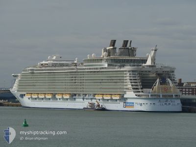
ALLURE OF THE SEAS
Passengers Ship
Current Trip
SAN JUAN
| Time Travelled | 13 h, 13 mins |
|---|---|
| Remaining Time | --- |
| Distance Travelled | 282.70 nm |
| Remaining Distance | --- |
| AVG Speed | 21.9 Knots |
| MAX Speed | 23.1 Knots |
| AVG Wind | 13.1 knots |
| MAX Wind | 19.5 knots |
| MIN Temp | 26.6°C / 79.88°F |
| MAX Temp | 28.6°C / 83.48°F |
| Draught | 9.3 m |
| Position Received | 1 d ago |
Current Position
| Longitude | --- |
|---|---|
| Latitude | --- |
| Status | Under way using engine |
| Speed | 16.3 Knots |
| Course | 280.4° |
| Area | Caribbean Sea |
| Station | T-AIS |
| Position Received | 1 d ago |
Info
Information
The current position of ALLURE OF THE SEAS is in Caribbean Sea with coordinates 18.52987° / -65.63962° as reported on 2025-12-11 08:06 by AIS to our vessel tracker app. The vessel's current speed is 16.3 Knots
The vessel ALLURE OF THE SEAS (IMO: 9383948, MMSI: 311020700) is a Passengers Ship that was built in 2010 ( 15 years old ). It's sailing under the flag of [BS] Bahamas.
In this page you can find informations about the vessels current position, last detected port calls, and current voyage information. If the vessels is not in coverage by AIS you will find the latest position.
The current position of ALLURE OF THE SEAS is detected by our AIS receivers and we are not responsible for the reliability of the data. The last position was recorded while the vessel was in Coverage by the Ais receivers of our vessel tracking app.
The current draught of ALLURE OF THE SEAS as reported by AIS is 9.3 meters
Weather
| Temperature | 26.8°C / 80.24°F |
|---|---|
| Wind Speed | 12 knots |
| Direction | 125° SE |
| Pressure | 1014.9 hPa |
| Humidity | 76.1 % |
| Cloud Coverage | 1 % |
Featured Company
Last Port Calls
| Port | Arrival | Departure | Time In Port |
|---|---|---|---|
| 2025-12-11 06:16 | 2025-12-11 16:35 | 10 h | |
| 2025-12-10 07:42 | 2025-12-10 19:10 | 11 h | |
| 2025-12-06 05:27 | 2025-12-06 17:11 | 11 h | |
| 2025-12-04 06:13 | 2025-12-04 18:18 | 12 h | |
| 2025-12-03 14:01 | 2025-12-03 17:25 | 3 h | |
| 2025-12-01 06:30 | 2025-12-01 15:37 | 9 h | |
| 2025-11-30 05:39 | 2025-11-30 17:27 | 11 h | |
| 2025-11-29 18:04 | 2025-11-29 19:15 | 1 h | |
| 2025-11-27 07:17 | 2025-11-27 16:42 | 9 h | |
| 2025-11-26 08:14 | 2025-11-26 19:28 | 11 h |
Most Visited Ports (Last year)
| Port | Arrivals | |
|---|---|---|
| 31 | ||
| 30 | ||
| 28 | ||
| 27 | ||
| 27 | ||
| 17 |
Last Trips
| Origin | Departure | Destination | Arrival | Distance | |
|---|---|---|---|---|---|
| 2025-12-10 19:10 | 2025-12-11 06:16 | 188.56 nm | |||
| 2025-12-06 17:11 | 2025-12-10 07:42 | 1109.36 nm | |||
| 2025-12-04 18:18 | 2025-12-06 05:27 | 578.38 nm | |||
| 2025-12-03 17:25 | 2025-12-04 06:13 | 126.44 nm | |||
| 2025-12-01 15:37 | 2025-12-03 14:01 | 835.90 nm | |||
| 2025-11-30 17:27 | 2025-12-01 06:30 | 183.36 nm | |||
| 2025-11-29 19:15 | 2025-11-30 05:39 | 93.25 nm | |||
| 2025-11-27 16:42 | 2025-11-29 18:04 | 952.18 nm | |||
| 2025-11-26 19:28 | 2025-11-27 07:17 | 227.48 nm | |||
| 2025-11-22 16:56 | 2025-11-26 08:14 | 1145.55 nm |
Events
| Time | Event | Details | Position / Dest | Info |
|---|---|---|---|---|
| 2025-12-11 20:35 | PORT DEPARTURE |
|
18.47667 / -66.12833
SAN JUAN
|
Speed: 10 kn Course: -1° |
| 2025-12-11 20:26 | START Moving |
18.45833 / -66.11833
[PR] SAN JUAN
|
Speed: 5 kn Course: -1° |
|
| 2025-12-11 10:49 | STOP Moving |
18.46333 / -66.11166
[PR] SAN JUAN
|
Speed: Course: -1° |
|
| 2025-12-11 10:16 | PORT ARRIVAL |
|
18.46533 / -66.12633
[PR] SAN JUAN
|
Speed: 10 kn Course: 184° |
| 2025-12-11 08:09 | Status Changed | Default Under way using engine |
18.53230 / -65.65400
SAN JUAN
|
Speed: 16.3 kn Course: 280.4° |
| 2025-12-11 08:06 | OUT of Coverage |
18.52987 / -65.63962
Caribbean Sea
SAN JUAN
|
Speed: 16.3 kn Course: 280.4° |
|
| 2025-12-11 04:29 | Change Sea Area | Puerto Rican part of the Caribbean Sea British Virgin Islands part of the Caribbean Sea |
18.13488 / -64.64862
Caribbean Sea
SAN JUAN
|
Speed: 18.7 kn Course: 283.6° |
| 2025-12-11 04:08 | Status Changed | Under way using engine Default |
18.11008 / -64.53453
SAN JUAN
|
Speed: 17.8 kn Course: 284° |
| 2025-12-11 04:07 | Status Changed | Default Under way using engine |
18.10947 / -64.53191
SAN JUAN
|
Speed: 17.9 kn Course: 283.7° |
| 2025-12-11 03:20 | Status Changed | Under way using engine Default |
18.08372 / -64.29083
SAN JUAN
|
Speed: 17.7 kn Course: 274° |